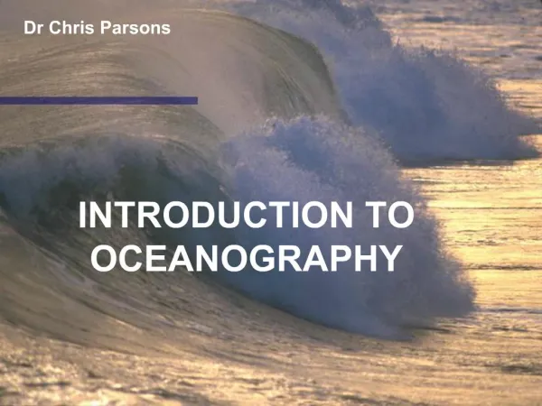
Oceanography
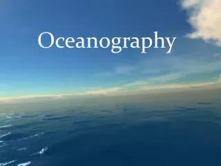
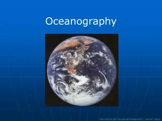
Oceanography. http://antwrp.gsfc.nasa.gov/apod/image/earth_1_apollo17_big.gif. The Oceans. Ocean Facts: Covers 71% of the earth’s surface Accounts for 97% of the water on earth (rest in land ice, groundwater, lakes & rivers) Average depth ~ 4,000 meters Average temp ~ 4 o C (only 39 o F)

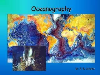
Oceanography
E N D
Presentation Transcript
Oceanography http://antwrp.gsfc.nasa.gov/apod/image/earth_1_apollo17_big.gif
The Oceans Ocean Facts: • Covers 71% of the earth’s surface • Accounts for 97% of the water on earth (rest in land ice, groundwater, lakes & rivers) • Average depth ~ 4,000 meters • Average temp ~ 4oC (only 39oF) • Average salinity ~ 35‰ = 3.5% (1 meter = 3.3 feet)
Ocean Zones coastal oceanic • Horizontal divisions: • Coastal (neritic) = on/over shelf (shallow) • Oceanic = beyond continental shelf (deep) benthic shelf benthic abyss
Ocean Zones coastal oceanic • Vertical divisions: • Pelagic = open water • Epipelagic (0-200m) • Mesopelagic (200-1000m) • Bathypelagic+ (1000m+) • Benthic = ocean bottom benthic shelf benthic abyss
Continental Margins Continental shelf • As narrow as <1 km (0.6 mi) at active margins (tectonic activity) • As wide as >750 km (470 mi) at passive margins (in middle of plates) • Shallow, typically <200 m (600 ft) • Only 8% of ocean surface, but biologically richest part of ocean
Continental Shelf • Intertidal zone (between high and low tides) – open, exposed • Sandy shores (Atlantic – Cape Cod and south) • Rocky shores (most Pacific, Atlantic – north of Cape Cod)
Continental Shelf • Intertidal zone (between high and low tides) – protected, muddy • Salt marshes (temperate) • Mangrove forests (tropical)
Tides • Tides are affected by both the moon and the sun • Tidal day = 24 hours, 50 minutes
Continental Shelf • Estuaries - any semi-enclosed coastal area where freshwater and seawater meet and mix
Long Island Sound http://www.epa.gov/region01/eco/lis/facts.html
South Shore Bays http://www.estuary.cog.ny.us/index.html
Peconic Bay http://www.epa.gov/owow/estuaries/programs/studies/pb.gif http://www.peconicestuary.org/CCMP_PDF/Chpt4.habitat.pdf
Continental Shelf • Subtidal zone (always underwater) • Soft-bottom (sand, mud) • Unvegetated • Seagrass beds NOAA
Continental Shelf • Subtidal zone (always underwater) • Hard-bottom • Seaweed, kelp forests • Coral reefs
Continental Margins http://oceanexplorer.noaa.gov/explorations/02hudson/background/mapping/mapping.html http://soundwaves.usgs.gov/2005/01/research.html
Deep-Ocean Basins Deep sea floor features: • Averages ~4000m (13,000 ft, 2.5 mi) http://oceanworld.tamu.edu/resources/ocng_textbook/chapter03/Images/Fig3-6.jpg
Deep Ocean Bottom • Soft bottom (most common): • Abyssal plains • Silt, clay, biogenic oozes (forams, diatoms, radiolarians) http://earthobservatory.nasa.gov/Study/Paleoclimatology_SedimentCores/Images/ocean_detritus.jpg http://www.deepseascape.org/index.php
Deep Ocean Bottom • Hard bottom: • Seamounts • Ridges • Deep coral reefs NOAA http://www.savethehighseas.org/photo_gallery.cfm?Cat=1
Hydrothermal Vents • High temperature • High chemical concentrations • High acidity http://www.dfo-mpo.gc.ca/communic/endeavour/photo_e.htm
Hydrothermal Vents • Chemosynthesis – energy from chemicals, not the sun • Chemosynthetic bacteria, archaea: • Outside on rocks • Inside some animals (tube worms, mussels, clams) • An oasis of warmth and food for other animals http://www.teara.govt.nz/NR/rdonlyres/E84896E2-2F7E-4D2A-9D46-366B50558303/87497/p5365dop.jpg http://oregonstate.edu/dept/ncs/photos/grazers.jpg
Cold Seeps • Brine pools: • Gulf of Mexico was shallow sea that dried up in Jurassic period • Thick layer of salts covered with sediment when seawater returned • Salt seeps up through cracks in sediment NOAA
Cold Seeps • Brine pools: • Underwater lakes of super salty water • Methane gases also seep out depth 700 m NOAA
Cold Seeps • Chemosynthetic bacteria in mussels • An oasis of food NOAA http://dx.doi.org/10.1371/journal.pbio.0030102
Water • Water is unique and critical for life • Viscous, thick medium • Slow to heat up & cool down, regulates climate • Exists in 3 states on earth • Maximum density at 4°C, not 0°C (ice floats, insulates) • Universal solvent
Seawater • Seawater is a complex solution of dissolved ions and other dissolved solids and gasses
Salinity • Salinity = the total amount of dissolved salts in water • Average amount = 35 g salt/1000 g seawater = 3.5% = 35‰ (parts per thousand) • Can be 0‰ at river mouths and >40‰ in parts of Red Sea
Salts in Seawater major minor
Temperature Gulf Stream Sargasso Sea California Current
Density • The density of water is a function of its temperature and salinity • Density increases with lower temperature (until 4°C) ← Cold water (max. 1000 at 4°C) ← Warm water (958 at 100°C) ← Solid ice (917 at 0°C) ← Water vapor (1.2) http://upload.wikimedia.org/wikipedia/commons/thumb/8/8a/Density_of_ice_and_water_%28en%29.svg/573px-Density_of_ice_and_water_%28en%29.svg.png
Density • The density of water is a function of its temperature and salinity • Density increases with higher salinity • Cold salty water is the densest of all ← Salty water (1027) ← Fresh water (1000) http://www.marietta.edu/~biol/biomes/physsal.gif
Density, Temperature, and Salinity • 3 stratified layers according to density: • Surface mixed layer (epipelagic) • Mixed by wind and waves • Warmer and less dense • Up to 200m deep • Intermediate transition layer (mesopelagic) • Deep stable layer (bathypelagic & beyond) • Colder and denser • Below 1000m
Density, Temperature, and Salinity 200 - pycnocline halocline
Dissolved Gasses • Most gases easily dissolve in seawater, but ocean proportions differ greatly from atmospheric proportions • Carbon dioxide is very soluble (0.039% of atmosphere, 15% of gases in ocean) • Oxygen is not very soluble (much less than in atmosphere) • Unlike solids, gases dissolve better in cold water, so all gas concentrations are higher in the polar waters than the tropics
Dissolved Gasses Highest at surface – mixing with air Oxygen minimum zone - decomposition of organic matter High at bottom – deep water formed at surface
Dissolved Gasses • Hypoxia = low oxygen (<3 mg/l) • Anoxia = no oxygen • Stressful or deadly for marine life http://www.gulfhypoxia.net/overview/images/image005.png http://longislandsoundstudy.net/wp-content/uploads/2010/08/Hypoxia.jpg
Dissolved Gasses • Hypoxia in Long Island Sound every summer http://longislandsoundstudy.net/wp-content/uploads/2010/07/freq-of-hypoxia-2011.jpg
Increased CO2 in air → more in the ocean Increase in H+ ions makes water more acidic, pH 8.2→8.1, expected 7.6-7.8 by 2100 Dissolved Gasses http://theotherco2problem.files.wordpress.com/2009/11/ocean-chemistry.gif
Dissolved Gasses • “Ocean acidification” • Bad for organisms with calcium carbonate shells http://s.ngm.com/2007/11/marine-micro/img/ftr-hdr-acid.jpg http://www.ucar.edu/communications/Final_acidification.pdf
Dissolved Gasses http://3.bp.blogspot.com/-9MpFK0zekqo/T-s8Mzm9qjI/AAAAAAAAB-c/5zsexadUp8A/s1600/oceanacidification.jpg
NOAA Light in the Ocean • Most sunlight does not penetrate very far into the ocean • transparency depends upon suspended matter • deeper in tropics, less in coastal • Blocked by scattering and absorption • Different colors penetrate to different depths
Light in the Ocean Epipelagic = photic zone (bright light, all plants/algae) Mesopelagic = twilight zone (little light, no plants/algae) Bathypelagic = aphotic zone (no light, no plants/algae)
Pressure in the Ocean • Water is heavier than air • Pressure increases with increasing water depth • Sea level = 1 atm. of pressure • In ocean, each 10m of depth (33ft) you add another atm. of pressure
Pressure in the Ocean Before and after travelling to 2000 ft http://www.naturalsciences.org/education/deepsea/images/cups_before_after.jpg