Download
1 / 16
160 likes | 427 Views
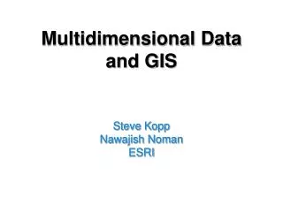
Temporal and Multidimensional Support in a GIS. Steve Kopp ESRI. The Requirements. Support temporal and multidimensional data structures and file formats. Provide visualization and data exploration tools specific to multidimensional data.

E N D
Temporal and Multidimensional Support in a GIS Steve KoppESRI
The Requirements • Support temporal and multidimensional data structures and file formats. • Provide visualization and data exploration tools specific to multidimensional data. • Perform traditional GIS operations and analysis on multidimensional data. • Build new analysis tools to take advantage of higher dimensionality.
The First Step… • Extend existing functionality to support time and multidimensional data • Add support for the netCDF data format • Dynamic Temporal Graphing • Mapping change through time • Support temporal animation • Initial focus • Data access and visualization • Earth science modeling
Temporal Data Structures for GIS • Vector Data Structures • Points, Lines, Polygons • Add attributes, fields and relationships to storage and query of time. • Raster Data Structures • A table pointing to a collection of raster datasets with a time attribute. • Multidimensional Arrays • Already support time as a dimension • e.g. netCDF, HDF, GRIB, etc. • New to most GIS users, common to Earth science modeling community.
T Y Z X What is netCDF? • An array based data structure for storing multidimensional data. • N-dimensional coordinates systems • X coordinate (e.g. longitude) • Y coordinate (e.g. latitude) • Z coordinate (e.g. altitude) • Time dimension • … other dimensions • Variables – support for multiple variables • Temperature, humidity, pressure, salinity, etc • Geometry – implicit or explicit • Regular grid (implicit) • Irregular grid • Points
NetCDF in ArcGIS • NetCDF data is accessed as • Raster • Feature • Table • Direct read,no scratch file • Also write GIS data to netCDF
NetCDF Tools • Make NetCDF Raster Layer • Make NetCDF Feature Layer • Make NetCDF Table View • Raster to NetCDF • Feature to NetCDF • Table to NetCDF • Select by Dimension
Using NetCDF Data • Behaves the same as any layer or table in: • Display • Same display tools for raster and feature layers will work on netCDF raster and netCDF feature layers. • Graphing • Driven by the table just like any other chart. • Animation • Multidimensional data can be animated through a dimension (e.g. time, pressure, elevation) • Analysis Tools • A netCDF raster layer will work just like any other raster layer, feature layer, or table. (e.g. create buffers around netCDF points, reproject rasters, query tables, etc.)
Emphasis on Data Exploration • Support animation of graphs temporally synchronized with maps • Support Linking and Brushing • Mechanisms used to visually explore the connections between information in maps, graphs and tables. • Connecting multiple visualizations provides more information than considering the component visualizations independently.
National Weather Service forecast for July 18th from NDFD netCDF
Some obstacles… • Date standards – not widely honored • Too many flavors of n-dim formats • Loose standardization • No ‘best practices’ guidelines • Weak coordinate system handling in n-dim formats • Horizontal – mostly lat/long WGS84 • Other dimensions such as vertical and time often not specified.