Download
1 / 23
230 likes | 370 Views
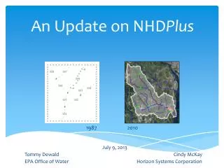
Catching Up on NHD Plus Version 2 ( N ational H ydrography D ataset Plus ). EPA Office of Water May 12, 2014 AWRA Specialty Conference on GIS and Water Resources VIII. Acknowledgements. NHD Plus Team Tommy Dewald / EPA Office of Water Cindy McKay / Horizon Systems Corporation

E N D
Catching Up on NHDPlus Version 2(National Hydrography Dataset Plus) EPA Office of Water May 12, 2014 AWRA Specialty Conference on GIS and Water Resources VIII
Acknowledgements • NHDPlus Team • Tommy Dewald / EPA Office of Water • Cindy McKay / Horizon Systems Corporation • Tim Bondelid / Consultant • Craig Johnston, Rich Moore, Al Rea / USGS Water • (Greg Schwarz, Kernell Ries, Dave Wolock / USGS Water) • (Karen Hanson / USGS WBD Technical Lead)
Overview NHDPlus Concepts Introducing NHDPlus Version 2 Applications Sampler
Why NHDPlus? • “What I think NHDPlusoffers that is unique is in the full characterization of the flow network, identification of unregulated and regulated gages and reaches, and network-based interpolation and adjustment of flows.” • - Al Rea, USGS
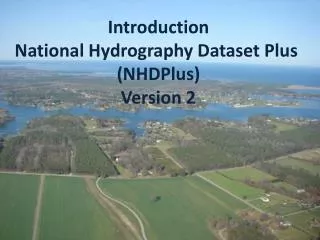
National Hydrography Dataset Plus (NHDPlus) • Developed by EPA and USGS-Water (2006) to provide flow volume and velocity estimates for pollution dilution modeling • Builds upon NHD stream network – integrated with elevation and HUC12s • Additional stream attributes (stream order, flow, etc) • Catchments and attributes (precipitation, temperature, land cover) • Success of initial version led to Version 2 production by EPA and USGS-Water (2012)
NHDPlus Concepts: Integration of NHD, WBD, and NED National Hydrography Dataset (NHD) Watershed Boundary Dataset (WBD) National Elevation Dataset (NED)
NHDPlusprovides the Surface Water Geospatial Framework Elevation (30m) NHDPluscatchments tie the landscape to the stream network forming a ‘surface watergeofabric’ Hydrologic Units (HUC12) Stream Network (These figures are approximations (+/- 10%) provided for purposes of comparison.)
NHDPlus Version 2 “By Endurance We Conquer” (Sir Ernest Shackleton) • Significant Version 2 improvements: • Over 5,000 isolated networks connected • Over 60% enhanced elevations nationally • Now-completed national HUC12s • More robust flow estimation method • Runoff (USGS water balance model) • Excess evapotranspiration • Reference gage regression • Flow additions and removals • Adjustment using gaged flows
Notable Quotes - NHDPlus Production 85. “We can’t afford to be perfect.” (P.Wiese, 6/8/00) 93. “Trust me, I’m an experienced burner.” (D.Maidment, 12/13/00) 131. “... everything that you can imagine happening, does happen.” (T.Bondelid, 7/5/05) 191. “No worries since we have unlimited minutes on nights and weekends!” (C.Johnston, 7/1/10) 198. “Are we allowed to sleep or what?” (A.Rea, 10/7/10)
NHDPlus Release Announcement (March, 2014) • Documentation - new NHDPlusV2 User Guide, metadata, training exercises, technical papers, more presentations • Data - component updates, monthly mean flow estimates • Tools - NHDPlusV2.1 Flow Table Navigator, NHDPlusV2.1 Toolbox (includes a tool that will compare your local data holdings with the versions available on the web site)
USGS NAWQA Cycle 2 SPARROW Nutrient Models (released August, 2011) Regional SPARROW Models Online Decision Support System Water managers, researchers and the general public can access SPARROW models and map predictions of long-term average water-quality conditions, track transport to downstream receiving waters, and evaluate management source reduction scenarios. (cida.usgs.gov/sparrow) RF1 NHDPlusV1 RF1 RF1 RF1 Next generation of NAWQA regional SPARROW models is using NHDPlusVersion 2 stream network and catchments NHDPlusV1 RF1
EPA Office of Water Geospatial Architecture Watershed Assessment Tracking and Environmental ResultS (WATERS)(www.epa.gov/waters) • Applications • Source Water Areas • NARS Watersheds • ATTAINS • NPS GRTS • Ask Waters • How’s My Waterway? • MyWATERS Mapper • MyWATERS Google KMZ • Watershed Plan Builder • NPDAT • DARTER (with COE) • Drinking Water Mapping Application • Construction General Permit • DMR Pollutant Tool • OECA ECHO • KCWaters.org • Many others Programmatic Data/Databases Reach Address Database (RAD) • Web Services • Mapping Layers • Name Search • Up/Downstream Search • Watershed Delineation • Watershed Report • Many others Discharge Permits Stream Addresses Water Quality Monitoring NHDPlus Water Impairments Drinking Water Intakes Many others
NHDPlus The inset map shows the watershed (white boundary) defining the drainage area upstream from the mouth of Four Mile Run (red dot) and a report of associated watershed characteristics – both produced using NHDPlus.
EPA National Aquatic Resource Surveys NHDPlusserves as the basis for establishing the NRSA and NLA survey sample frames – from which a representative set of sample sites are randomly selected. NHDPlus is also used to support data analysis, such as delineating drainage areas and associated attributes for sampled sites. Drainage Area = 114.24 km2 NLCD 2001 Land Cover : - Residential = 7.86 km2 - Forest = 86.42 km2 - Agriculture = 12.64 km2 - Wetlands = 7.32 km2 (www.epa.gov/owow/lakes/lakessurvey)
(Draft) Using the Catchments to Track Progress 2010 303(d)/305(b) Integrated Report 2012 303(d)/305(b) Integrated Report (young.dwane@epa.gov, reid.wendy@epa.gov)
West Virginia Chemical Spill • Spill of thousands of gallons of coal-washing chemical MCHM—4-methylcyclohexane methanol into the Elk River, WV • Spill one mile upstream from water treatment plant • Incident Command Tool for Drinking Water Protection (ICWater) used to warn downstream water suppliers • Uses NHDPlus flows and velocities • Adjusts with real-time gage data • Provided accurate travel-time estimates • Protected Cincinnati water supply and others (william.b.samuels@leidos.com)
Measured velocity Intake Spill site Model velocity
Building State Capacity to Identify Healthy Watersheds Owen McDonough, EPA ORISE Fellow 30 April 2014
(water.epa.gov/polwaste/nps/watershed) (gabanski.laura@epa.gov)
DRAFT - For many shallow groundwater systems, groundwater flowpaths closely follow the downward directions expressed by the land-surface topography (moore.richard@usgs.gov)
WIRED and Popular Science Magazines (June, 2013) Treehugger.com (January, 2014) – A recent report by the U.S. Environmental Protection Agency concluded that 55 percent of U.S. rivers and streams are in poor condition1. Most of us don't go to that many different rivers in our lives, so when we see a number like that we might not realize just how many rivers and streams there are in the United States. Well, the map above gives you an idea of how many there are. All river data comes from the NHDPlusdataset, a geo-spatial, hydrologic framework dataset envisioned by the USEPA. 1Draft National Rivers and Streams Assessment 2008-2009 (March, 2013) Courtesy:Nelson Minar
NHDPlus-related Sessions • Monday • Session 1C – Water and Energy Decisions-1 • Monday and Tuesday – • Poster presentation - “NHDPlusAttributes for Stream-Water-Quality Modeling” • Tuesday • Session 4A - Panel: The Integration of Elevation and Hydrography Data • Wednesday • Session 8B and 9B – NHD (and NHDPlus) Workshop: Parts 1 and 2 • Conference Luncheon - Panel: 3DNHD – The Plan For The Future • Session 10C - Integrated Watershed Management-2
‘All the water that will ever be is, right now.’ • National Geographic Magazine, October 1993 • ‘We forget that the water cycle and the life cycle are one.’ • - Jacques Cousteau Tommy Dewald EPA Office of Water dewald.tommy@epa.gov Questions? (On the Web - Google ‘nhdplus’)