Download
1 / 37
370 likes | 564 Views
Preparing for the New Geospatial Metadata Horizon. ESRI User Conference San Diego, CA ● July 9, 2003 Lynda Wayne Federal Geographic Data Committee GeoMaxim. Why change our standard?. Politically… responsible member of international geospatial community Technically… improved normalization

E N D
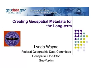
Preparing for the NewGeospatial Metadata Horizon ESRI User Conference San Diego, CA ●July 9, 2003 Lynda Wayne Federal Geographic Data Committee GeoMaxim
Why change our standard? Politically… • responsible member of international geospatial community Technically… • improved normalization • enhanced capabilities • interoperability
What is the status of the ISO metadata standard? CSDGM remains the US geospatial metadata standard ISO 19115 • design only • approved by ISO ISO 19139 • implementation • draft submitted June 2003 ISO 19103, 19109, 19111 • elements defined externally to ISO 19115/10139 e.g measurements and feature/attribute schemas • most in draft form
What’s new with ISO metadata? • Content • CSDGM similar and new elements • domains and conditionality • core metadata • Format • UML / XML • Multi-level metadata
ISO Metadata: New Content CSDGM Similar Elements • same metadata standard name • new terminology and definitions CSDGM = Originator ISO = Responsible party w/ role = originator custodian owner publisher….
ISO Metadata: New Content New (non-CSDGM) Elements • International elements Data / Metadata language • Extended elements CSDGM = geographic and temporal extent ISO = geographic, temporal, and vertical extent • Lacking elements ISO Topic category – 19standardized subject categories to facilitate data discovery
ISO Metadata: New Content Topic Categories – select one or more boundaries oceans transportation economy society elevation structure environment geoscientific_information health imagery_basemaps_earthcover inland waters planning_cadastre location utilities_telecommunications climatology_meteorology_atmosphere
ISO Metadata: New Content Domains and Conditionality • Fixed domains and code lists in place of free text Responsible party - role and Topic categories represented as numeric codes • role = originator (006) • topic category = transportation (018) • Fewer mandatory elements Core contains only 7 mandatory elements • More optional elements
ISO Metadata: New Content ISO Core Metadata • 22 basic metadata elements be that must be maintained for a dataset • includes mandatory, conditional, and optional elements • all national profiles of ISO must include the core
extensions core elements ISO Metadata: New Content Building the national profile
ISO Metadata: Core Metadata mandatory elements: CSDGM Dataset title Title Dataset reference date Publication_Date Abstract Abstract Metadata point of contact Metadata_Contact Metadata date stamp Metadata_Date Dataset language virtual default for US data sets Dataset topic category New
ISO Metadata: Core Metadata conditional elements:CSDGM Geographic location Bounding_Coordinates - if documenting a data set Dataset character set Metadata character set - if other than UCS Metadata language - if not encoded New
ISO Metadata: Core Metadata optional elements:CSDGM Dataset responsible party Originator Spatial resolution (for raster) Abscissa/Ordinate Resolut. Distribution format Format_Name Additional extent-temporal Time_Period_of_Content Spatial representation Direct_Spatial_Reference Reference system Horizontal_Coord_System Lineage Lineage
ISO Metadata: Core Metadata optional elements:CSDGM Online resource Online_Linkage & Network_Resource_Name Metadata standard name Metadata_Standard_Name Metadata standard version Metadata_Standard_Vers. Metadata file identifier filename for metadata record Spatial resolution (for vector) e.g. equivalent scale 1:24,000 New
ISO Metadata: New Format 19115 UML Design: entity relationships
ISO Metadata: New Format 19115 Data Dictionary: content specifications
ISO Metadata: New Format 19139 XML Schema: metadata record format
ISO Metadata: New Format Implications: the good news…. XML schema supports consistent and robust implementation via software tools • format and exchange - current implementation via txt, doc, db file, etc - exchange format is txt • internal metadata harvesting and other automated features
ISO Metadata: New Format Multi-level metadata Meta can be created for different levels: • Data Series - wetlands • Dataset - Paducah wetlands • Feature Type - marsh • Feature Instance - Mandy’s Marsh • Attribute Type - Salinity • Attribute Instance - actual % water salinity
ISO Metadata: New Format ISO Metadata: New Format Implications: the bad news…. Standard can no longer be ‘read’ by most geospatial data developers • greater dependency on tools • lack of direct contact with the standard will be difficult for some metadata creators, analogous to moving from command line to GUI
What about my legacy metadata? Crosswalks drafted for: • CSDGM Vers. 2.0 • Dublin Core, others Conversion software in development • sponsored by FGDC • ESRI and Intergraph/SMMS development partners
How do I prepare? Now…. • Continue metadata creation using CSDGM vers.2 !!! • Use ISO-poised software • ESRI ArcCatalog • Intergraph / SMMS • Add Topic Categories as a custom element or theme keywords with ‘ISO 19115’ as keyword thesaurus • Monitor FGDC website for news, materials, and training opportunities
How do I prepare? Soon… • Participate in FGDC review of crosswalk • Participate in INCITS-L1 19139 reviews • Educate and inform your organization that a migration, and assistance, is in the future • Develop a metadata conversion plan using crosswalks and conversion software • Adopt ‘CSDGM vers. 3.0’ when finalized
For More Information Contact: Sharon Shin, FGDC Metadata Coordinator sharon_shin@usgs.gov Lynda Wayne, FGDC / GeoMaxim Lwayne@GeoMaxim.com
For More Information Visit: FGDC Metadata Website: http://www.fgdc.gov/metadata ISO 19139 /Crosswalk Efforts http://metadata.dgiwg.org
Discussion What are your ISO metadata questions and concerns?
For more information: ANSI Review Julie Maitra Binder, FGDC Standards Coordinator jmaitra@fgdc.gov http://www.fgdc.gov/standards
For more information: ISO 19115 to CSDGM Vers. 2.0 Conversion Software Bruce Westcott, SMMS Metadata Consultant bwestcot@ingr.com Crosswalk http://ogcengine.nima.mil/metadata/index.htm
ISO: Topic Categories back farming health structure biota imagery location boundaries military oceans economy society elevation environment atmosphere inland waters geoscientific planning / cadastre transportation utilities/communications
What’s new with ISO 19115? New Terminology Replaced terms Data / Metadata Language • Extended elements Extent: geographic, temporal, vertical • Specified elements Logical Consistency: conceptual, domain, format, topology • Hierarchical elements
custodian FGDC / CSDGM: ISO distributor Point of Contact contact Responsible Party Processing Contact processor PI Distribution Contact publisher Metadata Contact …more What’s new with ISO 19115? New Design Method: Object Oriented
What is ISO? International Organisation for Standards • International standards organization - ANSI is US rep to ISO • US is one of approximately 92 member nations
What is the ISO metadata standard? ISO metadata is one component of ISO TC 211 Geographic Information / Geomatics Joint Steering Group on Spatial Standardization and Related Interoperability
WG 1 Framework and reference model ISO/TC 211 ISO/TC 211 UK USA NLD AUS NOR WG 5 WG 3 WG 4 WG 2 Geospatial data admin Geospatial services Profiles and standards Geospatial models and operators 10. Cataloguing 11. Geodetic reference systems 12. Indirect reference systems 13. Quality 14. Quality evaluation procedures 15. Metadata 16. Positioning services 17. Portrayal of geographic information 18. Encoding 19. Services 6. Profiles Reports Functional standards Raster and Gridded Data 1. Reference model 2. Overview 3. Conceptual schema language 4. Terminology 5. Conformance and testing 7. Spatial subschema 8. Temporal subschema 9. Rules for application schema 20. Spatial operators
ISO/TC 211 Several CSDGM-traditional elements are defined externally to ISO 19115/10139: ISO 19103 - measurement (distance, angles, units of measure) ISO 19109 - features, attributes, properties ISO 19111 - vertical datum ………………most are working documents