Download

1 / 13
130 likes | 447 Views
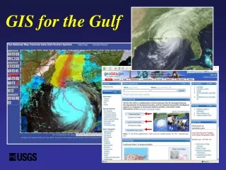
GIS for the Gulf. Filling Needs - Effective Emergency Response. Needs Preparedness of geospatial infrastructure No single place for incident information and status No integrated information base Inconsistent data Effective Emergency Response Saved lives & property

E N D
Filling Needs - Effective Emergency Response • Needs • Preparedness of geospatial infrastructure • No single place for incident information and status • No integrated information base • Inconsistent data • Effective Emergency Response • Saved lives & property • Saved enormous cost and time • Faster response • Better use of peoples skills
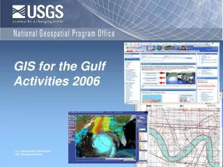
GIS for the Gulf (GFG) 2005An Integrated Database Partners : • NGA • DHS • USGS • ESRI Done in 14 days!
Getting Ready for this Season Hurricane Frequency Over the Last 100-Years
Implement a GIS database Build on the GIS for the Nation Data Model (Geospatial Blue Book) Enhance the Geospatial One Stop (GOS-2) Data Access Integrate the GFG-2 database within NGA’s Palanterra™ and DHS’s infrastructure Critical Asset Viewer (iCAV) GFG 2006 - Objectives
Data-Model Themes • Structures / Critical Infrastructure • Governmental Units (Boundaries) • Transportation • Addresses • Emergency Operations • Cadastral • Imagery • Elevation • Hydrography • Land Use / Land Cover • Environmental • Geodetic Control • Base Map • Utilities Over 60 Layers of Data!
GFG 2005 Partners • NGA • DHS • USGS • Contractor • GFG 2006 Additional Partners • HUD • DOT • NACCHO (Nat. Ass. County & Comm. Health Org.) • IAFC (International Ass. Of Fire Chiefs)
Keys to Success • Integrating • DHS State-Based Fusion Centers • USGS State Liaisons • NSGIC • States’ Coordinators • Local Communities & Counties • Accomplishing • Data Sharing Agreements • Data Maintenance • Identify Roles and Responsibilities
Geospatial Bluebook “GIS for the Nation” • Components • Nat. Spatial Data Infrastructure • USGS / NGPO • The National Map • Geospatial Enterprise Architecture • Geospatial One stop • Project Homeland • USGS’s Local Liaisons
GOS National Compilation State/Regional Systems ETL TNM Internet HLS/HLD Community: DHS, DoD, NGA, Law Enforcement, States, Locals … ETL Secure Networks Access Controlled Local Data High-Quality Data Compiled from Local Sources GIS for the Nation NC, UT, TX, DE prime examples
DHS DoD Project Homeland State & Local USGS NGA Project Homeland Community
References and URLs Palenterra (NGA) http://www.nima.mil/NGASiteContent/StaticFiles/OCR/Geo0704.pdf Geospatial OneStop http://gos2.geodata.gov/wps/portal/gos GIS for the Nation & Geospatial Blue Book Geodata.gov under “Special Interest, GIS for the Nation”