Download
1 / 22
220 likes | 345 Views
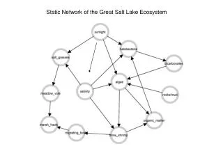
Remote Sensing of The Surface Temperature of the Great Salt Lake. Erik T. Crosman John D. Horel University of Utah Department of Meteorology NOAA Cooperative Institute for Regional Prediction Spring Runoff Conference Utah State University 27-28 March 2006. Outline.

E N D
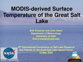
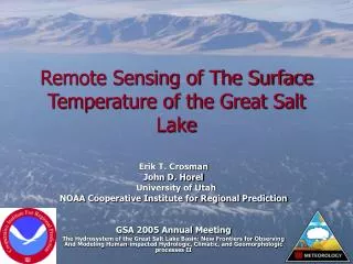
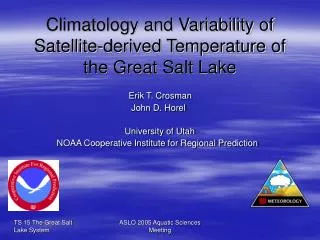
Remote Sensing of The Surface Temperature of the Great Salt Lake Erik T. Crosman John D. Horel University of Utah Department of Meteorology NOAA Cooperative Institute for Regional Prediction Spring Runoff Conference Utah State University 27-28 March 2006
Outline • Motivation and Methodology • Sources of Error • Case Studies of Lake Temperature • Summary and Future Work
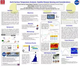
Research Goals • Use remote sensing data (AVHRR, MODIS) to characterize the lake state: level, temperature, salinity, turbidity, etc. • Investigate the impact of lake state on local weather (e.g., lake breeze, lake-effect snowstorms) • Future- examine regional and remote climate forcing on the Great Salt Lake
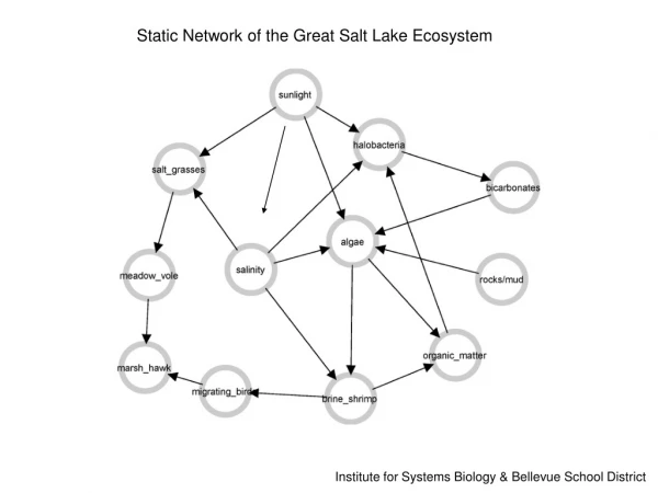
Impacts of lake temperature on local weather and climate • Lake state forces and is forced by the meteorology of the region on many different time scales. Zumpfe and Horel JAM 2006
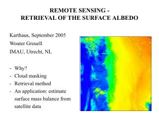
Methodology • Advanced Very High Resolution Radiometer (AVHRR) images at 1.1 km resolution from NOAA polar orbiting satellites 1981-present • Three visible channels used for daytime cloud identification and two infrared channels used for cloud identification and temperature • Infrared data calibrated and converted to brightness temperature • Split-window techniques used to correct for the effects of atmospheric water vapor for surface temperature • Lake temperature retrievals measure “skin” temperature of infinitesimally thin surface layer • Accuracy of AVHRR sea surface temperature retrievals approximately +/- 0.5 oC based on comparison to ocean buoys • MODIS SST and LST L2 products 2000-present (new) at 1 km resolution
Comparing MODIS and AVHRR AVHRR 16 JULY 2005 MODIS SST MODIS LST
Impact of salinity on emissivity CHANNEL 4 – CHANNEL 5 BRIGHTNESS TEMPERATURE south arm salinity 13% north arm salinity 26% For large zenith angle (64 degrees)
DescribingLake Surface Temperature • Short-term variations (diurnal cycle, surface heating, mixing, etc) • Weekly variations • Monthly variations • Interannual variations
Freshwater lens Surface temperature 13 May 2005 2220 UTC MODIS true color 2035 UTC MODIS true color 1855 UTC
Variable mixing Cooler water noted in regions where winds were stronger 10 March 1839 UTC 2112 UTC
Northerly winds Southerly winds
Day October 6, 2005 Lake Surface Diurnal Temperature Variability Night October 6, 2005
Fall Cooling October 2001 WEEK 2 ~15.5 C WEEK 1 ~19.5 C WEEK 3 ~14.0 C WEEK 4 ~12.0 C
Effect of River Inflow on Lake Temperature? June 2005 DAYTIMELAKE SURFACE TEMPERATURE JUNE 2005 LST BIAS FROM CLIMO JUNE TEMP
Beyond lake temperature • Satellite data likely will give valuable information on lake state beyond temperature • Salinity • Turbidity • Currents, lens, circulations 23 June 2005 6 June 2004
5-6 NOV 2004 : Lake circulation feature 5 November MODIS true color AVHRR ch 1 AVHRR ch 2 AVHRR LST 6 November
Winds interacting with bay inflow23 June 2005 Channel 1 reflectance Surface temperature
Summary and Future Work • Satellite imagery is useful for studying • 1) spatial and temporal variability of Great Salt Lake temperature • 2) interactions between lake temperature and limnological and meteorological forcing • 3) other characteristics of lake state (salinity, turbidity) • Satellite-derived surface temperature may be useful for examining lake-climate interactions • Further validation studies (buoy/platform?) required to minimize errors in AVHRR and MODIS satellite-derived surface temperature • Use AVHRR/MODIS data to quantify relationship between lake surface temperature and weather and climate forcing • Use MODIS data to better understand lake state (7 additional visible channels; 2 additional thermal channels)