Download
1 / 28
280 likes | 406 Views
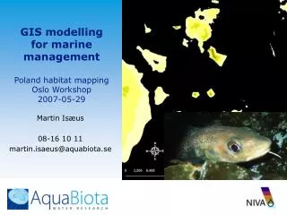
GIS modelling for marine management Poland habitat mapping Oslo Workshop 2007-05-29. Martin Isæus 08-16 10 11 martin.isaeus @aquabiota.se. What drives the marine mapping in Sweden, Norway and the Baltic?. EU National County management Industry – Marine Wind Power. BALANCE

E N D
GIS modelling for marine management Poland habitat mapping Oslo Workshop2007-05-29 Martin Isæus 08-16 10 11 martin.isaeus@aquabiota.se
What drives the marine mapping in Sweden, Norway and the Baltic? • EU • National • County management • Industry – Marine Wind Power BALANCE Off-shore reefs survey Nature reserve survey WPD Finngrunden
The BALANCE project • 19 partners & 10 countries • 2½ year & € 4,7 mio. • Main activities: • Collation of marine environ-mental & anthropogenic data • Baltic seafloor mapping • Biodiversity assessment • Marine spatial planning BSR INTERREG IIIB region from space, Source: SeaWiFS Project, NASA/Goddard Space Flight Centre and ORBIMAGE
The BALANCE approach • Collate & analyse available geo-physical and hydrographical information within HELCOM region • Define and agree on an unified data format • Decide a common platform for data handling, processing and projection of marine landscape map, e.g. ArcGis, WGS84, UTM • Define standards for classifying Baltic marine landscapes • Validation & confidence scheme • Applying an ecosystem-based approach, not the one nation – one approach
Seabed sediments Photic depth Bottom salinity Bathymetry Benthic marine landscapes Basic layers: Secondary layers: Temperature Wave exposure Ice cover Current velocity Word of caution!
Benthic marine landscapes • Features • 60 benthic landscapes identified • Most common is non-photic mud at 7,5 – 11psu covering 58.640 km2 or 14,3% of total seabed • 8 landscapes cover 371.000 km2 or 90,7% of total seabed • 40 landscapes cover less than 1% of total seabed area • Coverage data for each EEZ as well as entire HELCOM region is available
Pelagic marine landscapes – an example • Linking the physical characterisation to socio-economic exploitation • Illustrating the value of (transnational ?) marine landscape mapping • Could be linked to implementation of various EU obligations, e.g WFD or pMSD (?) • Could be linked to climatic change showing the consequences to marine environment Annual variation in the Cod Reproductive Volume, DIFRES
Habitat mapping Norway Denmark Sweden Lituania Estonia Finland
Nephrops in Skagerrak Martin Isæus, AquaBiota Hans C. Nilsson, NIVA Mattias sköld, Swedish board of Fishery
Study areaGrids from multi-beam survey:Bathymetry (5 m res.)Hardness (4 classes) New field data SPI + new fauna sample (2) SPI (22) SPI + fauna (14)
Probalitity of Nephrops presence Spearman Corr 0.659
Random SPI + Nephrops burrow shape + Trawling frequency => density plot and population estimate
Kernel density 2002-2006 mean yield per cage Radius 5 km, 100m-grid.
Spatial predictions of Laminaria hyperborea at the Norwegian Skagerrak coast Kjell Magnus Norderhaug Martin Isæus Trine Bekkby Frithjof Moy Are Pedersen
Probability of L. hyperborea Monitoring data vs All available data
Natura 2000? Off-shore bank survey 2003-06 • Benthic biology • Marine geology • Hydrography
Utbredning av ”Död mans hand” Alcyonium digitatum
Nature values Fucus (+) Chara (+) Epithytes (-) Filamentous (-) Detritus (-) Sulphuric bacteria (-)
WPD FOTO: KNUT STRØM Wind Power
Bathymetry (multi-beam) Back-scatter Bentic biota Fish Birds Bats Seals
Presence of fish Stensnultra cvROC=0,843 ROC=0,889 cvCOR=0,63 COR=0,682
Abundance of fish Stensnultra cvCOR=0,509 COR=0,619