Download
1 / 39
390 likes | 548 Views
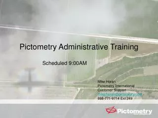
Pictometry Administrative Training. Scheduled 9:00AM. Mike Horan Pictometry International Customer Support mike.horan@pictometry.com 888-771-9714 Ext 249. Training Objectives. Pictometry Team Craig Witmer – Regional Vice President Matthew Thomas – District Manager

E N D
Pictometry Administrative Training Scheduled 9:00AM Mike Horan Pictometry International Customer Support mike.horan@pictometry.com 888-771-9714 Ext 249
Training Objectives • Pictometry Team • Craig Witmer – Regional Vice President • Matthew Thomas – District Manager • Kevin Beers – Regional Technical Manager • Mike Horan – Implementation Manager • Claudia Friedman – Trainer • Robert Kulpa – Deployment Specialist • Jeremiah McGrath – Customer Relations Email Address Format – first.last@pictometry.com Administration EFS 2.7
Training Objectives • Brief Product Suite Demonstration • Discussion: Delivery Drive Contents • Discussion: Image Data and GIS Data • Installation / Upgrade of Applications • Administrative Applications • ESRI Integration Information Administration EFS 2.7
Demo: Client Product Suite • Electronic Field Study 2.7 • Pictometry ArcMap Extension Administration EFS 2.7
Training Objectives • Brief Product Suite Demonstration • Discussion: Delivery Drive Contents • Discussion: Image Data and GIS Data • Installation / Upgrade of Applications • Administrative Applications • ESRI Integration Information Administration EFS 2.7
Switch Control!! Administration EFS 2.7
Training Objectives • Discussion: Delivery Drive Installers • EFS 2.7 • ArcMap Extension 1.4 Administration EFS 2.7
Training Objectives • Brief Product Suite Demonstration • Discussion: Delivery Drive Contents • Discussion: Image Data and GIS Data • Installation / Upgrade of Applications • Administrative Applications • ESRI Integration Information Administration EFS 2.7
Pictometry Imagery • Consists of ORTHOS and OBLIQUE Imagery • Communities – 12” • Neighborhoods – 4” • Ortho Sector Tiles – 1 Meter and 6” • US State Plane 1983 • Texas Central • JPG with World Files Administration EFS 2.7
GIS Data - Uses • Search Functions for EFS • Address Search Profiles • Workspace Functions • Overlay • Query • Labeling Administration EFS 2.7
Auto Labeling Administration EFS 2.7
Training Objectives • Brief Product Suite Demonstration • Discussion: Delivery Drive Contents • Discussion: Image Data and GIS Data • Installation / Upgrade of Applications • Administrative Applications • ESRI Integration Information Administration EFS 2.7
Installing EFS 2.7MinimumHardware Specifications • Desktops, Laptops and Vehicle Rigs • Windows NT, 2000, XP • Pentium III 600MHz (or better) • 256MB of RAM • Display Resolution 1024x768 (or better) • Hard Drive Space • EFS Application – 60MB of available space • Mouse • Network Interface Card • If the Library is stored on the network • Can be wired or wireless Administration EFS 2.7
EFS - Points of Configuration • Post install of EFS requires additional configuration • Image Tool Properties (warehouses) • Address Search Setup • SDE Credentials • Any other non-default settings desired Administration EFS 2.7
New Install of EFS? • Run the installer • Leverage Pictometry Configuration File • .PCF files created in EFS Config Editor • New license automatically used • EFS is installed FULLY CONFIGURED Administration EFS 2.7
EFS Documentation • Is installed along with the application! Administration EFS 2.7
Documentation • Listing of documentation that we provide • EFS 2.7 User Guide • Getting Started • Quick Reference Guide • Can make this available to whomever needs access to it. You can print as many as needed. Administration EFS 2.7
Training Objectives • Brief Product Suite Demonstration • Discussion: Delivery Drive Contents • Discussion: Image Data and GIS Data • Installation / Upgrade of Applications • Administrative Applications • ESRI Integration Information Administration EFS 2.7
EFS Configuration Editor • Administrative Tool Only • Captures desired settings into a file • The file is a ‘Pictometry Configuration File’ • The PCF file is used during the install of EFS on to remaining PCs Administration EFS 2.7
Address Search Functions This setup information is tracked in a unique location in the computers registry. Address Search Profiles added via a PCF file are always additive. Administration EFS 2.7
Steps for EFS Configuration Editor • Install EFS and fully configure as desired • Install the EFS Configuration Editor • Create a PCF file • Copy PCF into the EFS Installer Folder • Only ONE PCF file should be there at a time • Install EFS on additional machines • Directions: • EFS 2.7 SysAdminGuide.pdf Administration EFS 2.7
Address Search Functions • Address Search Setup and Profiles • Based on GIS Data Attributes • Search for ‘Addresses’ based on • Parcel or Centroid file • GeoCode from Street Centerlines Administration EFS 2.7
GIS Data • Recommended Data Attributes • Address Lookups • Parcel or Address Points with parsed fields for • Street Numeric Address • Pre-Direction • Street Name • Post Direction • Street Type Administration EFS 2.7
GIS Data • Recommended Data Attributes • GeoCode Lookups • Street Centerline Layer with fields for • Pre-Direction • Street Name • Post Direction • Street Type • Address Range – Left Hi and Left Lo • Address Range = Right Hi and Left Lo Administration EFS 2.7
Address Search Functions • A profile defines one ‘search’ setup • Pictometry creates ‘index’ files (.pdx) • MUST be kept in lockstep with GIS Updates • You can ‘export’ and ‘import’ Address Profiles • You can incorporate them into .PCF files • Note: This configuration component is an EFS configuration, NOT a workspace item. • Directions: • EFS 2.7 User Guide Chapter 1 Pg. 1-26 Administration EFS 2.7
Workspace Optimization • Without Optimization, users can experience ‘slowness’ when images are being viewed, panned and navigated • Usually, the ‘slowness’ results when EFS needs to ‘render’ the GIS data on the images • Can also be seen when performing a GIS Query • Optimization minimizes the ‘hourglass’ • INDEXING of GIS Shapefiles = Optimization Administration EFS 2.7
Spatial Index Administration EFS 2.7
Shape File Indexes • There are 4 types of Shape File Indexes that may be created • All index files have a .pdx extension: • Spatial Indexes • Speeds Rendering of Vector Data as it overlays imagery • Manual Creation and Maintenance is required • Query Field Indexes • Speeds up GIS Query (or may be required if file is too large) • Manual Creation and Maintenance is required • Address Search Profile Indexes • Used for Lookup Functions • Initial Creation Automatic / Manual Maintenance • Auto-Labeling Indexes • For the option to even work • Initial Creation Automatic / Manual Maintenance Administration EFS 2.7
Shape File Indexes - Details • All index files follow the following rules • Index files are created and maintained in the same folder where the shape file resides • Note: Beware of Permissions Issues • Index files always have a .PDX extension • Index files follow the naming convention of: • SHAPEFILENAME_FIELDNAME.PDX Administration EFS 2.7
Shape File Indexes - Details • All index files follow the following rules • Spatial Index • Has a special ‘name’ of SHAPE in filename of the index • Ex: StreetCenterlines_SHAPE.PDX • Query Field Indexes • Uses chosen field name in filename • Ex: Parcel_PIN.PDX • Address Search Profile Indexes • Every Search Profile requires a PAIR of index files • One for the field associated with ‘NUMBER’ in the profile. Ex: Address_HNUM.PDX • One for the field associated with ‘STREET NAME’ in the profile Ex: Address_STNAME.PDX • If a Search Field is NOT associated, you still get an index. Ex: Address_.PDX • Auto-Labeling Indexes • Every Auto-Label requires a PAIR if index files • One is a SPATIAL INDEX (above) • One for the field being used for label Ex: StreetCenterlines_FULLNAME.PDX Administration EFS 2.7
Shape File Indexes • Creation and Maintenance • Spatial Indexes • Workspace’s GIS Layer Properties – PDX tab • Annotate Pulldown – Shapefile Maintenance • Custom Toolbar – Shapefile Maintenance Button • Query Field Indexes • Workspace GIS Layer ‘Search’ – PDX tab • Annotate Pulldown – DBF File Maintenance • Custom Toolbar – DBF Maintenance Button • Address Search Profile Indexes • When creating or ‘editing’ profile where PDXs are not present • Annotate Pulldown – DBF File Maintenance • Auto-Labeling Indexes • Workspace’s GIS Layer Properties – PDX tab (Spatial) • Annotate Pulldown – Shapefile Maintenance (Spatial) • Annotate Pulldown – DBF File Maintenance (Display Field) Administration EFS 2.7
Suggested Shape File Maintenance Procedures • Stage ‘New’ GIS Layer in a STAGING folder • Review the ‘PRODUCTION’ data location to determine indexes that are present • Recreate the required indexes in the STAGING folder • Copy new GIS files AND index files into the PRODUCTION folder once they are created Administration EFS 2.7
Training Objectives • Brief Product Suite Demonstration • Discussion: Delivery Drive Contents • Discussion: Image Data and GIS Data • Installation / Upgrade of Applications • Administrative Applications • ESRI Integration Information Administration EFS 2.7
Sector Planner An administrative tool that automates the creation of subwarehouses • Subwarehouse = a standalone subset of your delivery • Locate or create a shape file of the boundary of desired area • Locate available space for the new subwarehouse • Using Sector Planner, create the subwarehouse • Directions • Subwarehouse-Sectorplanner.pdf Administration EFS 2.7
Training Objectives • Brief Product Suite Demonstration • Discussion: Delivery Drive Contents • Discussion: Image Data and GIS Data • Installation / Upgrade of Applications • Administrative Applications • ESRI Integration Information Administration EFS 2.7
ArcMap Extension • Prerequisites • Microsoft .NET1.1(ArcMap 9.0 and 9.1) • Microsoft .NET 1.1 and .NET2.0 (ArcMap 9.2) • Install ArcMap • Or ensure that ESRI’s ArcMap .NET is installed • Run the Pictometry Installer Administration EFS 2.7
ArcMap Script • Prerequisites • ESRI ArcMap • Pictometry EFS • Code for a custom ArcMap tool • Passes desired coordinates to EFS • Use of the programmatic ‘COM’ Administration EFS 2.7
Training Objectives • Brief Product Suite Demonstration • Discussion: Delivery Drive Contents • Discussion: Image Data and GIS Data • Installation / Upgrade of Applications • Administrative Applications • ESRI Integration Information Administration EFS 2.7
Thanks for Coming Questions? Administration EFS 2.7