Collecting Field Data for a Bedrock Geologic Map
90 likes | 337 Views
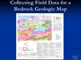
Collecting Field Data for a Bedrock Geologic Map. GEOL 3000. Preparation. Establish Objectives Why are you mapping?

Collecting Field Data for a Bedrock Geologic Map
E N D
Presentation Transcript
Preparation • Establish Objectives • Why are you mapping? • - previously unmapped or inadequately mapped area, adding additional level of detail to previously mapped area, trying to solve a specific geologic problem, evaluating economic potential of an area, ... • What are you mapping? • - quadrangle, county, geological unit of interest, area of mineralization potential • What scale will your final map be? • determines the scale of your field map (always map at more detail than the final map) and the coverage of outcrop you acquire • Who will be mapping and where? • - balance expertise, safety, coverage of field parties • Research Previous Mapping and Useful Data • Review published and unpublished maps (e.g. thesis maps, exploration company maps) and related reports or scientific articles • Seek out original field maps and notes if available • Investigate any handsamples and thin sections from previous studies • Investigate any drill core or core logs in your field area
Gear for Northwoods Field Work I’m gonna find me some outcrop today! • Clothing • long sleeve collared shirt • loose-fitting, light but rugged long pants • inexpensive rain pants and jacket • field hat • rugged water-proof boots • field vest &/or back pack • Geologic Equipment • field map and map board • notebook (water-resistant) • Brunton AND orienteering compasses • hand lens, magnet, acid bottle • hammer (and chisel) • pencils (reg. & colored) • sample bags and permanent markers • Other • - insect repellent and more insect repellent • - water (2 liters) • - field lunch (gorp, fruit, jerky)
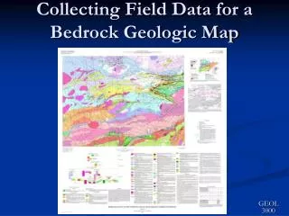
The Field Map • Topographic Base • ~ page size • scale greater than final map scale (e.g. for 1:24,000 map, field map at 1:12,000 or 1:10,000) • add UTM grid for ease of locating • use waterproof paper or laminate • overlay with sheet of mylar • Outcrops • label station ID that matches notebook and sample ID • discriminate rock type with colored pencil • note sample locations • draw strike and dip of measured structures • Other Features • route taken • new roads or trails • possible geologic contacts or faults • other things of note BE ACCURATE BE NEAT! Field Map of part of Tofte 7.5’ quadrangle
Finding Outcrop Start here M486 S80ºW or 260º ~700’ or 1120m ~140 paces massive gabbro
Recording Outcrop Information • Scout around the outcrop: • Make careful observations of rock type(s), • textures, structures; peel moss if necessary • Measure orientation of structures/contacts • Hammer off a piece of rock for a closer look • Take a sample if necessary or important • Take a picture if photogenic exposure • Find a comfortable spot on the outcrop; Apply bugspray if necessary; pull out notebook and map; check GPS location • On the field map, mark: • Route to outcrop location • Area of outcrop - ACCURATELY (in color?) • Station ID# label • Strike and dip symbols of structures • Locations of samples taken • In the notebook, record: • Station ID#, UTM coordinates • Extent, visibility, & type of outcrop • Rock description- mineralogy, texture, structure • Structure measurements • Photographs taken • Samples descriptions
Finding More Outcrop Start here M486 No OC 25o S60ºW or 250º ~1100’ or1750m ~220 paces M487 S75ºW or 255º ~750’ or1200m ~150 paces S5ºW or 185º ~950’ or1520m ~190 paces massive gabbro S-- M488 layered gabbro 20o