Understanding Atmospheric Circulation Patterns and Their Effects on Climate
This module explores the intricate mechanisms of atmospheric circulation, which play a crucial role in shaping Earth’s climate and weather. It covers concepts such as vertical and horizontal motion of air, the significance of isobars in weather maps, and the influence of the Coriolis force on wind patterns. By analyzing local phenomena like sea breezes and global wind systems, learners can model the complex interactions that define weather systems. This understanding is essential for forecasting weather and recognizing climate influences.

Understanding Atmospheric Circulation Patterns and Their Effects on Climate
E N D
Presentation Transcript
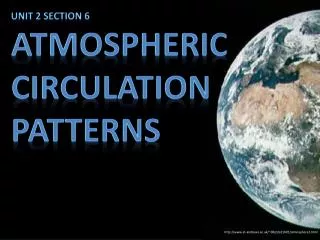
Unit 2 Section 6 Atmospheric Circulation Patterns http://www.st-andrews.ac.uk/~dib2/GE1001/atmosphere2.html
LEARNING TARGETS: •I can explain how the atmosphere shapes Earth’s climate and weather. •I can use weather data to model the complex interactions responsible for weather and climate http://www.fractaluniverse.org/v2/?page_id=145
Explain what is meant by vertical and horizontal motion? Vertical motion is when warm air rises and becomes buoyant. Horizontal motion is when wind is created by air moving from high pressure areas, where air is densely compressed, to low-pressure areas, where air is less dense. V E R T I C A L H O R I Z O N T A L http://vector-magz.com/illustrations/wind-clip-art-item-2/
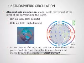
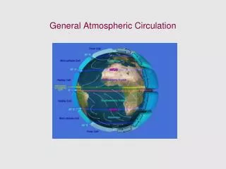
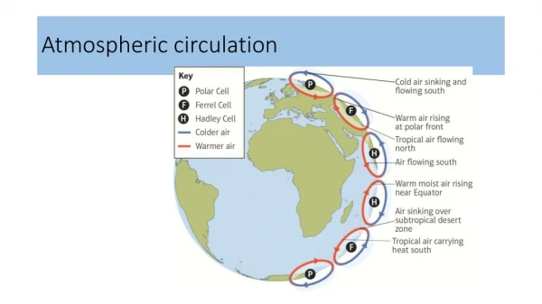
Even with disruptions like weather fronts and storms, there is a consistent pattern to how air moves around our planet’s atmosphere. https://spark.ucar.edu/shortcontent/global-look-moving-air-atmospheric-circulation
Define and explain isobars. Isobars are the lines on a weather map that show pressure differences. The parallel lines show changes in pressure, usually in increments of 2 to 4 millibars. http://tnms.org/DataDiscovery/Hurr_ED_Center/Hurr_Structure_Energetics/Closed_Isobars/Closed_Isobars.html
66. Sea breezes show how vertical and horizontal movements combine to modify temperature and pressure at a local level. Diagram A Diagram B http://www.learner.org/courses/envsci/unit/text.php?unit=2&secNum=6
Explain what is happening in diagram A and why. During the day coastal land regions heat up more than the sea because land warms more quickly than water. Air over the land is thus warmed and rises, increasing pressure in the atmosphere above the surface, where it starts to cool and form clouds. It then flows at altitude from the area of high pressure over land to lower pressure over the sea. Because there is then less mass over the land and more over the sea, pressure at the surface is higher at sea, so air flows in from the sea to the land. Diagram A sea breeze by day
Explain what is happening in diagram B and why At night, when land cools more quickly than the ocean, the cycle is reversed. sea breeze at night
Define the Coriolis force. What is the effect of this phenomenon? The Coriolis force is an apparent force caused by Earth’s rotation that allows for winds that move over very long distances to appear to curve. http://www.nc-climate.ncsu.edu/edu/k12/.coriolis • *Air at a point on the equator rotates at 1,700 kph, compared to 850 kph for a point that lies at 60°.
The measure of the extent to which an object will continue to rotate about a point unless acted upon by an external torque. Hurricanes are giant, spiraling tropical storms that can pack wind speeds of over 160 miles http://environment.nationalgeographic.com/environment/natural-disasters/hurricane-profile/
69. An object's angular momentum is the product of its mass, its velocity and its distance from the reference point (its radius). 70. The Coriolis force makes the winds in low-pressure weather systems such as hurricanes rotate (counterclockwise in the Northern Hemisphere and clockwise in the Southern Hemisphere), curving into spirals. http://www.almanac.com/topics/weather/severe-weather/hurricanes
Air parcels will spiral into low pressure areas near the surface, then rise once they reach the center. As the air rises, it cools, producing condensation, clouds, and rain. Air parcels will spiral away from high pressure areas near the surface toward low pressure areas. http://disasterandemergencysurvival.com/archives/what-to-do-if-a-hurricane-is-coming
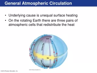
73. The first attempt to show how weather patterns combined to produce a general circulation of the atmosphere was offered in 1735 by English meteorologist George Hadley. 74. Hadley's model was accurate in many respects. What was he not aware of in his explanation? He was not aware of the Coriolis force, which produces easterly winds near the surface at low latitudes ("trade winds") and westerly winds at high latitudes. Farther north and south, this pattern repeats in two more sets of circulation zones, or "cells," between the tropics and the poles. http://www.co.hunterdon.nj.us/911/oem/hurricaneseason.html

