Download
1 / 19
190 likes | 372 Views
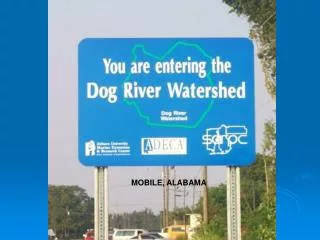
MOBILE, ALABAMA. Dog River Alabama. Dog River and its tributaries drain most of Mobile, Alabama. Those tributaries range from relatively pristine streams to concrete lined drainage ditches to sluggish, sediment choked, tidal channels .

E N D
Dog River Alabama • Dog River and its tributaries drain most of Mobile, Alabama. • Those tributaries range from relatively pristine streams to concrete lined drainage ditches to sluggish, sediment choked, tidal channels . • As the city itself spreads out into the upper reaches of the watershed, poorly managed construction and the replacement of natural vegetation with impermeable surfaces contribute to the deterioration of water quality in Dog River. • Sediment , sewage, and trash are the major issues. • This urban watershed empties into Mobile Bay, a National Estuary.
DOG RIVER WATERSHED The Dog River Watershed covers approximately 95 square miles. About 56% of the watershed lies within the Mobile City limits, and 44% lies outside the city limits. Major tributaries of Dog River include Alligator Bayou, Rabbit Creek, Halls Mill Creek, Moore Creek, Eslava Creek, and Robinson Bayou.
Concrete Lined Drainage Ditch that replaced the wetlands, like Wragg Swamp, that once handled flood waters and storm water runoff
Poorly Managed Construction as was seen with construction of the HWY 98 connector by ALDOT.
Aerial photograph showing the sediment plume from Moore Creek entering Dog River. This picture was taken by Gerritt Carver just after the heavy rainfall associated with Hurricane Georges in September 1998. The vast majority of the sediment came from the Montlimar Canal which drains into Moore Creek. Although sediment is a non-point source pollutant, most of this came from the Mobile Country Club.
There was evidence of a slight water discoloration, but only in and near the western tip of the bayou. No point sources for sedimentation could be found in the western bayou, leading me to believe that the discoloration is due to shallow waters that have been easily stirred up from the rain. No sediment can be seen in the eastern portions or being deposited in Dog River. Most of the river is shallow enough for the bottom to be seen in the photos.
This was the major source of sediment deposition into Dog River. Water discoloration is very evident throughout the entire Creek extending into Dog River. A number of construction sites can be found along the banks. Although construction sites could be contributing to the problem, the worst discoloration occurs farther west where the creek meanders through a relatively undeveloped area, mostly a wooded area. No point sources could be found through the thick foliage west of railroad tracks.
Montlimar Creek ran a close second to Halls Mill Creek in terms of sediment being deposited into Dog River. All along its banks, construction sites are present. Erosion can be seen in large stretches, sometimes over 100 meters long (Fig. 3). Sediment buildups within the stream are present. There are many drainage systems dumping excess water and sediment into the creek. The water discoloration is not as bad north of where the Eslava Creek runs into it north of Airport Blvd.
Once we reach Dog River, the water seems to turn towards a more natural looking color, not as milky-brown looking. This continues until we come upon the mouth of Montlimar Creek. From this point on, sediment can be seen flowing downstream along the western bank of DogRiver. Once the mouth of Halls Mill Creek is reached, the sediment from Montlimar seems to stop and the sediment from Halls Mill Creek starts being deposited directly into the center of the stream. (Figure 5 - sediment being deposited into Dog River from Halls Mill Creek)
Trash/Pollution drained into the waterways the watershed is collected.
Gabion = wire basket filled with rock or soil to stop erosion
Link to Papers written by college students at USA about Dog River and the surrounding area. Many papers include photos and interesting history about Mobile and the Dog River Watershed. • http://www.usouthal.edu/geography/fearn/480page/dogriver.html