Download
1 / 37
370 likes | 517 Views
Curriculum Planning and Resource Package. Water Systems on Earth. Scope. The Grade 8 Unit of Water Systems on Earth covers a variety of topics about water. Outcome WS8.1, has students exploring the distribution of water, the water cycle, and human interactions and influences on water systems

E N D
Curriculum Planning and Resource Package Water Systems on Earth
Scope • The Grade 8 Unit of Water Systems on Earth covers a variety of topics about water. • Outcome WS8.1, has students exploring the distribution of water, the water cycle, and human interactions and influences on water systems • Outcome WS8.2, includes understanding water ‘s effect on the landscape and environment. • Outcome WS8.3 focuses on water wildlife species and how water and the changing environment effects them. • There is also a significant focus in our unit on sustainability and conservation of water that is reflected throughout the outcomes and is highlighted in many of the activities and discussions. This is important because students are learning about water, but also changing their perspective to positively influence the future of our planet.
Sequence and Timeframe • This unit follows the same sequence as the curriculum, starting with Outcome WS8.1, then WS8.2, and finally WS8.3. The unit focus on sustainability of water and it ties in with both starting and ending the unit. • The unit covers an estimated time of 6 – 8 weeks, depending on how much time is spent on some of the activities and extension opportunities.
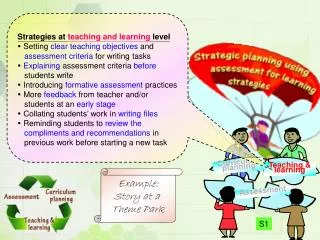
Pedagogical Strategies • This unit is made up of a majority of activity based learning. We chose this approach because it provides the opportunity for students to experience the learning and have hands on experience in the science field. This allows for a deeper understanding of the topics and learning. We experimented with non traditional ways of teaching science in order to get students excited and interested. We also incorporated activities and techniques that adapted to all types of learners, visual, audio, and kinaesthetic, so all students have the chance to learn and enjoy. Human and environmental justice was another approach we had during this unit. The human element is brought in to work with the indicators, but also provide the unique opportunity for students to think more critically about the world and how we can improve it.
‘5 E’ Learning Cycle • The ‘5 E’ learning cycle is important to our unit and is incorporated in many ways. Since out unit is comprised of activities, we have a unique opportunity to utilize this cycle a lot. In some cases, the 5 ‘E’s are all used in a single activity and other times there is a combination of activities that work together to piece the 5 E cycle for the student’s benefit.
‘5 E’ Learning Cycle • Example ‘5 E’ Learning Cycle • Engage: • World Water Statistics Discussion • Explore: • Water Footprint Activity • Explain: • Dragonfly Pond Activity (Project Wild, p. 354) • Elaborate: • Dragonfly Pond Research and Debate • Evaluate: • Dragonfly Pond Presentation and Journal Reflection
Classroom Management and Safety At the beginning of the Water Systems Unit it is important to establish classroom rules and expectations. Within these expectations we will also establish classroom safety rules and procedures. Throughout the unit we will review to ensure that all students understand. Our classroom management strategies will be activity based. By making our classroom activity based it will keep the students engaged and interested. This responsibility will empower students to achieve their goals. Our activities that we chose to engage students also involve different environments to keep students interest by not always being in the classroom. To help with time management in the classroom pre made groups will be made at the beginning of the unit to maximize time for activities.
Outcome WS8.1Analyze the impact of natural and human-induced changes to the characteristics and distribution of water in local, regional, and national ecosystems • a) Construct visual representations of the world distribution of water, and the distribution of water in Saskatchewan, including watersheds, lakes, rivers, streams, river systems, wetlands, ground water, saline lakes, and riparian areas. • b) Compare physical characteristics of surface water features, such as lakes, rivers, streams, wetlands, and riparian areas. • c) Examine the significance of water to First Nations and Métis people of Saskatchewan, including water as an essential element of life, transportation, water quality, fishing practices, and treaty rights regarding fishing. • d) Apply the concept of systems as a tool for interpreting the structure and interactions of water systems by constructing representations of systems such as the water cycle, watersheds, and continental drainage basins and showing interrelationships between parts of the system. • e) Construct a written, visual, or dramatic representation of the water cycle, including showing or explaining how a single particle of water can travel through the cycle over extended periods of time. • f) Identify possible personal, societal, economic, and environmental consequences of natural changes and human practices and technologies that pose threats to surface and/or ground water systems in Saskatchewan. (e.g., vegetation removal, water and sewage treatment plants, timber harvesting, over-application of fertilizers, agricultural and urban irrigation, impervious ground cover, land alterations, mining, introduction of invasive species, shoreline erosion, fluctuating lake levels, flooding, draining and/or channelling of surface water features, and damming of rivers). • g) Research a specific human practice or technology that may pose a threat to surface and/or groundwater systems in Saskatchewan and explain how different groups in society (e.g., landowner, consumer, business owner, recreational user, fisherman, government official, and farmer) may have conflicting needs and desires in relation to the practice or technology and how those decisions or actions of different stakeholders may or may not be addressed by scientific or technological knowledge. • h) Evaluate individual and group processes used in planning, problem solving, decision making, and completing a task related to studying threats to water systems, such as accepting various roles in a group, sharing responsibility for carrying out decisions, and seeking consensus before making decisions.
Outcome WS8.1 Activities Orange Peel World Activity (1) • Students will understand how much of the earth’s surface is water through following direction to peel an orange representing the earth. • Indicators: • a) Construct visual representations of the world distribution of water, and the distribution of water in Saskatchewan, including watersheds, lakes, rivers, streams, river systems, wetlands, ground water, saline lakes, and riparian areas.
Outcome WS8.1 Activities It’s a Small World (2) (3) • Students will act out and see a visual representation of the distribution of fresh water around the world and discuss and explore the reasons and consequences for this. • Indicators: • a) Construct visual representations of the world distribution of water, and the distribution of water in Saskatchewan, including watersheds, lakes, rivers, streams, river systems, wetlands, ground water, saline lakes, and riparian areas. • Cross Curricular: Social Studies
Outcome WS8.1 Activities How Wet is Our Planet (Project Wild, p. 50) • Students will understand the distribution of water on earth (ie oceans, rivers, lakes) through a measuring and calculating activity. • Indicators: • a) Construct visual representations of the world distribution of water, and the distribution of water in Saskatchewan, including watersheds, lakes, rivers, streams, river systems, wetlands, ground water, saline lakes, and riparian areas. • Cross Curricular: Mathematics
Outcome WS8.1 Activities The History of Water (4) • Students will read and share traditional First Nations stories of the history of water, how it came on earth, and its importance. Students will then write their own legend on how water first came into being. • Cross Curricular: ELA Wood Bending (5) • In this activity students will learn about and use water to bend and shape pieces of wood to understand one of the traditional First Nations uses of water. • Indicators: • c) Examine the significance of water to First Nations and Métis people of Saskatchewan, including water as an essential element of life, transportation, water quality, fishing practices, and treaty rights regarding fishing.
Outcome WS8.1 Activities Surface Water Features (20) • Students will look at a variety of photographs and pictures of examples of surface water features. They will put them into categories and write down a list of characteristics that accompany each feature. The class will compare their lists of characteristics and add any to the list to make the distinctions between what makes each one unique and classifiable. (use resource for information) • Saskatchewan’s Water (6) • This site offers information about the distribution of water in Saskatchewan and the uses of it as a resource. • Saskatchewan Watershed Authority: Conserving Our Water Document (7) • This document is a huge resource with information regarding the distribution of water in Saskatchewan and the water conservation issue. It also provides questions for the students to think about, discuss, and answer, and actually send in to the government. • Indicators: • Compare physical characteristics of surface water features, such as lakes, rivers, streams, wetlands, and riparian areas.
Outcome WS8.1 Activities “Branching Out” (Project Wet, p. 129) • Students will build a model landscape and investigate how water flows through and connects to different surface water areas. • Indicators: • b) Compare physical characteristics of surface water features, such as lakes, rivers, streams, wetlands, and riparian areas. • d) Apply the concept of systems as a tool for interpreting the structure and interactions of water systems by constructing representations of systems such as the water cycle, watersheds, and continental drainage basins and showing interrelationships between parts of the system.
Outcome WS8.1 Activities • Extension opportunities: Watershed (Project Wild, p. 376) • As a class project, students construct and monitor their own watershed and record and explore its uses. • Indicators: • b) Compare physical characteristics of surface water features, such as lakes, rivers, streams, wetlands, and riparian areas. • d) Apply the concept of systems as a tool for interpreting the structure and interactions of water systems by constructing representations of systems such as the water cycle, watersheds, and continental drainage basins and showing interrelationships between parts of the system.
Outcome WS8.1 Activities “Alice in Waterland” (Project Wild, p. 380) • Students will visual imagine the water cycle through story telling. Then they will create a visual mural representation of the process in which a single drop goes through from human use through the cycle. • Cross Curricular: Arts Ed “Imagine” (Project Wet, p.157). • Students use their imagination sparked by visualization and prompts to go through the various forms (liquid, solid, gas) of the water cycle around the world. Water Cycle Song (8) (9) • Students will listen to the water cycle song written and produced by Don Waite and will create their own musical rendition depicting the water cycle. • Cross Curricular: Information Processing • Indicators: • e) Construct a written, visual, or dramatic representation of the water cycle, including showing or explaining how a single particle of water can travel through the cycle over extended periods of time.
Outcome WS8.1 Activities “The Incredible Journey” (Project Wet, p.161) • Students simulate the water cycle, moving from stations with rolling die, and its interactions throughout the ecosystem and then discuss the experience and the effects. • Indicators: • d) Apply the concept of systems as a tool for interpreting the structure and interactions of water systems by constructing representations of systems such as the water cycle, watersheds, and continental drainage basins and showing interrelationships between parts of the system • e) Construct a written, visual, or dramatic representation of the water cycle, including showing or explaining how a single particle of water can travel through the cycle over extended periods of time.
Outcome WS8.1 Activities Water Cycle (10) Students will explore an interactive website to formally understand the water cycle. “Water models” (Project Wet, p.201) • Students will construct model demonstrating the water cycle. • Indicators: • d) Apply the concept of systems as a tool for interpreting the structure and interactions of water systems by constructing representations of systems such as the water cycle, watersheds, and continental drainage basins and showing interrelationships between parts of the system • e) Construct a written, visual, or dramatic representation of the water cycle, including showing or explaining how a single particle of water can travel through the cycle over extended periods of time.
Outcome WS8.1 Activities World Water Statistics (12) • Students will be shown statistics about water use worldwide and discuss the reason and implementations of them. Water Footprint (11) Students will calculate their impact they have with their lifestyle on water resources to understand how much of an effect humans have on and need water. • Indicators: • f) Identify possible personal, societal, economic, and environmental consequences of natural changes and human practices and technologies that pose threats to surface and/or ground water systems in Saskatchewan.
Outcome WS8.1 Activities • Research and Debate Project: • Dragonfly Pond (Project Wild, p. 354)(Expanded) • Students will understand the many uses of a wetland and the effects that humans have on the resource and the personal, social, economic, and environmental consequences. Through this simulation they will understand and figure out how and why a variety of groups in society, including First Nations, need and use water. • Research • Students, in groups, will investigate further and research their chosen group. They will find more specifically (ie. what they need and use water for, how they do that, what kinds of conservation techniques they could use). • Debate • After researching and preparing themselves, groups will then have a class debate as their chosen group to present and try to win the argument over who gets priority to use the land around the pond. • Cross Curricular: ELA, Social Studies
Outcome WS8.1 Activities • Research and Debate Project: • Indicators: • f) Identify possible personal, societal, economic, and environmental consequences of natural changes and human practices and technologies that pose threats to surface and/or ground water systems in Saskatchewan. (e.g., vegetation removal, water and sewage treatment plants, timber harvesting, over-application of fertilizers, agricultural and urban irrigation, impervious ground cover, land alterations, mining, introduction of invasive species, shoreline erosion, fluctuating lake levels, flooding, draining and/or channelling of surface water features, and damming of rivers). • g) Research a specific human practice or technology that may pose a threat to surface and/or groundwater systems in Saskatchewan and explain how different groups in society (e.g., landowner, consumer, business owner, recreational user, fisherman, government official, and farmer) may have conflicting needs and desires in relation to the practice or technology and how those decisions or actions of different stakeholders may or may not be addressed by scientific or technological knowledge. • h) Evaluate individual and group processes used in planning, problem solving, decision making, and completing a task related to studying threats to water systems, such as accepting various roles in a group, sharing responsibility for carrying out decisions, and seeking consensus before making decisions. • c) Examine the significance of water to First Nations and Métis people of Saskatchewan, including water as an essential element of life, transportation, water quality, fishing practices, and treaty rights regarding fishing.
Outcome WS8.1 Activities Extension Opportunity: Saskatchewan Science Center “Field of Streams” (12) • Students will take a class field trip to the Saskatchewan Science Center and investigate the interactive activity “Field of Streams”, where students get to build models and see how water effects the land and buildings. • Indicators: • f) Identify possible personal, societal, economic, and environmental consequences of natural changes and human practices and technologies that pose threats to surface and/or ground water systems in Saskatchewan. (e.g., vegetation removal, water and sewage treatment plants, timber harvesting, over-application of fertilizers, agricultural and urban irrigation, impervious ground cover, land alterations, mining, introduction of invasive species, shoreline erosion, fluctuating lake levels, flooding, draining and/or channelling of surface water features, and damming of rivers).
Outcome WS8.2Examine how wind, water, and ice, have shaped and continue to shape the Canadian landscape a. Explain how the processes of weathering, erosion, and deposition result from water movement and wave action, including how waves and tides are generated and how they interact with shorelines. b. Plan and conduct a simulation to demonstrate how temperature differences cause water currents. c. Explain the meaning and significance of the forces that shape the landscape to First Nations and Métis people. d. Describe how the interactions of ocean currents, winds, and regional climates shape local, regional, national, and global environments. e. Critique the design and function of technologies designed to minimize damage due to waves and tides (e.g., piers, breakwaters, dune vegetation, and coastline reconfiguration) in oceans and in-land water bodies. f. Create a written, visual, physical, or dramatic representation of the processes that lead to the development of rivers, lakes, continental drainage systems, and ocean basins, including glaciation, continental drift, erosion, and volcanic action. g. Relate factors that affect glacier formation and reduction and their effects on the environment to the formation of glacial landforms in Saskatchewan (e.g., drumlins, moraines, eskers, and kettle lakes). h. Identify factors that affect polar icecap formation and reduction and their effects on the environment, including possible changes to ocean currents and climate patterns. i. Propose new questions and problems for future study that arise from the study of the effects of wind, water, and ice on the landscape (e.g., “How might changes in glaciers affect Saskatchewan water supplies?” “How might icecap melting change Canadian coastlines?”).
Outcome WS8.2 Activities • The Great Stony Book • (Project WET pg 150) • A simulation of water eroding through layers of rock (ex. Grand Canyon) • Indicators: • a. Explain how the processes of weathering, erosion, and deposition result from water movement and wave action, including how waves and tides are generated and how they interact with shorelines. • d. Describe how the interactions of ocean currents, winds, and regional climates shape local, regional, national, and global environments. • f. Create a written, visual, physical, or dramatic representation of the processes that lead to the development of rivers, lakes, continental drainage systems, and ocean basins, including glaciation, continental drift, erosion, and volcanic action.
Outcome WS8.2 Activities • A House of Seasons (Project WET pg 155) • Students create a collage displaying the presence of water in each season. • Indicators: • b. Plan and conduct a simulation to demonstrate how temperature differences cause water currents. • c. Explain the meaning and significance of the forces that shape the landscape to First Nations and Métis people. • d. Describe how the interactions of ocean currents, winds, and regional climates shape local, regional, national, and global environments. • f. Create a written, visual, physical, or dramatic representation of the processes that lead to the development of rivers, lakes, continental drainage systems, and ocean basins, including glaciation, continental drift, erosion, and volcanic action. • Extension opportunities: • ELA - write a story, poem, or song about your collage • Science- Students can investigate how the earths axis and rotation causes seasons.
Outcome WS8.2 Activities • Just Passing Through(Project WET pg 166) • Students investigate the movement of water over land • Indicators: • a. Explain how the processes of weathering, erosion, and deposition result from water movement and wave action, including how waves and tides are generated and how they interact with shorelines. • b. Plan and conduct a simulation to demonstrate how temperature differences cause water currents. • c. Explain the meaning and significance of the forces that shape the landscape to First Nations and Métis people. • d. Describe how the interactions of ocean currents, winds, and regional climates shape local, regional, national, and global environments. • e. Critique the design and function of technologies designed to minimize damage due to waves and tides (e.g., piers, breakwaters, dune vegetation, and coastline reconfiguration) in oceans and in-land water bodies. • f. Create a written, visual, physical, or dramatic representation of the processes that lead to the development of rivers, lakes, continental drainage systems, and ocean basins, including glaciation, continental drift, erosion, and volcanic action. • Extensions Opportunities: • - Possible opportunity to research the meaning of various plants, types of weather, and other elements of our environment from a First Nations perspective.
Outcome WS8.2 Activities Glaciers and Icebergs (14) • Students will construct their own glacier and observe what happens when glaciers move and how the moving glacier leaves clues to the climate in a particular place over a long period of time Indicators: f. Create a written, visual, physical, or dramatic representation of the processes that lead to the development of rivers, lakes, continental drainage systems, and ocean basins, including glaciation, continental drift, erosion, and volcanic action. g. Relate factors that affect glacier formation and reduction and their effects on the environment to the formation of glacial landforms in Saskatchewan (e.g., drumlins, moraines, eskers, and kettle lakes). h. Identify factors that affect polar icecap formation and reduction and their effects on the environment, including possible changes to ocean currents and climate patterns. • Propose new questions and problems for future study that arise from the study of the effects of wind, water, and ice on the landscape (e.g., “How might changes in glaciers affect Saskatchewan water supplies?” “How might icecap melting change Canadian coastlines?”).
Outcome WS8.2 Activities To wrap up the outcome of 8.2 I would propose to students that they construct a final project based around indicator (i). They will propose a question for deeper understanding and will then display their new knowledge any way they see fit. i. Propose new questions and problems for future study that arise from the study of the effects of wind, water, and ice on the landscape (e.g., “How might changes in glaciers affect Saskatchewan water supplies?” “How might icecap melting change Canadian coastlines?”). Possible ways of doing so: Research paper, Diorama, Poster or display board, Song, Dramatic performance, Poem or short story. Many of these possible idea could be extended to various subjects like ELA or Arts Ed. This will be used to asses the students and show that they understand.
Outcome WS8.3Analyze natural factors and human practices that affect productivity and species distribution in marine and fresh water environments Indicators • A. Examine the ways in which First Nations and Métis people traditionally valued, depended upon, and cared for aquatic wildlife and plants in Saskatchewan and Canada. • B. Identify diverse examples of organisms in a variety of marine and freshwater ecosystems (e.g., wetlands, lakes, rivers, salt marsh, estuary, ocean, and intertidal zone) and explain how biodiversity is an indicator of ecosystem health. • C. Identify factors that affect productivity and species distribution in aquatic environments (e.g., temperature, turbidity, sunlight, nutrients, salinity, water depth, currents, overfishing, upwelling, and pollutants). • D. Research a student-selected aquatic species, describe the characteristics of its environment, identify factors that could affect its productivity, and suggest methods of ensuring long-term viability of the species. • E. Measure factors that provide indicators of water quality, such as temperature, turbidity, dissolved oxygen content, presence of nitrates or phosphates, and macroinvertebrates, from a variety of samples of water. • F. Interpret patterns and trends in water quality data, and infer and explain relationships among the variables. • G. Identify strengths and weaknesses of different methods of collecting and displaying data about water quality. • H. Describe examples of technologies used to assess water quality and how those technologies have changed over time. • I. Provide examples of how individuals and public and private Canadian institutions contribute to the sustainable stewardship of water through traditional knowledge and scientific and technological research and endeavours related to aquatic environments (e.g., marine research institutes, universities, federal and provincial government departments, and ecological groups) and identify possible careers related to the study and stewardship of water.
Outcome WS 8.3 Activities • “Biodiversity” (15) - This activity came from National Geographic. In this activity students research two different types of ecosystems, as well as an aquatic species from both ecosystems. For example, the Hawaiian islands and the humpback whale. • Indicators: • d. Research a student-selected aquatic species, describe the characteristics of its environment, identify factors that could affect its productivity, and suggest methods of ensuring long-term viability of the species. • A. Examine the ways in which First Nations and Métis people traditionally valued, depended upon, and cared for aquatic wildlife and plants in Saskatchewan and Canada. Extension Opportunities- • Research a species native to Canada and its significance to First Nations tradition. Cross Curricular -Social Studies -Geography
Outcome WS 8.3 Activities • Turtle Hurdle • (P. 363 Project Wild) • - In this activity students discover the life cycle, mortality factors, making inferences about the effects of limiting factors on sea turtle populations, as well as making recommendations to limit these factors. • Indicators: • b. Identify diverse examples of organisms in a variety of marine and freshwater ecosystems (e.g., wetlands, lakes, rivers, salt marsh, estuary, ocean, and intertidal zone) and explain how biodiversity is an indicator of ecosystem health. • c. Identify factors that affect productivity and species distribution in aquatic environments (e.g., temperature, turbidity, sunlight, nutrients, salinity, water depth, currents, overfishing, upwelling, and pollutants). • d. Research a student-selected aquatic species, describe the characteristics of its environment, identify factors that could affect its productivity, and suggest methods of ensuring long-term viability of the species. • Extension Opportunities- Can extend/ be applied to local animals • Cross Curricular- Health (life cycles of both humans and animals)
Outcome WS 8.3 Activities • “Contaminated Drinking Water”(16) • In this activity students will contaminate their water with edible ingredients (vinegar& salt). The purpose of this activity is to see if students can detect contaminated water with their taste buds & their eyes. • Indicators: • e. Measure factors that provide indicators of water quality, such as temperature, turbidity, dissolved oxygen content, presence of nitrates or phosphates, and macroinvertebrates, from a variety of samples of water. • f. Interpret patterns and trends in water quality data, and infer and explain relationships among the variables. • g. Identify strengths and weaknesses of different methods of collecting and displaying data about water quality. • h. Describe examples of technologies used to assess water quality and how those technologies have changed over time. • Extension Opportunities- can extend into math, health, as well as deeper into science(profound impact something as harmless as salt can have on us and our water) • Cross Curricular- could cross into health (consuming poor quality water)
Outcome WS 8.3 Activities • Ocean in a bottle (17) • In this activity, students make their own ocean in a bottle, contaminating their bottle with oils and soap. From this activity, students gain an understanding of water pollution and how some of it mixes in while others don’t. • Indicators: c. Identify factors that affect productivity and species distribution in aquatic environments (e.g., temperature, turbidity, sunlight, nutrients, salinity, water depth, currents, overfishing, upwelling, and pollutants). e. Measure factors that provide indicators of water quality, such as temperature, turbidity, dissolved oxygen content, presence of nitrates or phosphates, and macroinvertebrates, from a variety of samples of water. • f. Interpret patterns and trends in water quality data, and infer and explain relationships among the variables. • g. Identify strengths and weaknesses of different methods of collecting and displaying data about water quality. • h. Describe examples of technologies used to assess water quality and how those technologies have changed over time. • Extension Opportunities- Research how these pollutants end up in the water, and what harm they present to us and animals alike. Or, research one body of water in particular and see how “healthy” it is.
Assessment and Evaluation • Science journals (20%) • Student will keep a “Science Learning Journal”. They will record the activities that they do in the unit and write their discoveries, feelings, and questions towards the topics and science. This will account for the “for” and “as” assessment. • Outcome WS8.1 (30%) • Dragonfly pond project and presentation. • Outcome WS8.2 (30%) • Deeper Questioning project and presentation. • Outcome WS8. 3 (20%) • “Biodiversity” Species Research Project and presentation.
Resources • Project Wet Curriculum and Activity Guide, 2005, The Watercourse, Project Wet International Foundation: Montana • Project Wild Activity Guide, 2006, Canadian Wildlife Federation, Council for Environmental Education: Ontario • 1) Field Trip Activity (attachment 1) • 2)http://www.cwec.ca/content/documents/Teachers/small%20world.pdf • 3)http://www.worldmapper.org/display.php?selected=102 • 4) ://www.forrex.org/JEM/ISS1/vol1_no1_art7.pdf • 5) http://www.literacycommunity.com/grade3/firstnations/waters.htm • 6)http://www.econet.sk.ca/issues/water/overview.html • 7) http://www.swa.ca/WaterConservation/Documents/WaterConservation.pdf • 8) Don Waite’s Earth Songs CD • 9) “GarageBand”
Resources • 10) http://www.epa.gov/safewater/kids/flash/flash_watercycle.html • 11) www.waterfootprint.org • 12) http://www.worldometers.info/ • 13)http://www.sasksciencecentre.com/here/exhibits/fieldofstreams.html • 14) http://school.discoveryeducation.com/lessonplans/programs/iceberg/ • 15)http://www.nationalgeogrsphic.com/expeditions/lessons/08/g68/index.html • 16)http://www.reachoutmichigan.org/funexperiments/agesubject/lessons/bottledocean.html • 17)http://www.reachoutmichigan.org/funexperiments/agesubject/lessons/cdwater.html • 18) http://www.janegoodall.ca/project-blue/FirstNationsandWater.html • 19) http://dsc.discovery.com/discovery-earth-live/#story=midway-journey • 20) http://ga.water.usgs.gov/edu/mearthsw.html
Attachment 1 • * * FIELD-TRIP ACTIVITY #1 * * • ACTIVITY: • 1. Take the orange and remove 3/4 of the peel • **This represents how much of the earth is water. • 2. Take away 1/2 of what’s left on the peel. • **This represents swamps, deserts, cities, mountains, etc. where food is not grown. • 3. Take away another 3/.4 of the remaining peel • **This represents areas that are too hot, too cold, too wet, too rocky, or too infertile to farm. • 4.That bit of peel left (1/32) shows how much land there is on the whole earth to provide food for people and • animals. This thin layer represents the thin crust of the earth upon which all people, animals and plants depend for • food and survival!