Download

1 / 6
0 likes | 7 Views
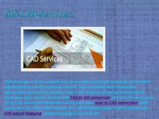
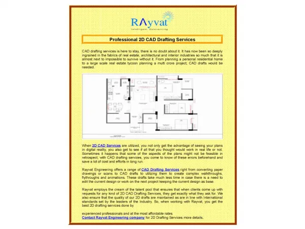
At a full-service CAD and GIS services company like ITechLance, you would avail CAD drafting, data conversion, GIS data transformation and 3D modeling services with the highest accuracy and precision. Their services are not just going to be helpful in construction engineering industry, but also in other industries like healthcare, agriculture, transportation, banking, automotive, aerospace, product design and more. Their reputation and expertise as a worldwide provider of point cloud to CAD and GIS services is second to none. https://www.itechlance.com/cad-conversion-drafting.html<br>

E N D
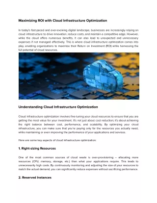
Whether you are an individual architect doing a few small construction design jobs or a big construction company dealing with more sophisticated engineering projects at multiple sites, time is money for you. If you finish up the projects before deadline, you become a preferred name in the industry and your business takes off remarkably quickly. Your own skills and expertise are a key factor, but that alone may not ensure timely delivery of every single job that you handle. It’s a fact that a professional CAD and GIS services company would be of great assistance to you in several different ways. They provide you more than just the point cloud to CAD or the Geographic Information System (GIS) services that you need for a successful project delivery. They become a key player in multiplying your ROI and achieving steady business growth. They offer you peace of mind.
If you are on the lookout for one such company that would help you with your CAD and GIS related services to achieve satisfaction, ITechLance could fit your bills. They are a highly experienced, professional GIS services company that would provide you with 100% accurate point cloud to CAD conversion, high- precision GIS services, 3D Scanning and Visualization, Floor planning, and Utility Mapping services. Let’s learn more about how point cloud to CAD conversion works and why it is essential efficiency. the highest customer for high-end operational
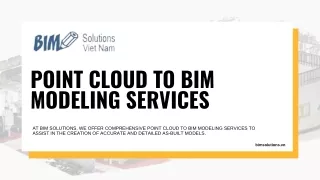
Point cloud to CAD Point cloud to CAD conversion conversion A point cloud consists of many millions of points obtained through a 3D scan of an object. This means the point cloud contains all the points contained in the object within their coordinated system including the ‘X’, ‘Y’ and ‘Z’ axes. Every point in the cloud has its own 3-dimensional position represented as the three axes on the 3D space. Each point gives additional information about its color value represented in the RGB (Red, Green, Blue) format and luminance value meaning its brightness. The collection of all the points along with their coordinates, color value and luminance value form the 3D object. ITechLance as your CAD partner would take the point cloud data from you or use their own technology to collect the raw data directly from the source, filter it and process it to get a 3D image of the object. Further, they study every minute detail of the image and perform the CAD conversion process to get the desired design as the end product. With their safe hands, you can expect to get the best outcome every time.
At a full-service CAD avail CAD drafting, data conversion, GIS data transformation and 3D modeling services with the highest accuracy and precision. Their services are not just going to be helpful in construction engineering industry, but also in other industries like healthcare, agriculture, transportation, banking, automotive, aerospace, product design and more. Their reputation and expertise as a worldwide provider of point cloud to CAD and GIS services is second to none. CAD and and GIS GIS services services company company like ITechLance, you would
I-Tech Lance information Technology Pvt. Ltd. Mahalaxmi Bhawan, Plot No: 329, Behind of Dasarathi Enclave, Jayadev Vihar, Bhubaneswar Odisha, India-751013 Tel:- +91 (0) 9861538899 Email-info@itechlance.com Web: https://www.itechlance.com/