Download
1 / 24
240 likes | 394 Views
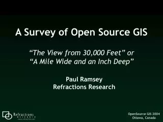
A Survey of Open Source GIS. “The View from 30,000 Feet” or “A Mile Wide and an Inch Deep”. Paul Ramsey Refractions Research. C Tribe UMN Mapserver GRASS OpenEV QGIS OGR/GDAL PROJ4 GEOS PostGIS. Java Tribe GeoTools GeoServer DeeGree OpenMap JUMP uDig. OpenGIS WMS/WFS. JDBC.

E N D
A Survey of Open Source GIS “The View from 30,000 Feet” or“A Mile Wide and an Inch Deep” Paul RamseyRefractions Research
C Tribe UMN Mapserver GRASS OpenEV QGIS OGR/GDAL PROJ4 GEOS PostGIS Java Tribe GeoTools GeoServer DeeGree OpenMap JUMP uDig OpenGISWMS/WFS JDBC Two Tribes
PostGIS GEOS OpenEV OSSIM OGR/GDAL GRASS Mapserver Proj4 QGIS GMT Thuban C Tribe
C Libraries • GDAL • Raster Format Reader / Writer • OGR • Vector Format Reader / Writer • PROJ4 • Coordinate Reprojection • GEOS • Geometry Objects and Functions
C Servers • Mapserver • OpenGIS Web Map Server • OpenGIS Web Feature Server • OGR / GDAL / PROJ4 • PostGIS / ArcSDE / OracleSpatial • PostGIS • OpenGIS Simple Features for SQL • PROJ4 / GEOS
Mapserver TIFF PostGIS ArcSDE Oracle WMS Mapserver WFS Shape MapInfo WMS
PostGIS WMSClient JUMP Internet WMS / WFS LAN PostGIS WFSClient QGIS
Viewers Processors C Applications • OpenEV • QGIS • Thuban • GRASS • OSSIM • GMT
OSSIM OpenSourceSoftwareImage Map
GMT • Generic Mapping Tools • UNIX Philosophy • Many small tools, chained together • Gridding, Contouring, Plotting • Surface Models
Java Tribe JCS Conflation Suite OpenMap uDig / JUMP2 GeoServer JUMP Unified Mapping Platform GeoTools WKB4J DeeGree GML4J JTS Topology Suite
Java Libraries • JTS Topology Suite • OpenGIS Geometries and Methods • GeoTools • Data Formats, Java GIS Toolkit • WKB4J • Java Well-Known Binary Reader / Writer • GML4J • Java GML Reader / Writer
Standalone JTS Based Java Applications • OpenMap • DeeGree • JUMP / JCS • GeoServer • uDig
OpenMap • Oldest Complete Java Toolkit • Telephone Company Project (BBN) • Design Application (not Data) Focused
DeeGree • Academic Roots • Bonn University • Message Passing API • OpenGIS Standards • Server Focused (WMS, WFS, SLD)
JUMP / JCS • Specialized Original Vision (Conflation) • General Purpose Tool • Editing, Processing, Transforming
GeoServer • OpenGIS WFS-T • Web Feature Server - Transactional • OpenGIS WMS (Beta) • Database Datasources + Shape
uDig • User-friendly Desktop Internet GIS • WFS, WMS, WRS • PostGIS, ArcSDE, OracleSpatial • Printing, Reprojection • Shape, GeoTIFF • GeoInnovations • Schedule
Strengths Server Side Heterogeneous Environments Performance Standards Support Complex or Custom Applications Weaknesses Interactive Desktop Paper Production Lowest Common Denominator “Standard” Applications Summary
Questions? 1 Mile 1 Inch