Download
1 / 27
270 likes | 447 Views
Standardized GIS using Open Source Software Experiences of Thailand. Dr.-Ing. Phisan Santitamnont Survey Engineering Department Faculty of Engineering Chulalongkorn University Bangkok Thailand Email: Phisan.S@eng.chula.ac.th. Contents. Open Source Software

E N D
Standardized GIS using Open Source SoftwareExperiences of Thailand Dr.-Ing. Phisan Santitamnont Survey Engineering Department Faculty of Engineering Chulalongkorn University Bangkok Thailand Email: Phisan.S@eng.chula.ac.th
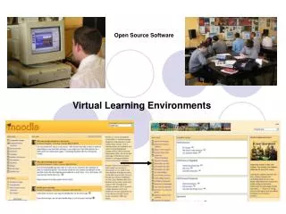
Contents • Open Source Software • Efforts at Chulalongkorn University • Conclusion and Outlook
Benefits of Open Source Software • Cut down budget • Opportunity for technology exploration • On-the-job training and education • Prototyping and demo • Excellent tools for research and development
Interesting Web Sites • www.fgdc.gov : isite • www.freegis.org : 158 entries • UMN/DNR MapServer : mapserver.gis.umn.edu • Postgis http://postgis.refractions.net/ • OGDI (Open Geographic Datastore Interface) • GeoServer: geoserver.sourceforge.net • Others: proj4, gml4j, gdal
Interesting Projects • Minnesota MapServer • Package of cgi-based map server • Known of standard GIS data format • Developed by UMN, DNR Minnesota • WMS 1.0.X compliant. • PostGIS • OpenGIS SF specification • Using Postgres as DB Engine • Some advance indexing features
A Study of Government Data Infrastructure 2001-2002 • Initiated by the National Information Technology Committee (NITC), Ministry of Science and Technology • study of data integrity in Thai government • 4 Categories of Data: personal data,…. spatial data • For spatial data, study done by Chulalongkorn University • Final report is underway.
Outcomes of GDI • Overview of european and north-american standard • Analysis of NSDI throughout the world • Overview of Thai administration • Seminars and Interview 200 departments and at 5 Ministry CIOs • Prototype • Clearinghouse: Isite with gateway implementation • Web Map Server Interface Standard: Minnesota MapServer
Prototyte: Clearinghouse • Base on FGDC: Isite package • Gateway also has been realized. • Two experimental node
สืบค้นด้วยขอบเขตพิกัดสืบค้นด้วยขอบเขตพิกัด ทางภูมิศาสตร์ 1 สืบค้นด้วยตัวอักษร 2 สืบค้นด้วยการระบุเวลา 3 ระบุฐานข้อมูลที่ต้องการ สืบค้น 4
สืบค้นด้วยขอบเขตพิกัดสืบค้นด้วยขอบเขตพิกัด ทางภูมิศาสตร์ 1 สืบค้นด้วยตัวอักษร 2 สืบค้นด้วยการระบุเวลา 3 ระบุฐานข้อมูลที่ต้องการ สืบค้น 4
1 2
1 GetCapability ระบุเครื่องแม่ข่าย
1 2 3 ระบุเครื่องแม่ข่าย GetMap
2 3 GetFeatureInfo
Education and Research on OpenGIS • Thesis and projects • Web Map Server, Web Feature Server based on MapServer and PostGIS • XML, GML, XSLT, SVG • OpenGIS-compliant WWW browser • Promotion and Training of OpenGIS
ผู้ใช้ A ผู้ใช้ B GIS ในยุค e-Governmentทุกหน่วยงานผลิตชั้นข้อมูลที่รับผิดชอบ ผู้ผลิต A, IP=A.org WMSI ผู้ผลิต B, IP=B.org WMSI ผู้ผลิต C, IP=C.org WMSI
GIS ในยุค e-Governmentผู้ใช้เรียกใช้ข้อมูลพร้อมกันจากหลายผู้ผลิตพร้อมกัน ผู้ใช้ ผู้ผลิต A, IP=A.org GIF ผู้ผลิต B, IP=B.org ผู้ใช้ ผู้ผลิต C, IP=C.org XML
Upcoming Events • Open source GIS and GRASS users conference 2002, Trento, Italy, 11-13 September 2002, University of Trento http://www.ing.unitn.it/~grass • PNC Annual Conference and Joint Meetings 2002PNC/ECAI/ IPSJ-SIGCH/EBTI, 15th-23th September, Japan, http://pnc-ecai.oiu.ac.jp/index-e.html • International Symposium on GeoInformatics for Spatial Infrastructure Development in Earth and Allied Sciences, GISIDEAS'2002) Hanoi, Vietnam, 25-28 September 2002, http://gisws.media.osaka-cu.ac.jp/gisideas/ • “Digital Asia” Project, under the Digital Asia Network (DAN) initiated by ACRORS/AIT , promoting on OpenGIS for spatial information sharing, 2002-2005, http://www.acrors.ait.ac.th/digital_asia/ • Training Program on OpenGIS for Spatial Information Sharing held by GAC, during 12th-16th November 2002, Bangkok, http://www.gac.ait.ac.th/training/schedule.htm
Conclusion • Open Source Software has open way for researcher to enable ‘standard’. • Thailand has ‘learnt by doing’ using OSS • Research and education for standardized GIS is going on. • Once technology is possessed and requirement had been ratified, then