Download
1 / 23
230 likes | 444 Views
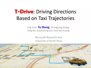
T-Drive : Driving Directions Based on Taxi Trajectories. Jing Yuan, Yu Zheng , Chengyang Zhang, Xing Xie, Guanzhong Sun, and Yan Huang. Microsoft Research Asia University of North Texas. What We Do. A smart driving direction service based on GPS traces of a large number of taxis

E N D
T-Drive: Driving Directions Based on Taxi Trajectories Jing Yuan, Yu Zheng,ChengyangZhang, Xing Xie, Guanzhong Sun, and Yan Huang Microsoft Research Asia University of North Texas
What We Do • A smart driving direction service based on GPS traces of a large number of taxis • Find out the practically fastest driving directions with less online computationaccording to user queries
Q=( and t) t =7:00am t = 8:30am
Background • Shortest path and Fastest path (speed constraints) • Real-time traffic analysis • Methods • Road sensors • Visual-based (camera) • Floating car data • Open challenges: coverage, accuracy,… • Have not been integrated into routing parking Human factor Traffic light
Background • What a drive really needs? • Finding driving direction > > Traffic analysis Traffic Estimation (Speed) Many open challenges Error Propagation Driving Directions Sensor Data Physical Routes Drivers Traffic flows
Observations • A big city with traffic problem usually has many taxis • Beijing has 70,000+ taxis with a GPS sensor • Send (geo-position, time) to a management center
Motivation • Taxi drivers are experienced drivers • GPS-equipped taxis are mobile sensors Traffic patterns Human Intelligence
Challenges we are faced • Low-sampling-rate • Data sparseness • Intelligence modeling
Methodology • Pre-processing • Building landmark graph • Estimate travel time • Time-dependent two-stag routing
Step 1: Pre-processing • Trajectory segmentation • Find out effective trips with passengers inside a taxi • A tag generated by a taxi meter • Map-matching • map a GPS point to a road segment • IVMM method (accuracy 0.8, <3min)
Step 2: Building landmark graphs • Detecting landmarks • A landmark is a frequently-traversed road segment • Top k road segments, e.g. k=4 • Establishing landmark edges • Number of transitions between two landmark edges > • E.g.,
Step 3: Travel time estimation • The travel time of an landmark edge • Varies in time of day • is not a Gaussian distribution • Looks like a set of clusters • A time-based single valued function is not a good choice • Data sparseness • Loss information related to drivers • Different landmark edges have different time-variant patterns • Cannot use a predefined time splits • VE-Clustering • Clustering samples according to variance • Split the time line in terms of entropy
Step 3: Travel time estimation • V-Clustering • Sort the transitions by their travel times • Find the best split points on Y axis in a binary-recursive way • E-clustering • Represent a transition with a cluster ID • Find the best split points on X axis iteratively
Step 4: Two-stage routing • Rough routing • Search a landmark graph for • A rough route: a sequence of landmarks • Based on a user query (, t, ) • Using a time-dependent routing algorithm
Step 4: Two-stage routing • Refined routing • Find out the fastest path connecting the consecutive landmarks • Can use speed constraints • Dynamic programming • Very efficient • Smaller search spaces • Computed in parallel
Implementation & Evaluation • 6-monthreal dataset of 30,000 taxis in Beijing • Total distance: almost 0.5 billion (446 million) KM • Number of GPS points: almost 1 billion (855 million) • Average time interval between two points is 2 minutes • Average distance between two GPS points is 600 meters • Evaluating landmark graphs • Evaluating the suggested routes by • Using Synthetic queries • In the field studies
Evaluating landmark graphs K=500 • Estimate travel time with a landmark graph • Using real-user trajectories • 30 users’ driving paths in 2monts • GeoLife GPS trajectories (released) K=4000 K=2000
Evaluating landmark graphs • Accurately estimate the travel time of a route • 10 taxis/ is enough
Synthetic queries • Baselines • Speed-constraints-based method (SC) • Real-time traffic-based method (RT) • Measurements • FR1, FR2 and SR • Using SC method as a basis
In the field study • Evaluation 2 • Different two users with similar driving skills • Travers two routes simultaneously • Evaluation 1 • Same drivers traverse • different routes at different times
Results • More effective • 60-70% of the routes suggested by our method are faster than Bing and Google Maps. • Over 50% of the routes are 20+% faster than Bing and Google. • On average, we save 5 minutes per 30 minutes driving trip. • More efficient • More functional
A free dataset: GeoLifeGPS trajectories 160+ users in a period of 1+ years Thanks! Yu Zheng Microsoft Research Asia yuzheng@microsoft.com
References [1] Jing Yuan, Yu Zheng, Chengyang Zhang, Wenlei Xie, Xing Xie, Guangzhong Sun, Yan Huang. T-Drive: Driving Directions Based on Taxi Trajectories. In Proceedings of ACM SIGSPATIAL Conference on Advances in Geographical Information Systems (ACM SIGSPATIAL GIS 2010). [2] Yin Lou, Chengyang Zhang*, Yu Zheng, Xing Xie. Map-Matching for Low-Sampling-Rate GPS Trajectories. In Proceedings of ACM SIGSPATIAL Conference on Geographical Information Systems (ACM SIGSPATIAL GIS 2009). [3] Jin Yuan, Yu Zheng. An Interactive Voting-based Map Matching Algorithm. In proceedings of the International Conference on Mobile Data Management 2010 (MDM 2010).