Download
1 / 16
170 likes | 513 Views
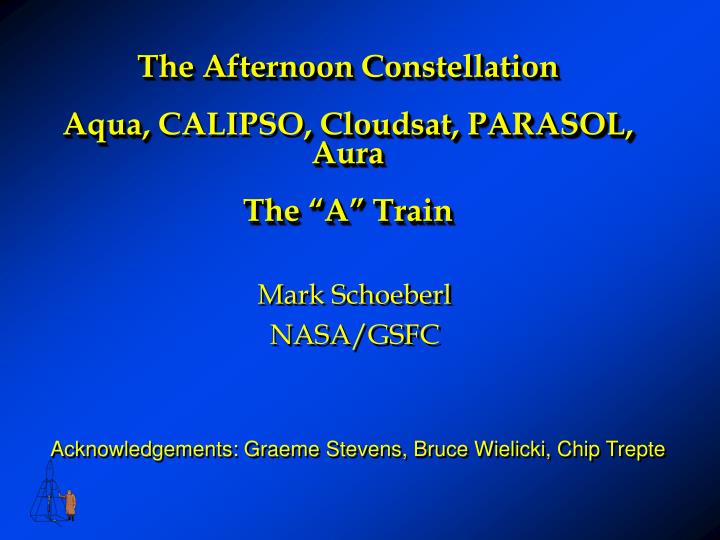
The Afternoon Constellation Aqua, CALIPSO , Cloudsat, PARASOL, Aura The “A” Train. Mark Schoeberl NASA/GSFC. Acknowledgements: Graeme Stevens, Bruce Wielicki, Chip Trepte. 1:38 PM. 1:30 PM. Aura. Cloudsat. CALIPSO. Aqua. PARASOL. OMI - Cloud heights OMI & HIRLDS – Aerosols

E N D
The Afternoon ConstellationAqua,CALIPSO, Cloudsat, PARASOL, AuraThe “A” Train Mark Schoeberl NASA/GSFC Acknowledgements: Graeme Stevens, Bruce Wielicki, Chip Trepte
1:38 PM 1:30 PM Aura Cloudsat CALIPSO Aqua PARASOL OMI - Cloud heights OMI & HIRLDS – Aerosols MLS& TES - H2O & temp profiles MLS & HIRDLS – Cirrus clouds CALPSO- Aerosol and cloud heights Cloudsat - cloud droplets PARASOL - aerosol and cloud polarization MODIS/ CERES IR Properties of Clouds AIRS Temperature and H2O Sounding The Aqua/Aura Afternoon Constellation The “A” Train
CALIPSO Control Box Aqua Cloudsat CALIPSO PARASOL Aura Cloudsat will “orbit”CALIPSO, both loosely following Aqua
Aqua • Sun - synchronous, polar • Altitude - 705 km nominal • Inclination - 98.2 +/- 0.1 degrees • Ascending node - 1:30 p.m. +/- 15 minutes • Period - 98.8 minutes • Launched - May 4, 2002 Instruments • Atmospheric Infrared Sounder (AIRS) • Advanced Microwave Sounding Unit (AMSU) • Humidity Sounder for Brazil (HSB) • Advanced Microwave Scanning Radiometer-EOS (AMSR-E) • Clouds and the Earth's Radiant Energy System (CERES) • Moderate Resolution Imaging Spectroradiometer (MODIS)
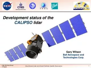
CALIPSO(formerly Picasso-CENA) Cloud-Aerosol Lidar and Infrared Pathfinder Satellite Observation LITE measurements over convection IIR 20 km 10 Laser WFC 0 Distance • 2-wavelength (532 and 1064 nm) polarization-sensitive LIDAR that provides 30 m vertical resolution profiles of aerosols and clouds. • Imaging infrared radiometer (IIR) that provides calibrated infrared radiances at 8.7 µ, 10.5 µ and 12 µ. These wavelengths are optimized for combined IIR/lidar retrievals of cirrus particle size. • High-resolution wide field camera (WFC) that acquires high spatial resolution imagery for meteorological context (620 to 670 nm).
Cloudsat • 94 GHz Cloud Profiling Radar (CPR) • Nadir-viewing • 500 m vertical resolution • 1.2 km cross-track, 3.5 km along track • Sensitivity: -30 to -36 dBZ Data Products • Radar reflectivity • Visible and near-IR radiances • Cloud base and top heights • Optical depth • Atmospheric heating rates • Cloud water content • Cloud ice content • Cloud particle size • Precipitation Occurrence
PARASOL POLDER Instrument Polarization and Directionality of the Earth's Reflectances Polarization and Anisotropy of Reflectances for Atmospheric Science coupled with Observations from a LIDAR POLDER is a push broom, wide field of view, multi-band imaging radiometer/polarimeter, 114-degree wide field of view, 7km x 6km footprint. A filter/polarizer wheel rotates and scans eight narrow spectral bands in the visible and near infrared (443, 490, 565, 665, 763, 765, 865 and 910 nm), and three polarization angles for select wavelengths.
Aura Atmospheric Chemistry and Climate: Launch mid-2003 • High Resolution Dynamics Limb Sounder (HIRDLS:USA) • Measures IR limb emission of trace gases and aerosols • Microwave Limb Sounder (MLS:USA) • Measures microwave limb emission of ozone destroying chemicals • Tropospheric Emission Spectrometer (TES: USA) • Down looking and limb looking measurements of air pollution • Ozone Monitoring Instrument (OMI: Netherlands) • Measures global ozone change Direction of flight M LS HIRDLS OMI TES
6x7 km POLDER 1. 4 km Cloudsat 0.5 km MODIS Band 3-7 0.09 km CALIPSO Cloud 13.5 km AIRS IR; AMSU & HSB m wave 5.3 x 8.5 km TES “A-Train” Nadir Footprints 2.3 km AIRS 0.4-1 m Washington DC USGS Map
30 25 20 15 10 5 0 Vertical Resolution of the “A Train” Aura Aqua CALIPSO Cloudsat AMSU HSB Km AIRS TES MLS HIRDLS 0.03 1.5-2 1.5 2.3 1 2 0.5 Vertical resolution in km
A-Train Science Aqua/CALIPSO/Cloudsat/Parasol/Aura • What are the aerosol types and how do observations match aerosol global emission & transport models? • CALIPSO aerosol height information + Aqua/MODIS & POLDER to get aerosol size distribution and composition • How do aerosols contribute to the Earth radiation budget/ climate forcing? • CALIPSO aerosol height information + MODIS & POLDER size distributions + Aqua CERES for Earth Radiation budget • How does cloud layering effect the Earth Radiation budget? • Cloudsat + CALIPSO + MODIS provides cloud height and thickness information; CERES provides Earth Rad. Budget • What is the role of Polar Stratospheric Clouds in ozone loss and denitrification of the Arctic vortex? • CALIPSO + Aura/HIRDLS cloud height measurement + Aura MLS Ozone, Temperature, HNO3 and ClO • What is the vertical distribution of cloud water/ ice in cloud systems? • Cloudsat + Aura/MLS + Aqua/HSB & AMSR/E
“A” Train Correlative Measurements • AIRS/HSB/AMSU and MLS - upper tropospheric water vapor • MLS: Upper tropospheric O3, H2O, Cirrus ice - 1.5 km vertical resolution ~ 7.5minutes behind Aqua (fraction of ppm accuracy) • HIRDLS 22.5 minutes behind- upper trop. down to cloud tops, 1 km vertical res. • MODIS, PARASOL and OMI - aerosols and clouds • PARASOL gets polarization from different angles which can be used to identify aerosol types • OMI gets UV absorbing aerosols (smoke, dust and sulfates) • MODIS gets small and large aerosol concentration • HIRDLS and CALIPSO • HIRDLS makes limb IR aerosol measurements with vertical resolution of 1.5 km • CALIPSO makes aerosol measurements to 30m • TES and AIRS - Spectral information • TES: Spectral Coverage 3.2 - 15.4 mm, 0.025 cm-1 resolution • AIRS: Spectral Coverage 3.4 - 15.4 mm, resolution ~1 cm-1
Summary of the “A” Train • The Formation • Aqua (1:30 PM )and Aura (1:38 PM)) must maintain groundtrack on the WRS (±20 km) using frequent burns (once every 3 months) • Cloudsat and CALIPSO ~20 seconds (~140 km) behind Aqua within a control box 40 seconds wide. Near end of mission, CALIPSO drifts (left) across MODIS swath. • PARASOL is roughly lined up Aqua about 3 minutes behind • Aura is 15 minutes behind Aqua (crossing time is 1:38 PM) • The Science • Unprecedented cloud science • Unprecedented climate/aerosol/chemistry science • Correlative measurements • Challenges • Variety of vertical and horizontal resolutions which will be challenging to match
Formation Flying with Aqua Aura and Aqua have different WRS paths. TES Limb track MODIS 1150 km Orbit Plane Airs 825 km Aqua MLS Limb track N Ground track (WRS Path) ~2500 km 15 min (~ 52o lat) CALIPSO PARASOL Cloud Sat 7 min (~ 26o lat) CALIPSO/Cloudsat ~2 minutes behind Aqua Parasol is 3 minutes behind Aqua ~2500 km 73 km 373 km Aura 197 km Equator OMI 1300 km 172 km TES Limb track 7 min OMI swath is larger than MODIS or AIRS ~394 km 1000 km 2000km HIRDLS scan
Aqua’s Temperature and Moisture Sounding Suite AMSR/E (Cloud properties, precipitation, total moisture) 12 channels at six discrete frequencies in the range of 6.9 to 89 GHz AMSU (Temperature and moisture profiles) 15 discrete channels in the range of50 to 89GHz AIRS (Temperature & moisture profiles, cloud properties) 2,300 spectral channels in the range of 0.4 to 1.7 µ and 3.4 to 15.4 µm MODIS (Cloud and aerosol properties etc.) 36 spectral bands from 0.4 to 14 µm HSB (Moisture profiles) 5 discrete channels in the range of 150 to 183 MHz CERES (Radiant energy flux) Two sensor, one scanning cross track, the other scanning azimuthally view in three channels per scanner: shortwave (0.3 to 5 µm), longwave (8 to 12 µm), and "total" (0.3 to > 50 µm)