Download
1 / 54
540 likes | 689 Views
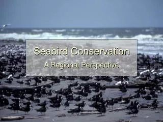
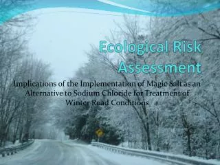
The Seabird Ecological Assessment Network (SEANET). A project of Tufts University’s Cummings School of Veterinary Medicine North Grafton, Massachusetts. The State of the World’s Oceans. Oceans cover 70% of Earth’s surface and profoundly affect biological and physical processes

E N D
The Seabird Ecological Assessment Network (SEANET) A project of Tufts University’s Cummings School of Veterinary Medicine North Grafton, Massachusetts
The State of the World’s Oceans Oceans cover 70% of Earth’s surface and profoundly affect biological and physical processes 60% of world’s population lives on or near a coast Number will increase to ~75% in next decade Oceans are under increasing pressure!
Seabirds are Sentinels of Ocean Health • One of most numerous and visible groups of wildlife in coastal marine environments worldwide • Spend most of their lives on the ocean • Specialized diets • Populations and reproduction are closely linked to status of marine prey • Top predators • Bioaccumulate toxins and contaminants acquired from prey
Global Threats Facing Seabirds • Emerging infectious diseases • Interactions with fisheries – bycatch, entanglement • Harmful algal blooms • Contaminants (e.g. heavy metals, pesticides) • Plastics • Sewage contamination • Overfishing Plastic debris Oil contamination Bycatch
How do we detect changes in seabird populations? • Count live birds • Census breeding colonies (breeding adults and offspring) • Count birds at sea • Count dead birds • Mortality data are critical for understanding the magnitude and causes of population change • Easier to count carcasses than live birds; and, data are verifiable with photographs (live bird data often difficult to verify)
SEANET: monitoring beached birds • SEANET is the only coordinated seabird mortality surveillance project on the Atlantic coast • SEANET is carried out by both scientists and conservation minded citizens. Through this program, you can participate in university science and marine conservation.
SEANET is citizen science • Over 100 volunteers • Beaches covered: Maine to New Jersey; Georgia and Florida • Beaches walked 1 or 2 times a month • Volunteers do not need specialized birding skills to participate: Jerry Golub, volunteer in New Jersey
Data generated by SEANET • Beached Bird Encounter Rate • # of carcasses found per km of beach per month • Beach “conditions” during survey • e.g. Wind, Temperature, Precipitation • Live seabirds and shorebirds • These data are optional
SEANET Protocols PART ONE: GETTING STARTED I. Volunteer Supplies: SEANET provides: You provide: volunteer protocol digital camera datasheets binoculars foot key gloves measurements diagram rain gear wing ruler sun protection calipers pencil and clipboard cable ties (for marking carcasses)
Beached Bird Field Guide Not required, but very useful for beached bird identification in the field Can be purchased from Tufts for $31.50 (+ $4.50 shipping & handling)
Foot Key for ease of ID Foot key is used to identify a bird to “foot family”
PART ONE: GETTING STARTED II. Choosing a beach • Work with SEANET staff and Google Earth (a free download) to determine which beach to survey • Pick a beach that you can reliably access year-round • Beaches should be at least 1km in length
Beach Characteristics Form This form tells us about the types of factors specific to your beach that might influence the number of carcasses you find It should be completed during your first survey and then mailed to Tufts. Description of Start and End points should be written in enough detail for anyone to understand; photos of your stop and end points are also requested This form is an opportunity for you to tell us about your unique beach!
Beach Characteristics Form You may not have all the answers to the questions, but fill them out as thoroughly as you can
PART TWO: WALKING YOUR BEACH I. When to survey • Surveys must be conducted either once or twice monthly YEAR-ROUND. If you cannot walk year-round, please team up with another person who can walk while you are away. Weekly surveys are ideal, but only if done consistently year-round • Make sure that surveys are evenly spaced over time (e.g. if once a month, make sure they are around the same time each month) • Do not report beached birds observed on “random” walks outside of your surveys (we cannot use these data) • Conduct surveys at low tide, or just after high tide as the tide is going out • Consult your local newspaper for tide charts, or go to http://tidesonline.nos.noaa.gov (this is in the SEANET protocol)
PART TWO: WALKING YOUR BEACH II. Where to survey • Conduct surveys on the same segment of beach each time • Data are reported as the # of carcasses per km of beach – therefore, the length of your beach must remain the same on each survey • *Do not submit a survey sheet if you were only able to walk part • of your beach • If your beach changes due to erosion or other physical processes, please contact your local SEANET Coordinator as soon as possible to update the Start and End points
PART TWO: WALKING YOUR BEACH II. Where to survey Survey low and high on your beach - the wrack line on your beach is particularly important to search thoroughly –carcasses often found in wrack Wrack line – the line of stranded debris, both natural (seaweed) and human-made (plastic bottles and bags) that forms at the water’s edge during high tides Natural wrack Be sure to search both wrack line from the most recent high tide as well as the wrack from extreme high tides (farther inland) Unnatural wrack
What to look for when searching for dead birds Fresh carcasses will often look like lumps on the beach: Older carcasses may be partially buried in sand or wrack Be sure to look for wing tips and feathers in sand and wrack Thick wrack can be searched using a walking stick
PART THREE: RECORDING THE DATA I. Filling out the datasheets • PLEASE REFER TO THE DATASHEET FOR THE FOLLOWING SLIDES • Remember to fill out your name, date of survey and beach number on each sheet (especially if you are going to submit the paper forms) • Provide the name(s) of all individuals participating in the survey • Additional surveyors increase the likelihood of finding carcasses and must be accounted for in data analyses • Record start time and duration of the survey (do not include time spent recreating)
BEACH CONDITIONS DATA Conditions during your survey that may influence the likelihood of finding carcasses: • Temperature (look up in local newspaper) • Fog (yes or no) • Sky (clear, partly cloudy, or overcast) • Wind direction and speed (can also look up in local newspaper) • Precipitation during the survey • Storm during past 48 hours • Ice/snow on beach (may obscure carcasses and lower likelihood of encounters) • Tide incoming our outgoing/high, low, or intermediate at time of survey (helps us determine how likely you were to find recently deposited carcasses)
BEACH CONDITIONS DATA III. Continuous • Wrack Line • None, patchy, continuous If continuous, narrow (<1m) or wide (>1m) II. Patchy I. None Two lines of wrack here - one from most recent high tide, other (higher up) from extreme high tide
BEACH CONDITIONS DATA • Beach raked? (usually done during summer, tourist season) • Recent beach stabilization • e.g., beach nourishment (addition of sand or dredged materials)
BEACH CONDITIONS DATA • Oil on beach? • May be balls, sludge, or an oily sheen Should be able to detect smell of petroleum IF OIL, CONTACT National Response Center Hotline and SEANET * NRC contact info in protocol
LIVE BIRD COUNTS • This is the ONLY optional section in the datasheet • We encourage, but do not require, live bird sightings • Live bird numbers can tell us something about dead bird numbers • Record the total number of each species • Conduct counts mainly on outbound leg of survey and keep a running tally - do not recount birds on return leg unless you are confident they are different birds • Report confidence in your ID (Very, Somewhat, Not Very) Data can be entered via SEANET or eBird (citizen science project of Cornell Lab of Ornithology); see Volunteer Protocol for instructions
REPORTING BEACHED BIRDS • What is a beached bird? • Any carcass or partial carcass with measurable bill, wing, or leg (Parts of bones or piles of feathers do not count) • Live birds that are injured, ill, or in distress are included as “beached” birds • Live birds should NOT be touched – report bird on SEANET datasheet and contact local rehabilitator • Also, if sick marine mammal found, DO NOT TOUCH – report to local stranding network Sick swan found by SEANET volunteer in 2008
REPORTING BEACHED BIRDS • Record Common Name of bird; if you do not know species, record as much as you can (e.g. “unknown gull”) • Use foot key to help with ID – also see “severed wing guide” on SEANET blog • Describe Status of bird: Live (in the case of sick or debilitated birds), fresh dead, moderate decomposition, advanced decomp, mummified skeletal
REPORTING BEACHED BIRDS • Body Parts Found • Entangled? Yes/No
REPORTING BEACHED BIRDS • Oil • Oil is also detectable by its aroma • Evidence of scavenging • Scavengers: gulls, foxes, raccoons • Gulls particularly common scavengers Gull scavenging - often a hole with breast meat eaten away
REPORTING BEACHED BIRDS • Sex • Usually cannot be determined except in the case of sea ducks (e.g. eiders) where males and females have different plumage • Age Class • Adult, Subadult, Chick, Unknown Plover chick – note down instead of feathers Subadult gull (note plumage)
REPORTING BEACHED BIRDS • Banded? (Leg or wing) • Measurements: Wing chord – (use ruler, cm) distance between wrist bend and tip of longest primary feather; keep wing in bent position during measurement Culmen – (use calipers, mm) Distance between tip of bill And the point where bill meets skin or feathers of forehead; always measured from top side of bill Tarsus – (use calipers, mm) measure diagonally across bone from middle groove of ankle joint to top edge of the foot
REPORTING BEACHED BIRDS Photo Protocol: Brush off sand and position carcass so that the head is in profile and wings are in a “M” position Take 2 photos: one ventral and one dorsal – be sure to be directly above carcass when taking photograph (avoid angled shots) Include ruler in photo for scale Include label in photo – beach ID, Date, Bird Species • PHOTOGRAPH EVERY DEAD BIRD • REQUIRED for independent verification of species ID Do not place label on top of carcass Position head so that profile can be seen – not possible to see bill profile in this photo Good example
REPORTING BEACHED BIRDSWHAT TO DO WITH CARCASS AFTER RECORDED? • Bird Disposition – Left at Site, Transferred for necropsy, Transferred for rehabilitation, Discarded • If Left at Site, MARK THE CARCASS so as not to recount it – EXTREMELY IMPORTANT – use cable ties provided On bill, slide tie through both nostrils On wings, secure cable tie as close to bone as possible On tarsus, secure cable tie as tightly as possible above foot • If carcass is not marked, it MUST be disposed of • Discard inland of beach (far enough that it will not be brought back to the beach by an extreme high tide!) (or throw in trash can)
Safety considerations • Do surveys in pairs when possible - that way, one person can hold field guide or record notes – and, be present in case of emergency • Wear protective clothing – ALWAYS wear gloves to handle carcasses • Do not rub your eyes, chew your pencil, etc while surveying • If you have touched a carcass (even with gloves), wash your hands with soap and water, or use Purell
SUBMITTING DATA • IMPORTANT: Datasheets must be filled out for every survey regardless of presence/absence of beached bird • This allows us to calculate an average beached bird encounter rate for your beach, which is used to compare to other beaches in order to understand why some beaches accumulate lots of carcasses and others do not • Data and photos can be submitted: • Via “snail” mail to Tufts staff (see protocol for address) • Via email (seanet@tufts.edu) • Via web-based data entry system at: • http://wildlifedisease.nbii.gov/seanet • Contact SEANET for username and password
SUBMITTING DATA ONLINE • Contact Tufts for Username and password for online data entry
USING THE BEACHED BIRD FOOT KEY Identify the Foot Type Family using the Foot Key The key divides birds by simple characters such as: number of toes degree of webbing tarsus shape and length heel shape and size Make sure to look at the entire foot- some hind toes are small! hind toe front toe All will have 3 - 4 toes (very few with 5)
Live Bird Observations Shorebird and seabird abundance data • Migration patterns population trends, range shifts • Piping Plovers – banded siblings observed together by SEANET New collaboration with eBird • Data verification – regional experts
Changes in bird ranges and distributions • Long Island Sound • Brown Pelican • Live observation on Long Island • Found dead in CT
Baseline data for Oil and Wind Energy Oil spills Development projects
Example: Illegal bilge dumping in Canada • Minimum of 300,000 birds oiled each year off NL • (75% of beached birds were oiled in late 90s) • Illegal dumping of oily bilge wastes • Bill C-15 in Canada, in force June 28, 2005 • SEANET data used in support (~2% oiling rate in New England)
Fisheries Interactions: Bycatch on Long Island, NY • 58 Red-throated loons drowned in gill nets at Napeague State Park, Long Island, NY November and December 2008 • Detected by SEANET and reported; currently under investigation by USFWS
Detection of Emerging Infectious Diseases Mass mortality events can indicate disease outbreaks Selective sampling of dead birds (when funding available): Avian Influenza Newcastles Salmonella Giardia Cryptosporidium Brucella
Necropsy Case Reports Necropsies conducted by collaborating veterinarians in some states Greater shearwater mortalities on Martha’s Vineyard (Necropsies conducted at Tufts Veterinary School)
Necropsy findings • All juveniles • All emaciated • Many with plastic pieces in lower stomach (gizzard)
The true role of the plastic? • Comparison with birds drowned in fishing nets (bycaught): (1) Bycaught birds were juveniles in excellent condition (2) Bycaught birds had all ingested plastic