Download
1 / 16
170 likes | 328 Views
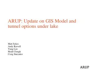
ARUP: Update on GIS Model and tunnel options under lake. Matt Sykes Andy Kervell Yung Loo Heidi Clough Craig Sturzaker. Contents. Definition of Study Area Update on GIS tool Development Current Status Further S teps Potential outcomes examples and decisions

E N D
ARUP: Update on GIS Model and tunnel options under lake Matt Sykes Andy Kervell Yung Loo Heidi Clough Craig Sturzaker
Contents • Definition of Study Area • Update on GIS tool Development • Current Status • Further Steps • Potential outcomes examples and decisions • Tunnel construction optioneering • Lake crossing: Bored/IMT • Next Steps
Current Status • User Inputs • Alignments of 6 FCC Options • Interactive alignment location on map • Alter Shaft locations (10%) - slidebar • Select Tunnel Depth - slidebar • Select Tunnel Gradient - slidebar • Outputs • Dynamic Chart: • Profile surface elevation and geology • Profile of tunnel • Shaft Locations • Warnings when tunnel above ground level • Dynamic Tables: • Depth to tunnel (mBGL) • Shaft Length intersecting geology layer • % age of tunnel intersecting geology Depth (mBGL) (Length of Shaft Intersecting Layer)
Future Development • GIS Decision Support Tool: • Addition of Geology Layers • Addition of Hazard layers (?) • Adjust gradient inflection point • Export of Results – table/report • Future Analytical Functions: • Export of user selected 3D alignment to GIS layer • Intersection with Geological hazards + results • 3D Visualisation (desktop) in ArcScene/ browser (?)
Diagram of Solution Users CERN GADZ Arup • Select Tunnel Alignment • Move Alignment within study area • Select Shaft position, tunnel depth & gradient • Visualise alignment / shaft on map • Send final alignment to database • Calculate shaft location @10% circumference • Charting of surfaces / shaft locations • Calculation & presentation of statistics for tables Web Browser Client Javascript Dimension Charting CrossFilter Web Server Interface Layer (PHP Script) PHP Web Server • Application security • Client / Database interface PostGIS • Create points (@1%) from alignment geometry • Intersect points with surface/geology layers • Return XYZ at every point to Client Spatial Database (on Server) PostGreSQL
GIS Tool – Future Steps • Integration of GADZ data • Extension of Quaternaire-Molasse layer • Molasse – Crétacélayer • Geohazard layers • (http://infoterre.brgm.fr/viewerlite/MainTileForward.do) • Decision Aid Possibilities • GeoMol
Lake Crossing: Tunnelling Considerations • Bored/IMT Construction Methods • Excavation Technology • Ground conditions, geotechnical risk • Logistics: Segmental vs prefab and casting basin • Long term durability: Stability, joints, maintenance & operation • Environmental: Spoil disposal, dredging, ship impacts • Energy: Power and fuel consumption • Cost and programme
Lake Crossing: Tunnelling Considerations Superficial sediments Moraine Molasse Fiore et al. 2011, Würmiandeglaciation of western Lake Geneva (Switzerland) based on seismic stratigraphy
Lake Crossing: Tunnelling Considerations Superficial sediments Slurry TBM IMT Moraine Slurry TBM Molasse EPBM
Next Steps • Completion of GIS tool • Integration of GADZ data • Produce preliminary optioneering screening results