The Significance of Mapping Parcel Data Statewide
110 likes | 216 Views
Discover how parcel data mapping aids in economic development, transparency, and property assessments. Learn about the history and uses of GIS files shared by counties. Explore the benefits of collecting and analyzing local data.

The Significance of Mapping Parcel Data Statewide
E N D
Presentation Transcript
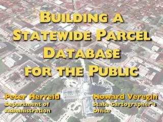
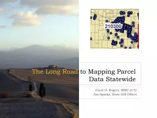
The Long Road to Mapping Parcel Data Statewide Carol O. Rogers, IBRC at IU Jim Sparks, State GIS Officer
A brief history of county GIS access • Jim Sparks, State GIS Officer Did you know almost all counties now share their GIS files? IBRC @ Indiana University
A brief history of parcel data • Carol Rogers, IBRC at Indiana University and director of Information for Indiana initiative Wow, now I can see how important property is to businesses and population! IBRC @ Indiana University
Collecting Local Data IBRC has developed and deployed multiple web-based collection tools as part of the Information for Indiana Initiative: • Property Parcel Data • Sales Disclosure forms can be input online (or uploaded if county is using a vendor) • Government Gateway for Government Units allows for submission of budgets for tax certification and annual reports of expenditures Data IBRC @ Indiana University
Just a Few of the Uses • Analysis of local government taxing and spending • Aid in uniform property assessments • Homestead validation • Transparency • Cross boundary comparisons IBRC @ Indiana University
Missing Piece has been “The maps” • Parcel data is inherently spatial • Inability to “see” the intersection of taxing districts • Confusion IBRC @ Indiana University
Parcel Shapefiles Make All the Difference • Suddenly, we can see the intersections of property and people’s lives IBRC @ Indiana University
Proximity of work and housing IBRC @ Indiana University
Home sales in context of all parcels IBRC @ Indiana University
Why All Counties • Provides regional context • Allows for use of metro area data • Can place information within the context of what’s in place • Economic development IBRC @ Indiana University
Let’s talk about this … IBRC @ Indiana University