Red Flag Watch / Warning Program for Hawaii
350 likes | 539 Views
Red Flag Watch / Warning Program for Hawaii. Derek Wroe National Weather Service Honolulu. Red Flag Program. Purpose: 1. A combination of dry fuels and weather conditions supports extreme fire danger and/or extreme fire behavior. 2. Alert land managers for the potential of

Red Flag Watch / Warning Program for Hawaii
E N D
Presentation Transcript
Red Flag Watch / Warning Program for Hawaii Derek Wroe National Weather Service Honolulu
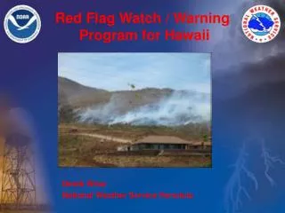
Red Flag Program • Purpose: 1. A combination of dry fuels and weather conditions supports extreme fire danger and/or extreme fire behavior. 2. Alert land managers for the potential of widespread ignitions or control problems with existing fires, both of which could pose threat to life and property. • NWS cannot keep Red Flag event confidential
Red Flag Program • Products: 1. Fire Weather Watch - Issued when there is a high potential for the development of a Red Flag event. Issued 12 to 72 hrs prior to expected onset of criteria. 2. Red Flag Warning - Issued for impending or occurring Red Flag event. Denotes a high degree of confidence that weather and fuel criteria of a Red Flag event will occur in 24 hrs or less. • Forecasters can coordinate issuance of Red Flag products with local land and fire managers • All NWS watches and warnings must be available to public
Proposed Criteria • All three criteria met at Honolulu International Airport (HNL): - KBDI ≥ 600 - Minimum RH (1 hr or more) ≤ 45 % - Wind Speed (1 hr or more) ≥ 20 mph • For mainly leeward only? - Chu (2003) confirmed highest fire danger over leeward areas • Criteria met an average of 4 days/yr from 1980-2005 - Target: less than 10 days
What is KBDI? • Chosen to reflect fuel conditions by describing soil moisture deficit • Designed for the warm and humid southeastern U.S. that is somewhat similar to the climate of Hawaii • Developed to determine availability of drought fuel load • Ranges from 0 to 800: - 800 = extreme drought - 0 = saturated soil • Changes daily based on observed maximum temperature and rainfall
KBDI • 0 – 200: Nearly all soil organic matter, duff and litter are left intact after a burn. Within minutes after fire area is smoke free. • 200 – 400: Litter and duff begin to contribute to fire intensity. Soil exposure is minimal. Smoldering with resulting smoke can carry into night. • 400 – 600: Upper range at which most understory type burning should be conducted. Most of the duff and organic layers will ignite and actively burn. Considerable soil exposure occurs. Complete consumption of all but largest dead fuels. Fuels may smolder for days with possible fire control problems. • 600 – 800: Most severe drought conditions. Many states issue burning bans. Fires will be intense and deep-burning. Most subsurface soil organic material will be consumed with great soil exposure. Live understory is part of fuel complex. Smoldering may occur for many days with fire control problems.
Why KBDI and Why HNL? • Dolling et al (2005) found a strong statistical relationship between KBDI and fire activity, both in the number of fires and total acres burned • Dolling et al (2005) found that the driest leeward stations on each island can serve as reference stations to diagnose fire activity - Kekaha, Kauai - HNL, Oahu - Lahaina, Maui - Naalehu, Hawaii • Only HNL can provide high quality, real-time data • In tropics small fluctuations in weather variables are crucial - Departures of 5 – 15 % from average can be considered large! • Using HNL to assess Red Flag potential simplifies the forecast process and can be effective
Mean Annual Precipitation 7000 mm = 275 inches 1200 mm = 47 inches 600 mm = 24 inches
Mean Annual Precipitation 9000 mm = 354 in 7000 mm = 275 in 1000 mm = 39 in 400 mm = 16 in
Mean Annual Precipitation 9000 mm = 354 in 7000 mm = 275 in 1000 mm = 39 in 400 mm = 16 in
Mean Annual Precipitation 7000 mm = 275 inches 1200 mm = 47 inches 600 mm = 24 inches
Mean HNL Conditions • Criteria most likely met during fire season peak • Only small departures (5-15 %) from mean wx conditions will satisfy Red Flag criteria • Proposed criteria: - KBDI ≥ 600 - RH ≤ 45% - Wind ≥ 20 mph
HNL Mean RH 1980-2005 • RH ≤ 45 % on 23 % of the days from 1980 to 2005
HNL Mean Max Wind 1980-2005 • Wind ≥ 20 mph on 22 % of the days from 1980 to 2005
Weather Criteria • Both weather criteria (RH ≤ 45 % and wind ≥ 20 mph) satisfied on only 5 % of days from 1980 to 2005 - On average, these conditions met only 17 days per year - Coupled with KBDI information about fuels, all three criteria designed to underscore potential for extreme fire behavior and/or extreme fire danger
HNL Mean KBDI • KBDI ≥ 600 typical late summer and early fall – peak fire season • KBDI ≥ 600 on 34 % of the days from 1980 to 2005
HNL KBDI 1980-2005 • Varies greatly during each year and from year-to-year • KBDI ≥ 600 represents the highest 34% of database • KBDI ≥ 500 typical nearly 50% of the year
Red Flag Criteria • Requested to keep Red Flag days to less than 10 • Only 1 % of days meet criteria, yielding an average of 4 Red Flag days per year • Events distributed unevenly with nearly half of the years from 1980 to 2005 having no events • Proposed criteria: - KBDI ≥ 600 - RH ≤ 45% - Wind ≥ 20 mph
Performance • Fire experts identified 6 past events exhibiting extreme fire behavior • Of the 5 events from 1980 – 2005, 3 out of 5 events occurred on or near a Red Flag day - 1 of the 2 “missed” events occurred on a borderline day • Another identified event (Aug 5, 1970) occurred in the middle of a five day stretch of Red Flag days • Remember, on average only 4 Red Flag days happen each year
2007 Performance • Most of 2007 was very dry (KBDI > 750 for only 4th time since 1980) - KBDI exceeded 600 in mid April (normally reached in late July) • 29 Red Flag days - highest number of Red Flag days of any year 1980 – 2007 - first Red Flag day of the year (Apr 23) had 60 acre fire near Village Park • Two very large fires exhibiting extreme fire behavior occurred during the year’s two extended Red Flag events - Olowalu Fire on Maui - Waialua Fire on Oahu • Through newspaper reports, over 20,000 acres burned in 85 events - 16 of these events occurred on Red Flag days, burning over 10,000 acres - Red Flag days cover 19% of the events but burned 52% of the acreage in 2007
2007 Extreme Events • Olowalu Fire: 2600 acres, Jun 28-30 - Red Flag days Jun 22-30 (except 27th) • Waialua Fire: 6700 acres, Aug 12-18 - Red Flag days Aug 13-21 (except 17th &19th) Waialua Fire Olowalu Fire & Wailua Kauai Fire Maili Fire Ukumehame Fire
Red Flag Predictability • In tropics small fluctuations in weather variables are crucial - Departures of 5 – 15 % from average can be considered large! • Forecasters can detect these trends (from Forecast Discussions): - Waialua Fire (Sun, Aug 12 – Aug 18, 2007): Fri, Aug 10: “A tightening of the pressure gradient will increase trade winds on Sunday.” Thu, Aug 16: “A much drier and more stable air mass is moving in from the east…” “…subsidence inversions are lower and stronger than 24 hours ago.”
Red Flag Predictability (cont) - Olowalu Fire (Thu, Jun 28 – 30, 2007): Thu, Jun 21: “…inversion height near 6000 ft is not expected to change much…and upstream moisture is rather meager.” “…expect locally breezy trades to blow through at least day 5…” Wed, Jun 27: “Expect winds to max out today through Thursday.” “Air mass over our region is expected to become more stable…hence expect showers in the coming days to be on the lighter side.” “…brisk trades and dry weather through Friday.”
Red Flag Predictability (cont) - West Big Island Extreme Event (Mon, Aug 1, 2005): Wed, Aug 1: “…feature seems to be kicking up winds…” “…remains stable therefore have below normal probability of precipitation…” “a breezy pattern can be expected…”
Summary • Purpose of Red Flag: - Combination of dry fuels and weather conditions supports extreme fire danger and/or extreme fire behavior. - Alert land managers for potential of widespread ignitions or control problems with existing fires • All three criteria met at Honolulu International Airport (HNL): - KBDI ≥ 600 - Minimum RH (1 hr or more) ≤ 45 % - Wind Speed (1 hr or more) ≥ 20 mph • To be issued for leeward areas only? • Criteria met an average of 4 days/yr from 1980-2005 • Criteria can capture extreme fire behavior events: - 4 out of 6 identified events prior to 2005 captured - 2 out of 2 known events during 2007 captured • 2007 fires on Red Flag days accounted for 52% of acreage burned
Questions? • derek.wroe@noaa.gov • 973-5280
Alternative Criteria? • Alternative criteria: - KBDI ≥ 500 - RH ≤ 45% - Wind ≥ 20 mph • Increase in Red Flag days would be minimal - 5 days per year on average - 1.5% of the days from 1980 to 2005 • Of the identified extreme fire days, these criteria perform with same accuracy as proposed criteria • 2007 performance unchanged from proposed criteria
Extreme Events • Identified informally: - Aug 5, 1970 West Oahu RFW - May 16, 1984 West Oahu No, borderline! - Jul 24, 1994 West Big Island No - Aug 4, 1999 West Big Island RFW - Jul 3, 2003 West Oahu RFW - Aug 1, 2005 West Big Island RFW • 2007 Extreme Fires - Jun 28 – 30 Olowalu RFW - Aug 12 – 18 Waialua RFW
