Download

1 / 45
450 likes | 649 Views
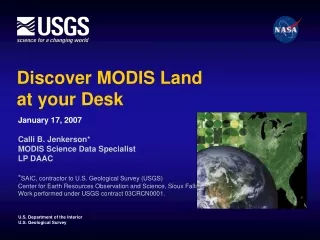
Discover MODIS Land at your Desk. January 17, 2007 Calli B. Jenkerson* MODIS Science Data Specialist LP DAAC * SAIC, contractor to U.S. Geological Survey (USGS) Center for Earth Resources Observation and Science, Sioux Falls, SD. Work performed under USGS contract 03CRCN0001. Rumors.

E N D
Discover MODIS Land at your Desk January 17, 2007 Calli B. Jenkerson* MODIS Science Data Specialist LP DAAC *SAIC, contractor to U.S. Geological Survey (USGS) Center for Earth Resources Observation and Science, Sioux Falls, SD. Work performed under USGS contract 03CRCN0001.
Rumors • Better resolution than AVHRR • Better repeat cycle than Landsat • Free data • Too many products • Weird map projection • Hard to find • Can I use MODIS data in my application?
Land Processes Distributed Active Archive Center at USGS Center for Earth Resources Observation and Science(LP DAAC at EROS)
MODIS Land Product Informationhttp://lpdaac.usgs.gov/modis/dataproducts.asp
MOD09GA V5 MYD09GA V5 MOD09GQ V5 MYD09GQ V5 MOD09CMG V5 MYD09CMG V5
MOD09GA V5 MYD09GA V5 MOD09GQ V5 MYD09GQ V5 MOD09CMG V5 MYD09CMG V5
MOD09GA V5 MYD09GA V5 MOD09GQ V5 MYD09GQ V5 MOD09CMG V5 MYD09CMG V5
MODIS Land Product One-Pagers http://lpdaac.usgs.gov/modis/mod09gav5.asp
MODIS Land Product One-Pagers http://lpdaac.usgs.gov/modis/mod09gav5.asp
MODIS Land Product One-Pagers http://lpdaac.usgs.gov/modis/dataproducts.asp • Terra, Aqua, and Combined • V004 and V005: • Surface Reflectance • Land Surface Temp/Emissivity • Land Cover / Land Cover Dynamics • Vegetation Indices • Thermal Anomalies/Fire • LAI/fPAR • Gross Primary Production • BRDF/Albedo
http://lpdaac.usgs.gov EDG - Earth Observing System (EOS) Data Gateway Data Pool - LP DAAC On-Line Archive GloVis – USGS Global Visualization Viewer
Summary: Data Access • EDG • GloVis • Data Pool • MTMGW • Subscription • MODExtract
Considerations for Use • File Format (HDF-EOS) • Map Projection (Sinusoidal) • Bit-encoded Quality Information
http://lpdaac.usgs.gov/datatools.asp MODIS Reprojection Tool (MRT)
MRT Capabilities Overview Reproject Sinusoidal to: • Geographic • Hammer • Mollweide • Sinusoidal • UTM • Transverse Mercator • Integerized Sinusoidal • Goode’s Interrupted Homolosine • Lambert Azimuthal • Lambert Conformal Conic • Polar Stereographic • Albers Equal Area -Spatial Subset -Mosaic -Spectral Subset -Outputs .hdf, .bin, .tif -Resampling -Datum Conversion
MRT Capabilities Overview Sinusoidal Lambert Azimuthal
MRT Capabilities Overview MODIS Reprojection Tool (MRT) Utility
MRT Capabilities Overview Integerized Sinusoidal Lambert Azimuthal
http://lpdaac.usgs.gov/datatools.asp MODIS Swath Reprojection Tool (MRTSwath)
MRTSwath Overview Developed for Level-2 MODIS Land Data Provides same general capabilities as MRT except -Requires Geolocation input (Level 1A MOD03) -Does not include mosaic function
MRTSwath Overview Level-2 Albers Level-2 Swath
http://lpdaac.usgs.gov/datatools.asp MODIS Land Data Operational Product Evaluation Tools (LDOPE)
MODIS LDOPE Tools • Perform any processing function necessary for manipulating MODIS Land data, except reprojection • QABits, mosaicking, subsetting, format conversion, multidimensionality, etc. • Stand-alone executables invoked from a command-line interface • Supported on Irix, Solaris, Linux, and Windows operating systems
http://lpdaac.usgs.gov MODIS Land Product Information: Collection Updates Product Characteristics QC-Bit Interpretation SDS Specifications Search and Order Tips Additional Links
http://lpdaac.usgs.gov MODIS Land Product Common Access: EDG Data Pool GloVis
http://lpdaac.usgs.gov MODIS Land Product Alternative Access: MTMGW Subscription MODExtract
http://lpdaac.usgs.gov MODIS Land Product Tools: HDF-EOS Tools MRT MRTSwath MODIS LDOPE
Data Applications Model Historical Approach Search & Order MODIS tiles Download individual tiles in standard format Conduct user-specified, local processing to create application-ready MODIS data Use MODIS data
Data Applications Model Future Approach Historical Approach Search & Order MODIS tiles Select MODIS tiles Download individual tiles in standard format Specify processing options Initiate and monitor remote processing job Conduct user-specified, local processing to create application-ready MODIS data Download application –ready MODIS data Use MODIS data Use MODIS data Day 2 Thursday 9:00 – 9:30
Questions, Comments, or Concerns Calli JenkersonMODIS Science Data SpecialistLP DAACjenkerson@usgs.gov(605) 594-2638