Download
1 / 42
460 likes | 874 Views
Causes of Weather. Ch. 12.1. What is ‘meteorology’?. Meteorology : the study of atmospheric phenomena Ex: clouds, breezes, warmth of sunlight The root word “ meteoros ” is greek for high in the air . Anything that is high in the sky is an example of a meteor .

E N D
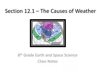
Causes of Weather Ch. 12.1
What is ‘meteorology’? • Meteorology: the study of atmospheric phenomena • Ex: clouds, breezes, warmth of sunlight • The root word “meteoros” is greek for high in the air. • Anything that is high in the sky is an example of a meteor. • Ex: rain, snow, sleet, cloud droplets = hydrometeors • Ex: smoke, haze, dust = lithometeors • Ex: thunder, lightning = electrometeors
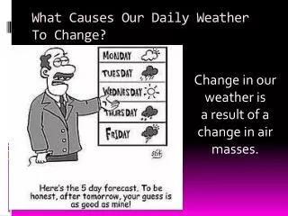
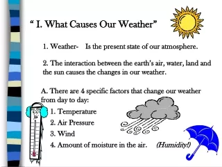
Weather v.s. Climate • Weather: short term variations in atmospheric phenomena that interact and affect the environment and life on Earth. • Variations can take place over minutes, hours, days, weeks, months, or years. • Climate: long term average of variations in weather for a particular area. • Meteorologists use weather-data that can average over 30 years of weather.
Heating Earth’s Surface • Imbalanced heating • Earth is tilted on its axis affecting the amount of daylight & solar radiation = affects the temperature in different regions. • Ex: In January, Miami, FL is much warmer than Detroit, MI. • Miami has more direct solar radiation than Detroit because of Earth’s tilt. • Thermal Redistribution: Air & H2O move thermal energy around to help maintain average temps.
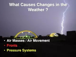
Air Masses • Air Mass • Spans over 1000’s of km’s • a large volume of air that has the same characteristics as its source region. • Ex: same temp & humidity. • Source region: area over which the air mass forms. • Most form over tropical or polar regions.
Air Mass Modification • Occurs when an air mass moves over land or water that has different characteristics than its source region. • Air mass acquires new characteristics from the land or water.
Weather Systems Ch. 12.2
Coriolis Effect • The direction of Earth’s winds are influenced by Earth’s rotation. • Air & water move in a curved path rather than a straight line called the Coriolis effect. • Northern hemisphere: air curves to the right • Southern hemisphere: air curves to the left • Animation • Transport colder air to warmer areas near the equator • Transport warmer air to colder areas near the poles.
3 Wind Systems • Also referred to a “basic zones” • Found at Earth’s surface in both hemispheres. • They are polar easterlies, prevailing westerlies, & trade winds.
Polar Easterlies • Found between 60ºN latitude & the north pole and60ºS latitude and the south pole. • Begins as dense polar air that sinks. • Flows in a westerly direction away from the poles (comes from the east and moves west) • Typically cold winds.
Prevailing Westerlies • Located between 30 and 60ºN latitude and 30 and 60ºS latitude. • Winds move in a easterly direction toward each pole. • Called “westerlies” because the winds originate from the west and goes east. • Steady winds that move much of the weather across the U.S. and Canada.
Trade Winds • Found between latitudes 30 degrees N and 30 degrees S latitude. • Air sinks at 30 N & 30 S • moves toward the equator in a westerly direction. • When air reaches the equator, it warms & rises. • NE Trade Winds & SE Trade Winds
Horse Latitudes • A belt of weak surface winds. • Found near 30ºN AND 30ºS latitudes due to the sinking air of the trade winds. • Creates high pressure here. • Earth’s major deserts are under these high-pressure conditions. • Ex: Sahara desert.
Intertropical Convergence Zone • Also called ITCZ & Equatorial Doldrums. • Found near the equator where the NE & SE trade winds meet. • Air rises here = Creates low pressure & clouds form. • Delivers moisture to many of the world’s tropical rain forests.
Jet Streams • Narrow band of fast, high-altitude, westerly wind. • Speeds vary with the temperature differences between the air masses at the wind zone boundaries. • Position varies with the seasons. • Represents the strongest core of westerly winds.
2 Types of Jet Streams • Major Jet Stream: Polar jet stream • Found between the polar easterlies and prevailing westerlies in both hemispheres. • Moves west to east. • Minor Jet Stream: Subtropical jet stream • Found between the trade winds and prevailing westerlies in both hemispheres.
Jet Streams and Weather • Storms form along jet streams and generate large-scale weather systems. • Weather systems generally follow the path of the jet stream. • Also affect the intensity of the weather systems by moving air of different temps from one region to another.
Fronts • Transition zone between 2 air masses of different densities. • Extend both vertically and horizontally • Can cover thousands of kilometers of Earth’s surface. • Types of fronts: • Cold front • Warm front • Stationary front • Occluded front
Cold Fronts • Cold, dense air displaces warmer, less dense air up a steep slope. • Air behind front is colder than air ahead of the front. • Creates intense precipitation and T-storms are common. • Warm, moist air is forced up and condenses. • Symbol: Blue line with triangles.
Warm Front • Warm air displaces cooler air and creates a gradual slope. • Air behind front is warmer and more moist than air ahead of front. • Causes widespread light precipitation & clouds OR no precipitation. • Symbol: red line with semicircles.
Stationary Front • Forms when 2 air masses meet and neither moves into the other’s area = stop moving. • Happens when the air masses’ temps are similar to each other. • Produces heavy precipitation & possible flooding because the front stalls/stops. • Symbol: line with alternating blue triangles and red semicircles pointing in opposite directions.
Occluded Front • Forms when a cold air mass RAPIDLY overtakes a warm air mass moving in the same direction. • Produces very strong winds & heavy rains. • Symbol: line of blue triangles and red semicircles point in the same direction OR a purple line with triangles & semicircles pointing in the same direction.
Pressure Systems • High Pressure • Sinking air • Air spirals outward • Moves clockwise in the northern hemisphere. • No Precipitation/Nice weather. • Low Pressure • Rising air • Air spirals inward • Move counter-clockwise in northern hemisphere. • Precipitation/Rainy weather.
Pressure Systems • Air always flows from areas of high pressure to low pressure. • Rotate because of the rising/falling of air and because of the Coriolis Effect.