Download
1 / 47
470 likes | 589 Views
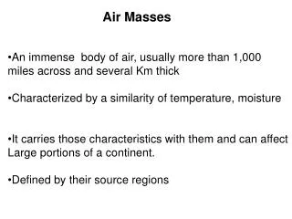
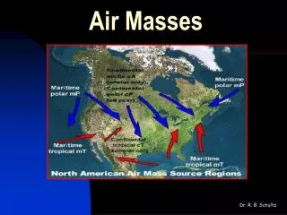
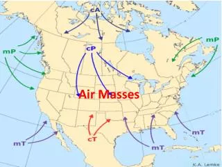
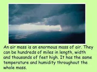
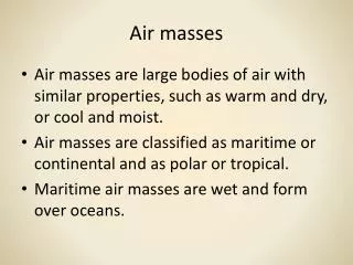
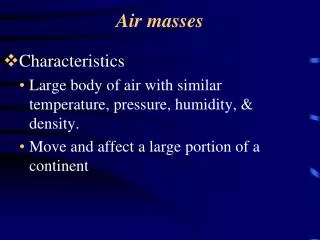
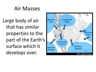
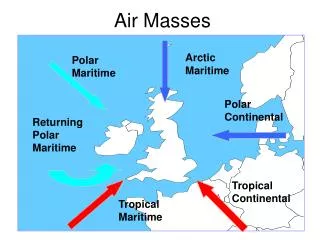
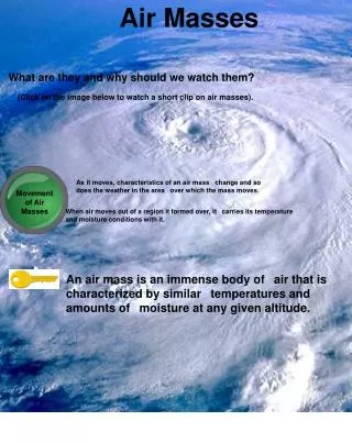
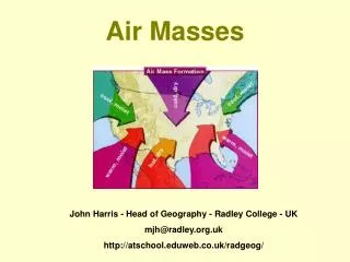
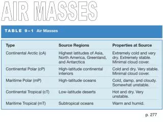
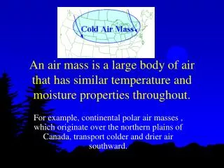
An air mass is a large body of air that has similar temperature and moisture properties throughout. For example, continental polar air masses , which originate over the northern plains of Canada, transport colder and drier air southward.

E N D
An air mass is a large body of air that has similar temperature and moisture properties throughout. For example, continental polar air masses , which originate over the northern plains of Canada, transport colder and drier air southward.
Maritime Tropical Air Masseswarm temperatures and rich in moisture • Maritime tropical air masses originate over the warm waters of the tropics and Gulf of Mexico. The northward movement of tropical air masses transports warm moist air into the United States, increasing the potential for precipitation.
Fronts - the boundaries between air masses
Cold Front -a transition zone from warm air to cold air • The air behind a cold front is noticeably colder and drier than the air ahead of it. • When a cold front passes through, temperatures can drop more than 15 degrees within the first hour.
Warm Front • The frontal zone slopes up and over the colder air mass ahead of it. Warm air rides along the front (up and over the cold air mass), cooling as it rises, producing clouds and precipitation in advance of the surface warm front. • Because the lifting is very gradual and steady, generally wide spread and light intensity precipitation develops ahead of a warm front.
Think of high pressure air (like in a balloon) escaping to a low pressure area (like a classroom). • Differences in pressure lead to winds.
Winds change direction due to the rotation of the Earth • The coriolis effect:
Air Pressure on Earth • We don’t feel air pressing on us because the pressure in our bodies is about the same as the surrounding air.
Air pressure is related to temperature • Hot air has lower air pressure Why…..? • Its molecules are moving quickly, so they aren’t packed in together closely • The air weighs less and exerts less pressure.
Cold air has higher pressure • Its molecules are packed closely together and move more slowly. • This also explains why cold air tends to sink.
The sun doesn’t heat much air directly… • Most of the sun’s heat passes through the atmosphere and reaches the earth. • The earth absorbs the heat and it “radiates” back into the atmosphere. • That’s one reason why it’s colder at higher altitudes.
Cirrus Clouds • Thin, wispy clouds that usually form above 18,000 feet • Thin because they form in the higher levels of the atmosphere where little water vapor is present • Made of ice crystals
Cumulus Clouds • Form as water vapor condenses in strong, upward air currents above the earth's surface • These clouds usually have flat bases and lumpy tops • Usually very isolated with large areas of blue sky in between the clouds • Most cumulus clouds form below 6,000 feet and are relatively thin and associated with fair weather
Cold Front • As the front advances, the colder air lifts the warmer air ahead of it (red arrows). • The air cools as it rises and the moisture condenses to produce clouds and precipitation ahead of and along the cold front. • Upward motions along a cold front are typically more vigorous, producing deeper clouds and more intense bands of showers and thunderstorms.
Stratus Clouds: • Are thin-layered clouds • Are low to the earth’s surface • Look like stripes or streaks in the sky • Look like a layer of fog that never reaches the ground
Cumulonimbus Clouds: • Are much larger and more vertically developed than fair weather cumulus • Can easily reach 39,000 feet or higher • Are associated with powerful thunderstorms
Rain Gauge Measures Precipitation (inches or centimeters)
Anemometer Measures wind speed (miles – or kilometers – per hour
Barometer • Barometers measure air pressure
Thermometer Measures Temperature (degrees Celsius or Fahrenheit)
Weathervane or wind vane • Show the direction of the wind