Download
1 / 20
200 likes | 343 Views
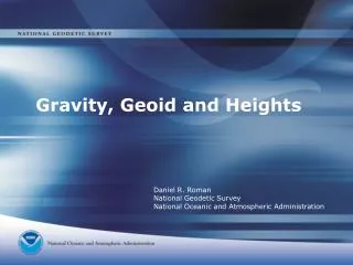
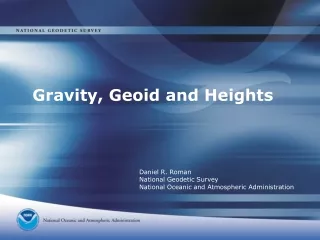
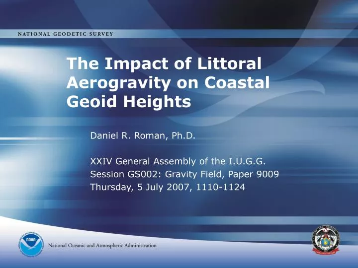
The Impact of Littoral Aerogravity on Coastal Geoid Heights. Daniel R. Roman, Ph.D. XXIV General Assembly of the I.U.G.G. Session GS002: Gravity Field, Paper 9009 Thursday, 5 July 2007, 1110-1124. Talk Outline. Collection Scheme Installation & Equipment GLS05 & GLS06 aerogravity

E N D
The Impact of Littoral Aerogravity on Coastal Geoid Heights Daniel R. Roman, Ph.D. XXIV General Assembly of the I.U.G.G. Session GS002: Gravity Field, Paper 9009 Thursday, 5 July 2007, 1110-1124
Talk Outline • Collection Scheme • Installation & Equipment • GLS05 & GLS06 aerogravity • GLS05 lidar comparisons in Tampa Bay, Florida • GLS06 tide station comparisons in northern Gulf Coast (MS, AL, FL) • Summary
VDatum Transformation Tool • Bathy/topo lidar studies • Develop tide surfaces based on mapped features and currents • 7 regions done thus far • Tampa Bay region is already done (GLS05) • Northern Gulf Coast (GLS06) in progress http://nauticalcharts.noaa.gov/csdl/vdatum.htm
N Tide gauge height ellipsoid Instantaneous Ocean Surface LMSL mDOT geoid Geoid (N) = LMSL – Mean Dynamic Ocean Topography (mDOT) Geoid (N) = Inst. SSH – mDOT – Tides – Sea State – inst. DOT
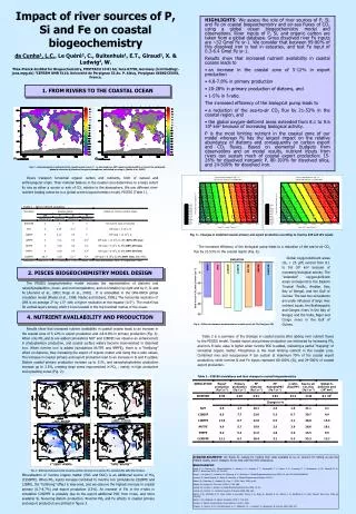
Lidar Data: a work in progress • So far, none of the 2006 data have been processed • Limited portions of the 2005 data have been reduced • Data are available in the Bay of Florida region and Tampa Bay region. • Since Tampa Bay is an established VDatum region, we’ll look at it more closely.
Port Tampa 5.961 UT 0.227 m -0.32 m -0.40 m 5.967 UT 0.239 m 0.031 m 6.759 UT -0.23 m 6.754 UT 0.016 m St. Petersburg 6.745 UT 0.047 m 0.062 m 6.738 UT 6.714 UT 0.175 m 6.706 UT 0.202 m 6.696 UT 0.193 m 0.176 m 6.687 UT 6.983 UT 0.182 m 0.179 m 6.677 UT 6.990 UT 0.191 m 7.001 UT 0.240 m 6.667 UT 0.156 m 7.011 UT 0.237 m Port Manatee 7.020 UT 0.248 m Averaged Residual Lidar Profiles in Tampa Bay (lidar – DOT - geoid) on 29 MAY 2005 0.03 – (-0.40) 0.43 m 0.06 – (-0.32) 0.38 m 0.18 – (-0. 23) 0.41 m
Gravity Data: Mainly Complete • As the GLS05 gravity data are very limited, they could not be used to analyze the gravity field near Tampa Bay other than to provide rough agreement • GLS06 data are much more complete • In conjunction with a DOT model and Tidal Bench Marks (TBM’s), the gravimetric geoid (USGG2003) can be analyzed • This is a simpler comparison than the lidar surface as much of the time-varying aspects are averaged away
Geoid Heights Compared with Tide Gauges • Top image shows USGG2003 comparison • Triangles note the locations of Tide Gauges within the study area • Note that the dm-level trend along shore • Bottom image shows aerogravity enhanced model comparison • Note there is very little along shore trend • Inclusion of aerogravity seems to have improved the geoid height model with respect to MSL
Summary • GLS05 gravity is insufficient to clean database • GLS05 lidar still being developed & need better ties • More tide station comparisons in/out of VDatum area • GLS06 gravity very useful in cleaning database • Must still resolve difference in NW GLS06 study area • Will likely need a ground survey comprised of several absolute and many relative observations • GLS06 lidar must be completed
Outlook • A combination of lidar and aerogravity will help to refine future gravimetric geoid models by combining them with ocean and tide models and observations • Such models will become indispensable for such tools as VDatum that seek to accurately and consistently transform between various datums • Work under this study is still in progress, though new data will be collected • Future collection and a larger effort for the entire Gulf Coast region is being planned and budgeted
For Further Information and Related Work • Jarir Saleh, CERP Poster Session, Paper 8789, July 4 On Some Aspects of GLS06 Data Quality assessment and downward continuation • Yan Wang, CERP Poster Session, Paper 12026, July 5 Accurate Account of the Topographic Effect on the Geoid Computations
NGS Staff Daniel R. Roman dan.roman@noaa.gov Yan M. Wang yan.wang@noaa.gov Jarir Saleh jarir.saleh@noaa.gov NRL Staff John M. Brozena john.brozena@nrl.navy.mil Vicki A. Childers vicki.childers@nrl.navy.mil Questions? • NASA Staff • Scott B. Luthcke Scott.B.Luthcke@nasa.gov • David L. Rabine David.L.Rabine.1@gsfc.nasa.gov • Hannes Greim greimh@gmail.com • University of Maryland • Michelle A. Hofton also with NASA michelle@avalon.gsfc.nasa.gov • Sandra A. Martinka formerly NRL sam@atmos.umd.edu