Download

1 / 35
350 likes | 470 Views
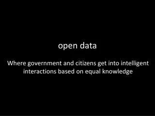
This article delves into John Snow's pioneering cholera map of 1854, a seminal work in the fields of epidemiology and public health. By employing open data, Snow identified the source of a cholera outbreak in London, revolutionizing our understanding of disease transmission. The piece recounts how Snow's analysis utilized Ordnance Survey data and highlights modern visualizations of his work through tools like CartoDB. This exploration emphasizes the importance of open relationships in data sharing, revealing its potential for social impact and informed decision-making today.

E N D
John Snow's cholera map (1854) http://www.guardian.co.uk/news/datablog/2013/mar/15/john-snow-cholera-map#_
Snow's cholera data using • Ordnance Survey OpenDataStreetView http://blog.rtwilson.com/john-snows-cholera-data-in-more-formats/
Snow's cholera map using CartoDB http://www.guardian.co.uk/news/datablog/interactive/2013/mar/15/cholera-map-john-snow-recreated
http://thumbnails.visually.netdna-cdn.com/the-open-data-movement_50290d2c351d5.jpghttp://thumbnails.visually.netdna-cdn.com/the-open-data-movement_50290d2c351d5.jpg
http://www.visualizing.org/visualizations/fight-against-breast-cancerhttp://www.visualizing.org/visualizations/fight-against-breast-cancer
http://www.floatingsheep.org/2013/02/the-urban-geographies-of-tweets-in.htmlhttp://www.floatingsheep.org/2013/02/the-urban-geographies-of-tweets-in.html
http://www.floatingsheep.org/2013/02/the-urban-geographies-of-tweets-in.htmlhttp://www.floatingsheep.org/2013/02/the-urban-geographies-of-tweets-in.html
http://www.floatingsheep.org/2013/02/the-urban-geographies-of-tweets-in.htmlhttp://www.floatingsheep.org/2013/02/the-urban-geographies-of-tweets-in.html
http://www.floatingsheep.org/2013/02/the-urban-geographies-of-tweets-in.htmlhttp://www.floatingsheep.org/2013/02/the-urban-geographies-of-tweets-in.html
http://www.floatingsheep.org/2013/02/the-urban-geographies-of-tweets-in.htmlhttp://www.floatingsheep.org/2013/02/the-urban-geographies-of-tweets-in.html
http://www.guardian.co.uk/news/datablog/interactive/2013/jan/15/climate-change-map-temperaturehttp://www.guardian.co.uk/news/datablog/interactive/2013/jan/15/climate-change-map-temperature
Pope Followers on Twitter http://www.floatingsheep.org/2012/12/does-pope-tweet-in-woods.html
How do people die? (Global) http://www.guardian.co.uk/news/datablog/interactive/2012/dec/13/how-people-die-global-mortality-visualised
How do people die? (N. America) http://www.guardian.co.uk/news/datablog/interactive/2012/dec/13/how-people-die-global-mortality-visualised
How do people die? (Caribbean) http://www.guardian.co.uk/news/datablog/interactive/2012/dec/13/how-people-die-global-mortality-visualised
How do people die? (Ctr. Africa) http://www.guardian.co.uk/news/datablog/interactive/2012/dec/13/how-people-die-global-mortality-visualised
Google Maps with Overlay of 1864 Map of Antigonish http://www.ourlibrary.ca/mapbrowser/picant/index.html#M1C45.62008!-61.9941Z16F3O55a6L28*
Google Maps with Overlay of 1864 Map of Antigonish http://www.ourlibrary.ca/mapbrowser/picant/index.html#M1C45.62008!-61.9941Z16F3O55a6L28*
Hans Rosling's 200 Countries, 200 Years, 4 Minutes http://www.youtube.com/watch?v=jbkSRLYSojo