National Parks and Wilderness Areas: Size, Visibility, and Air Quality
390 likes | 403 Views
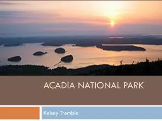
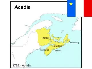
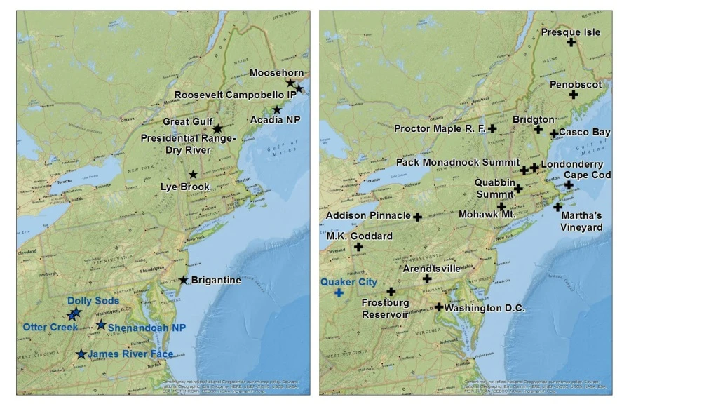
Explore the size, visibility, and air quality of Acadia National Park, Moosehorn, Great Gulf, Lye Brook, Brigantine, Dolly Sods, Shenandoah National Park, and James River. Analyze the clearest and most impaired days and their pollutants (sulfate, nitrate, carbonaceous matter, coarse mass) from 2000-2004 and 2013-2017.

National Parks and Wilderness Areas: Size, Visibility, and Air Quality
E N D
Presentation Transcript
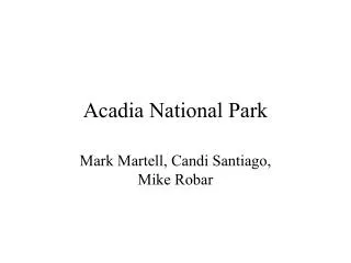
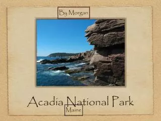
Acadia NP Size – 7.4 Horiz – 2.0 Vert – 0.1
Moosehorn Size – 7.4 Horiz – 2.0 Vert – 0.1
Great Gulf Size – 7.4 Horiz – 2.0 Vert – 0.1
Lye Brook Size – 7.4 Horiz – 2.0 Vert – 0.1
Brigantine Size – 7.4 Horiz – 2.0 Vert – 0.1
Dolly Sods Size – 7.4 Horiz – 2.0 Vert – 0.1
Shenandoah NP Size – 7.4 Horiz – 2.0 Vert – 0.1
James River Face Size – 7.4 Horiz – 2.0 Vert – 0.1
(a) 20% Clearest Days (b) 20% Most Impaired Days SIZE – 5.1 Position – 0.1 / 6.40 Horizontal - 0.1 / 0.1 Vertical ACADIA NP
(a) 20% Clearest Days (b) 20% Most Impaired Days SIZE – 5.1 Position – 0.1 / 6.40 Horizontal - 0.1 / 0.1 Vertical MOOSEHORN
(a) 20% Clearest Days (b) 20% Most Impaired Days SIZE – 5.1 Position – 0.1 / 6.40 Horizontal - 0.1 / 0.1 Vertical GREAT GULF
(a) 20% Clearest Days (b) 20% Most Impaired Days SIZE – 5.1 Position – 0.1 / 6.40 Horizontal - 0.1 / 0.1 Vertical LYE BROOK
(a) 20% Clearest Days (b) 20% Most Impaired Days SIZE – 5.1 Position – 0.1 / 6.40 Horizontal - 0.1 / 0.1 Vertical BRIGANTINE
(a) 20% Clearest Days (b) 20% Most Impaired Days SIZE – 5.1 Position – 0.1 / 6.40 Horizontal - 0.1 / 0.1 Vertical DOLLY SODS
(a) 20% Clearest Days (b) 20% Most Impaired Days SIZE – 5.1 Position – 0.1 / 6.40 Horizontal - 0.1 / 0.1 Vertical SHENANDOAH
(a) 20% Clearest Days (b) 20% Most Impaired Days SIZE – 5.1 Position – 0.1 / 6.40 Horizontal - 0.1 / 0.1 Vertical JAMES RIVER
a) 20% Clearest Visibility Days b) 20% Most Impaired Visibility Days Size 4.96
(a) Sulfate (b) Nitrate Acadia National Park (c) Carbonaceous Matter (d) Coarse Mass SIZE 3.7 POSITIONS 0.1 - 0.05 5.31 - 0.05 0.1 - 3.75 5.31 - 3.75
(a) Sulfate (b) Nitrate Moosehorn (c) Carbonaceous Matter (d) Coarse Mass SIZE 3.7 POSITIONS 0.1 - 0.05 5.31 - 0.05 0.1 - 3.75 5.31 - 3.75
(a) Sulfate (b) Nitrate Great Gulf (c) Carbonaceous Matter (d) Coarse Mass SIZE 3.7 POSITIONS 0.1 - 0.05 5.31 - 0.05 0.1 - 3.75 5.31 - 3.75
(a) Sulfate (b) Nitrate Lye Brook (c) Carbonaceous Matter (d) Coarse Mass SIZE 3.7 POSITIONS 0.1 - 0.05 5.31 - 0.05 0.1 - 3.75 5.31 - 3.75
(a) Sulfate (b) Nitrate Brigantine (c) Carbonaceous Matter (d) Coarse Mass SIZE 3.7 POSITIONS 0.1 - 0.05 5.31 - 0.05 0.1 - 3.75 5.31 - 3.75
(a) Sulfate (b) Nitrate Shenandoah NP (c) Carbonaceous Matter (d) Coarse Mass SIZE 3.7 POSITIONS 0.1 - 0.05 5.31 - 0.05 0.1 - 3.75 5.31 - 3.75
(a) Sulfate (b) Nitrate Dolly Sods (c) Carbonaceous Matter (d) Coarse Mass SIZE 3.7 POSITIONS 0.1 - 0.05 5.31 - 0.05 0.1 - 3.75 5.31 - 3.75
(a) Sulfate (b) Nitrate James River Face (c) Carbonaceous Matter (d) Coarse Mass SIZE 3.7 POSITIONS 0.1 - 0.05 5.31 - 0.05 0.1 - 3.75 5.31 - 3.75
(a) 2000-04 20% Clearest Days (b) 2013-17 20% Clearest Days Acadia (c) 2000-04 20% Most Impaired Days (d) 2013-17 20% Most Impaired Days SIZE 3.7 POSITIONS 0.1 - 0.05 6.7 - 0.05 0.1 - 3.8 6.7 - 3.8
(a) 2000-04 20% Clearest Days (b) 2013-17 20% Clearest Days Moosehorn (c) 2000-04 20% Most Impaired Days (d) 2013-17 20% Most Impaired Days SIZE 3.7 POSITIONS 0.1 - 0.05 6.7 - 0.05 0.1 - 3.8 6.7 - 3.8
(a) 2001-04 20% Clearest Days (b) 2013-17 20% Clearest Days Great Gulf (c) 2001-04 20% Most Impaired Days (d) 2013-1720% Most Impaired Days SIZE 3.7 POSITIONS 0.1 - 0.05 6.7 - 0.05 0.1 - 3.8 6.7 - 3.8
(a) 2000-04 20% Clearest Days (b) 2013-17 20% Clearest Days Lye Brook (c) 2000-04 20% Most Impaired Days (d) 2013-17 20% Most Impaired Days SIZE 3.7 POSITIONS 0.1 - 0.05 6.7 - 0.05 0.1 - 3.8 6.7 - 3.8
(a) 2000-04 20% Clearest Days (b) 2013-17 20% Clearest Days Brigantine (c) 2000-04 20% Most Impaired Days (d) 2013-17 20% Most Impaired Days SIZE 3.7 POSITIONS 0.1 - 0.05 6.7 - 0.05 0.1 - 3.8 6.7 - 3.8
(a) 2000-04 20% Clearest Days (b) 2013-17 20% Clearest Days Dolly Sods (c) 2000-04 20% Most Impaired Days (d) 2013-17 20% Most Impaired Days SIZE 3.7 POSITIONS 0.1 - 0.05 6.7 - 0.05 0.1 - 3.8 6.7 - 3.8
(a) 2000-04 20% Clearest Days (b) 2013-17 20% Clearest Days Shenandoah (c) 2000-04 20% Most Impaired Days (d) 2013-17 20% Most Impaired Days SIZE 3.7 POSITIONS 0.1 - 0.05 6.7 - 0.05 0.1 - 3.8 6.7 - 3.8
(a) 2001-04 20% Clearest Days (b) 2013-17 20% Clearest Days James River (c) 2001-04 20% Most Impaired Days (d) 2013-17 20% Most Impaired Days SIZE 3.7 POSITIONS 0.1 - 0.05 6.7 - 0.05 0.1 - 3.8 6.7 - 3.8
a) b) c) d)
a) b) c) d)