Download

1 / 22
220 likes | 332 Views
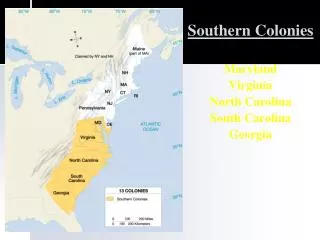
Geography of Delaware, Maryland, & Virginia. Kelly Hall Beth Reimer. Delaware. Coastline length: 45 km (28 mi) Shoreline length: 613 km (381 mi). Delaware River. Geography of Coastline. Delaware Canal. Rohoboth Bay. Character of Shoreline.

E N D
Geography of Delaware, Maryland, & Virginia Kelly Hall Beth Reimer
Delaware • Coastline length: 45 km (28 mi) • Shoreline length: 613 km (381 mi)
Delaware River Geography of Coastline Delaware Canal Rohoboth Bay
Character of Shoreline • Extensive saltwater marshes, sand dunes, long sandy barrier beaches • Cape Henlopen • Impt. Bays: Delaware Bay, Rehoboth Bay, Indian River Bay
Major Rivers/Estuaries • Delaware River flows to Delaware Bay • Delaware Canal links Del. Bay and Chesapeake Bay
Character of Coastal Region • Climate: hot humid summers/mild winters • 31 F – 80s F • 45 in. precip.
Development of Shoreline • Coastal population: 666,168 • U.S. rank: 25th of 35
Maryland • Coastline length: 50 km (31 mi) • Shoreline length: 5,134 km (3,190 mi)
Geography of Shoreline Susquehanna River Potomac River Assateague Island
Character of Shoreline • Tidal/non-tidal wetlands, sandy beaches, shallow lagoons, long narrow barrier beaches • Great Pocomoke Swamp • Chesapeake Bay • Assateague Island
Major Rivers/Estuaries • Nearly all of Maryland drains to Chesapeake Bay or Atlantic • Potomac River forms harbor at Baltimore • Susquehanna River enters head of Chesapeake Bay
Development of Shoreline • Coastal population: 3,339,056 • U.S. rank: 11th of 35
Virginia • Coastal length: 180 km (112 mi) • Shoreline length: 5,335 km (3,315 mi)
Geography of Shoreline Potomac River Rappohannock River York River Cape Charles James River Cape Henry
Character of Shoreline • Tidal marshes, swamps, long sandy beaches, barrier islands, • Great Dismal Swamp • Natural harbors: Chesapeake Bay, Hampton Roads • Cape Henry, Cape Charles
Major Rivers/Estuaries • 4 Tidal rivers: Potomac, Rappahannok, York, James
Character of Coastal Region • Industries: shipping, tourism, commercial/recreational fishing • Wildlife: blue crab, striped bass • Climate: hot, humid summers/ mild winters • 42 F – 100s F • 50 in. precip.
Development of Shoreline • Coastal population: 4,010,900 • U.S. rank: 9th of 35
References: • http://www.ocrm.nos.noaa.gov/pdf/statestats.pdf • http://www.nescenicphoto.com/ • http://www.netstate.com/states/maps/md_maps.htm • http://tidesonline.nos.noaa.gov/ • http://www.deq.state.va.us/coastal/whatnew.html • http://www.deq.state.va.us/coastal/whatnew.html • http://encarta.msn.com/encnet/refpages/RefArticle.aspx?refid=761572815 • http://encarta.msn.com/encnet/refpages/RefArticle.aspx?refid=761570698 • http://kd.mysearch.myway.com/jsp/GGimg.jsp?st=bar&ptnrS=KD&searchfor=