Download
1 / 24
240 likes | 353 Views
Status of Consolidated Invasive Plant Web Mapping. Presented by: PJ Nabors NBII-SAIN / TVA. SAIN team member developers: Matt Durnin, Jeremy Floyd, Brandon League, Wolf Naegeli, Farial Shahnaz. NBII – National Biological Information Infrastructure USGS funded program

E N D
Status of Consolidated Invasive Plant Web Mapping Presented by: PJ Nabors NBII-SAIN / TVA SAIN team member developers: Matt Durnin, Jeremy Floyd, Brandon League, Wolf Naegeli, Farial Shahnaz
NBII – National Biological Information Infrastructure USGS funded program Mission: to provide increased access to data and information on the nation’s biological resources Web-based Network (nbii.gov) with Regional and Thematic “Nodes”
SAIN – Southern Appalachian Information Node A Regional “Node” of the NBII network Mission: gateway to biological information in Southern Appalachia States: AL, KY, MS, TN (http://sain.nbii.org) .
Government Academic Non-Profit Corporate SAIN andPartners:
Southern Appalachian Volunteer Environmental Monitoring Prototype Partner: SAVEM Invasive Plant Surveys
Field Surveys Input Data Sheets P r o c e s s Database SAIN Web products: tables, maps, charts Output
Web Products Produced by SAIN for Invasive Plants • Tabular reports • Maps (3 types) • Downloadable GIS data • Metadata • 3D visualizations Overlooking Hot Springs, North Carolina
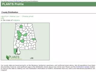
Data Sources: NPS, USFS, ecologists, volunteers
Map Type: 1 2 3
PDFs have (Adobe Printable Document Files) zoom capability and best print quality Maps Type 1 : Static Maps (PDF, JPEG)
Easy step-by-step process MapsType 2 : Make-a-Map
Map is created dynamically Output is a static web map Link to the advanced web map (Type 3) MapsType 2 : Make-a-Map
Uses GIS technology (Geographic Information System) via ESRI’s ArcIMS (Internet Map Server) Dynamic interaction with map and data Recommend high speed internet connection MapsType 3 : Advanced Interactive Map
North American Weed Management Association Standards
plants.usda.gov itis.usda.gov
FGDC Metadata • via NBII Metadata Clearinghouse
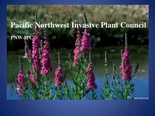
Focusing on: Oriental bittersweet Japanese honeysuckle Purple loosestrife Need GIS data contributions to be successful And at least annual updates Status of Regional Consolidation
Questions? http://sain.nbii.org Please also visit SaveOurHemlocks.org