Download
1 / 42
420 likes | 436 Views
Learn about the University of Georgia's Invasive Plant Mapping Program and the use of the Early Detection and Distribution Mapping System (EDDMapS) for tracking and managing invasive plant species. Explore data sharing, data access features, training sessions, and large-scale cooperative management initiatives. Get insights into specific case studies like Cogongrass and Japanese Knotweed management. Collaboration is key for success.

E N D
SE-EPPC’s Invasive Plant Mapping Program - Update Chris Evans & Chuck Bargeron University of Georgia – Bugwood Network
EDDMapS • Early Detection and Distribution Mapping System
Training Session • Today • 3:15 – 5:00 • Room L EDDR/Mapping Session • Tomorrow • 9:00 – 12:00 • Room L
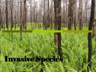
Addressing Needs Using EDDMaps • Distribution of Invasive Plants Across the South • Electronic Early Detection System to Allow for More Rapid Responses • Large Scale Cooperative Management of New Invasive Species
Distribution of Invasive Plants in the South • Enter data • View data • Download data
Current Data - Statistics • 78,000 records • 8,000 point records • 460 plants
Current Data – Collections • Herbarium records from Alabama Universities • Auburn • Troy • Jacksonville State • USFS-FIA • Tennessee Natural Areas Program • NBII-SAIN and SAVEM
Training Session • 3 in Alabama • Huntsville • Montgomery • Mobile • One this afternoon • One planned for Chattanooga in June • One planned at FL-EPPC Annual Meeting • Online Material
Electronic Early Detection System • Each state has a designated reviewer • Responsible for verifying all data entered in that state • Responsible for notifying the appropriate people when a EDRR species is reported • Each state can designate EDRR species that automatically are flagged • Email sent to designated persons within the state when a EDRR species is reported • State EDRR Committees
Electronic Early Detection System • State designated EDRR list vs. SE-wide list • State list allows for more specificity • Species that are common in one state may be a EDRR species in another • Example garlic mustard • Common in TN and KY • EDRR species in GA and AL
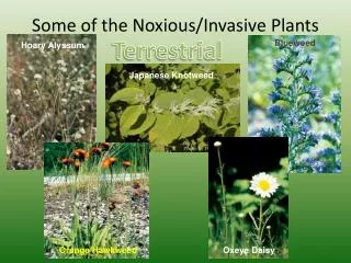
Large Scale Cooperative Management of New Invasive Species • Cogongrass in Georgia, South Carolina and Louisiana • Japanese Knotweed in North Carolina
Cogongrass Management • Georgia, Louisiana, and South Carolina are the “leading edges” of cogongrass’ range • All states have a taskforce setup to deal with cogongrass • All states are housing their distribution data in EDDMapS
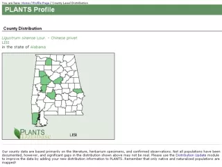
Japanese Knotweed Management • NC-EPPC members are working to place Japanese Knotweed on the state’s noxious weed list • Compiling records of occurrences across the state • Herbarium records • Observations • Using EDDMapS to store and display all of this data • 191 records in 38 counties
EDDMapS • 1 year and going strong • Further compilation of collection data • Additional training sessions • Applied for Pulling Together Grant • Looking for other funding opportunities • Need for collaboration between all of the mapping projects underway