Download
1 / 32
360 likes | 558 Views
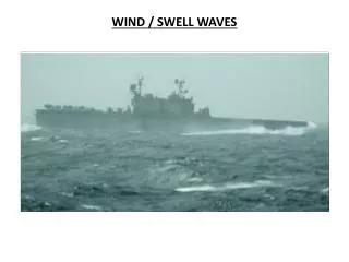
FLIGHT HAZARDS OF MOUNTAIN WAVES AND WIND EVENTS. Stan Rose National Weather Service, Pueblo, Colorado. Roughly one-half of the air accidents in vicinity of the Rocky Mountains are Weather Related. Mountain Turbulence: Convection. Stan Rose 2008. Convection: Thermally Generated flows.

E N D
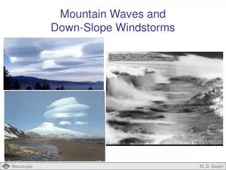
FLIGHT HAZARDS OFMOUNTAIN WAVES ANDWIND EVENTS Stan Rose National Weather Service, Pueblo, Colorado
Roughly one-half of the airaccidents in vicinity of the Rocky Mountains are Weather Related.
Mountain Turbulence: Convection Stan Rose 2008
Gap Winds • Strong winds flowing through gaps or passes. • Strongest winds found in the exit of the gap. • Pressure difference from one side to another is an indicator. • A reverse in expected pressure difference can indicate reversed flow, a possible hazard.
What determines how wind behaves when it encounters terrain? • The Nature of the obstacle (height, width) • The direction and strength of the wind (kinetic energy) • The Stability of the atmosphere (potential energy)
Stability and turbulence: UNSTABLE Only moderate cross-barrier flow needed. Unstable air : if unstable air crosses a mountain barrier, turbulence is almost certain. Cumulus clouds are good indicators. Leeside downdrafts can be strong, but generally don’t extend far beyond the range.
Stability and turbulence: STABLE Strong cross-barrier flow needed. Cloud rows and lenticular clouds are indicators. Rotor clouds can form in the lee, downstream, below ridge-top. Turbulence can be found well downstream.
A common meteorological index:The Froude Number • A Ratio, Similar to KE/PE or Velocity/Stability • If F > 1, Flow moves over the obstacle (strong flow, unstable conditions) • If F < 1, Flow is blocked. (weak flow, stratified atmosphere). • F = 1, a resonance (favorable for windstorms)
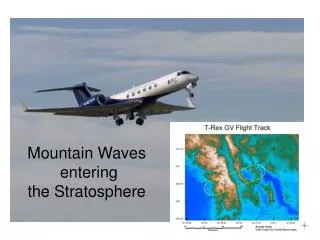
Mountain turbulence: mechanical1) vertically propagating wave
Lenticular clouds • Indicative of high winds aloft (jet stream) Dry air Moist air
Kelvin-Helmholz (K-H) Wave cloud Stan Rose 2008
Severe Down-slope Winds Most common in Winter Months. Can occur night or day: Often night Downdrafts of 50+ fps
Severe Down-slope Winds:Significant Indicators Winds at mountain top generally > 30 Kts. Jet stream in the vicinity. Frontal passage can precede SDW.
WINDSTORMS • Most often occur in the presence of a CRITICAL LAYER.
CRITICAL LAYER: Reverse Shear • Winds decrease with height (Shear is zero)
CRITICAL LAYER: Change in Stability • A Mountain top Stable Layer. • Decreasing stability with height.
Model Forecast Data NAM 12km 27h forecast; 10/10/2008 18Z valid 21Z 10/11/2008 Sea Level Pressure or 850mb Charts
Observational Data (adds.aviationweather.gov)
Observational Data Satellite imagery (wave clouds/cloud streets, lee drying)
Observational Data Satellite imagery (wave clouds/cloud streets, lee drying)
Observational Data Satellite imagery (wave clouds/cloud streets, lee drying)
Crossing Mountains • Climb to 3,000+ feet above ridge-tops. • Begin ascent 100+ miles from the mountains. • Be prepared to avoid the obstacle entirely. • Approach ridges/passes at 45 degree angle. • Don’t fly when there are widespread lenticulars!