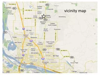
Economic Development and Transportation Infrastructure in Battle Ground, WA
Battle Ground, Washington, boasts a population of approximately 17,400 and a trade population of 48,000 within a 5-mile radius. Covering 6.95 square miles, the city prioritizes economic growth with over 450 active businesses. The city's accessibility is enhanced by state highways SR 503 and SR 502, facilitating daily traffic of over 50,000 trips. Ongoing improvements, such as the widening of SR 502, aim to increase safety and access while addressing challenges related to commercial development and regulatory requirements. Battle Ground is committed to fostering a business-friendly environment.

Economic Development and Transportation Infrastructure in Battle Ground, WA
E N D
Presentation Transcript
demographics & economy Current Population: 17,400 Trade Population (5-mile radius): 48,000 City Size: 6.95 square miles Median Age: 28.7 State Highways: SR 503 (Lewisville Hwy) Limited Access Average Daily Trips 24,217 SR 502 (Battle Ground Hwy) Controlled Access Average Daily Trips 26,601 The City is home to approximately 450 active retail, commercial, office, and light industrial including Anderson Plastics, JRT Mechanical, Old Castle Glass, Trail Tech, Legacy Propane, Tapani Underground, Waterway Business Park, Safeway, Albertsons, and Fred Meyer. Many of these are located along the State Route Corridors through the City, including the City’s downtown, “Old Town Battle Ground.” Economic development is a priority for the City. The City is business friendly in terms of providing excellent customer service, quick development review times, and maintaining the necessary water, sewer, and street capacity for additional growth.
State highways are central to Battle Grounds success • Battle Ground is in the heart of Clark County. East and north County traffic funnels through Battle Ground. This increases commerce and activity in the City. • The regional transportation network surrounding Battle Ground is critical to its success. Many residents commute to their jobs in the Vancouver-Portland metro area using the state highways. City businesses, Battle Ground School district, local health care providers, depend on efficient and safe travel to and from the City. Recent State Highway Improvements • In 2003, West Main Street (SR 502) was improved from two lanes to four lanes, including landscaped medians, center turn lanes, sidewalks, street trees, and street lights. The SR 503/ SR 502 intersection was improved as well.
I-5 & SR 502 Interchange A new I-5 interchange at SR 502 was completed in 2008, approximately 6 miles west of Battle Ground. The interchange eases congestion and improves safety both northbound and southbound on I-5, and helps improve access to Battle Ground. Before this project, access to Battle Ground from I-5 was at 179th Street, two miles to the south that required navigating through county roads to get to SR 502.
SR 502 - Widening From I-5 to Battle Ground Currently, WSDOT is in the design and property acquisition phase of a project that will widen State Route 502 from two to four lanes from I-5 to the City of Battle Ground. Median barriers will be installed to help reduce the severity of collisions along the corridor. In addition, 10 foot wide shoulders for pedestrians and bicyclists will be installed along the north and south side of SR 502 for the entire length of the corridor. • Project Benefits: • Better access from I-5 to Battle Ground. • Safety will increase by adding two additional lanes, controlling access, • and adding a median barrier.
The challenges… Currently, the City has been working with three developers to develop a total of 420,000 square feet of commercial development. The area is along the SR 503 corridor in the City’s Regional Commercial District. The involved developers are at various stages of their entitlement process. The size and success of these developments depend on signalized access at SR 503 and Scotton Way Blvd and Rasmussen Blvd. The City’s Transportation System Plan shows two east-west collector streets extending from SR 503 (Scotton Way & Rasmussen Blvd ) to a north-south arterial (SE 20th Ave). WSDOT has stated that signalized access will not be permitted at either location unless these collectors are extended to 20th Ave. A three-legged signal will not be permitted.
WSDOT Concerns: WSDOT holds this position because anytime a signalized intersection is introduced on a highway such as this: (1) an increase in collisions will result; (2) mobility will be further compromised; (3) WSDOT needs to see a regional benefit rather than just benefiting a single development; and (4) this east-west collector would also help relieve congestion on Main Street. City Concerns: Extending these collectors as a condition of the signalized intersections on SR 503 proves challenging for a number of reasons: (1) The area has a number of wetlands that will be impacted, increasing permitting time and construction cost; (2) financing the construction of these extensions is difficult - the City is pursuing a LIFT as a financing tool; (3) the required street extensions by WSDOT does not seem in proportion to the impact created by the development [WSDOT will give access (right-in, right-out), but not the desired (signalized) access]; (4) the City’s overarching concern is that this condition is inhibiting the much needed economic development at this time. This is the single issue holding up two developers who are ready to build their projects.
Moving forward • Maintain a good working relationship your regional WSDOT office • Get buy in from WSDOT, during Comprehensive Planning & Capital Facilities Planning • City Public Works Director is currently working on an access corridor plan for SR 503 with the Southwest Regional Office • This access plan will be memorialized in a Memorandum of Understanding • this will help balance some of the political priorities, that change with different Council priorities. • Helps clarify each others goals, and identifies where compromises can be achieved on each side.