Download
1 / 50
500 likes | 505 Views
This project aims to reduce ice damage and improve habitat in Chautauqua Creek near Lake Erie. It includes the construction of stone weirs and walls to stabilize the stream banks, prevent erosion, and create holding areas for steelhead. The project has been successful in reducing ice-related issues and improving the overall health of the creek.

E N D
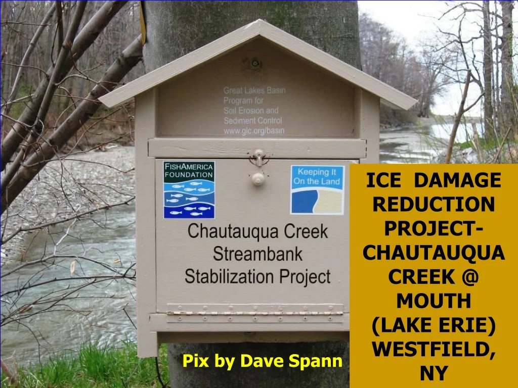
ICE DAMAGE REDUCTION PROJECT- CHAUTAUQUA CREEK @ MOUTH (LAKE ERIE) WESTFIELD, NY Pix by Dave Spann
CHAUTAUQUA CREEK ICE DAMAGE REDUCTION PROJECT –Near its mouth @ Lake Erie • Severe scour from ice and high flow velocities on the right descending bank had resulted in an overwidened section of stream. • Mid-channel sediment bars, mouth of creek @ Lake Erie clogged • No holding areas or habitat for steelhead • A heavily used public fishing section of the stream
Single Stone Bendway Weirs (pegged to bedrock) NEED PLANS & SPECS Trench Stone & Stacked Stone Wall Key Sloped Stone using “Big Flats” Key Flow Key Key Key Key Key
Construction June 2006. Looking uphill @ a key in the sloped bank area Pix by derrick
DRILLING & PEGGING TOE STONES & SINGLE STONE BENDWAY WEIRS WITH METAL RODS TO BEDROCK
Construction June 2006. Looking DS @ 2 hoes jack hammering a footer trench through solid stone Pix by derrick
Construction June 2006. Looking DS @ DS curved key Pix by derrick
7 ft long, 1 5/8 inch diameter rebar rods for pegging stone to bedrock. Pix by Joe Galati
Dave Spann of Chautauqua County Soil & Water Conservation District with a 7 ft long, 1 5/8 inch diameter rebar. Dave did everything from writing the grant to providing extraordinary project management. On time and under budget!!!! Pix by Joe Galati
Construction June 2006. Looking DS. Drilling 2.5 inch holes to peg stone to bedrock. The 2.5 inch bit was the only one they had on hand… Pix by Joe Galati
Construction June 2006. Drilling holes for metal pinning rods Pix by Joe Galati
Construction June 2006. Drilling solid stone Pix by Joe Galati
Construction June 2006. A good hole in a footer stone. Pix by Joe Galati
Construction June 2006. Looking US. Metal pinning rods not cut off yet. Pix by derrick
Construction July 2006. Metal pin in drilled hole pinning stone to underlying bedrock Pix by Joe Galati
Construction June 2006. Looking US during placement of “big flat” stones on the backfill/filter stone. Pix by derrick
Construction June 2006. Dave Spann hydro-seeding Pix by Joe Galati
July 2006. Looking US. One month after plant installation. Pix by Joe Galati
May 17, 2007. Looking DS @ top bank willow poles & other plantings Pix by Joe Galati
THE STACKED STONE WALL BANK PROTECTION AREA(the upstream section of the project)
Construction June 2006. Looking US at the footer stones of the stacked stone wall. Pix by derrick
Construction June 2006. Looking DS @ the stacked stone wall. Pix by Joe Galati
Construction June 2006. From the US key looking DS. Robust key goes deep into the woods. Pix by Dave Spann
CONSTRUCTION COSTSDoes not include admin, design, permitting, program management, construction oversight, or plant installation Total: $200,584.
Looking US during low flow @ Single Stone Bendway Weirs (SSBW) at the sloped bank section of the project. Weirs spaced 50 ft apart. SSBW SSBW SSBW 3 YEARS AFTER CONSTRUCTION-CHAUTAUQUA CR.-DERRICK 6-18-09
Aug 29, 2006 -high water- Looking US, note dead water near toe & thalweg location near arrow, all due to the Single Stone Bendway Weirs Photo by Dave Spann
Looking downstream at the SINGLE-STONE BENDWAY WEIRSHIGH WATERAUG 29, 2006
Aug 29, 2006-high water-looking DS Photo by Dave Spann Note rooster tail defining right edge of high velocity water
Aug 29, 2006-high water-Looking DS toward Lake Erie Photo by Dave Spann
Mar 14, 2006. Looking DS. Three submerged Bendway Weirs can be located due to surface disturbance Pix by Joe Galati
Mar 14, 2006. Looking DS. Close-up of two submerged Bendway Weirs Pix by Joe Galati
Project effects downstream at the mouth into Lake Erie Feb 7, 2007
Looking DS on Feb 7, 2007 at ice mountains blocking mouth of Chautauqua Creek @ Lake Erie {approx. 700 ft DS of DS end of project}. Pix from Joe Galati-NYSDEC
Looking DS at ice mountains blown out by concentrated flow from our project. This is approx. 700 ft DS of DS end of project. Mar 14, 2007 Pix from Joe Galati-NYSDEC
Nov 8, 2007. Looking DS. Thalweg off the ends of the Bendway Weirs Pix by Joe Galati
THE FASTEST ICE OUT DAVE SPANN HAS EVER SEEN (and he has lived nearby all his life) JANUARY 2008
Jan 2008-Ice in place. Looking DS toward Lake Erie Photo by Dave Spann
Dave Spann reports: • Had some ice flush over the weekend. Nasty little storm 60 plus mph winds and 9 foot waves smashing the ice formations. • The photos are taken in less than a 15 hour time period. The ice impacted and flushed sometime overnight. I have never seen it leave in less that 48 hrs ever before under these conditions. Nice! You can see from the photos that the creek was able to pass the ice even with the lake entering the mouth of the creek, and raising the water elevation 3 plus feet, in addition to the energy of the surf pushing upstream. • Pretty good test!, Dave Spann
Looking DS toward Lake Erie. Jan 2008-Ice has flushed out. Photo by Dave Spann
More thoughts from Dave Spann ::: • Historically, the ice did build on the banks prior to the project. It was forced up onto the flatter portions of the banks where it was heaved up by constant ice loading. Moreover, it was much less organized and irregular hindering ice movement. • I believe the project has greatly decreased the duration of the ice jamming, and therefore reduces overall ice loading. There is no doubt that the Bendways have greatly improved the efficiency of the ice movement.
Jan 2008-Ice has moved out. Looking DS. Nice thick ice sitting directly over the Bendway Weirs, note smooth streamside edge of ice. Photo by Dave Spann
3 YEARS AFTER PROJECT COMPLETIONPhotos by Derrick JUNE 17, 2009
Catskill sand cherry growing well in sun, but died when planted in shade. 3 YEARS AFTER CONSTRUCTION-CHAUTAUQUA CR.-DERRICK 6-18-09
Looking DS @ the project, all working well. All top bank willow was chewed down by beaver but regenerated as multi-stem shrubs. 3 YEARS AFTER CONSTRUCTION-CHAUTAUQUA CR.-DERRICK 6-18-09
Looking US @ deposition US of the big Single Stone Bendway Weir. The entire project is stable. For the 3 year life of the project the ice management aspects has performed as planned. 3 YEARS AFTER CONSTRUCTION-CHAUTAUQUA CR.-DERRICK 6-18-09