Download
1 / 24
240 likes | 382 Views
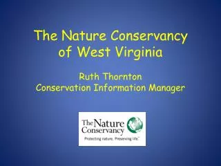
The Nature Conservancy’s Contribution to the IABIN Ecosystem Thematic Network. Steven R. Schill, PhD Senior Geospatial Scientist Mesoamerica & Caribbean Program The Nature Conservancy. Organizational Capacity. 450 offices in 32 countries Protection of 120 million acres

E N D
The Nature Conservancy’sContribution to the IABINEcosystem Thematic Network Steven R. Schill, PhD Senior Geospatial Scientist Mesoamerica & Caribbean Program The Nature Conservancy
Organizational Capacity • 450 offices in 32 countries • Protection of • 120 million acres • 5,000 miles of river • 100+ marine conservation projects • Global Initiatives in Forests, Freshwater, Marine, Climate Change, Invasive Species, Fire • Expansion of Conservation Information Systems (CIS)
TNC’s 2015 Goal By 2015, The Nature Conservancy will work with others to ensure the effective conservation of places that represent at least 10% of every Major Habitat Type on Earth.
2006: Started in SE. Africa 9 Conservation Regions – 7 in the Americas
Global Coordinator Senior Geospatial Scientist Data Manager Geospatial Scientists OU GIS Analysts ORGANIZATIONAL LEVEL STAFF DATA SCALE Worldwide Office GLOBAL GLOBAL EXTERNAL Regional Unrestricted Data Clearinghouse (Panama) INTERNAL Regional Complete Data Clearinghouse (Costa Rica) BIOGEOG REALM Region REGION MHT PUBLIC INTERNET (Search Nodes) ANALYSIS TNC INTRANET INFORMATION FLOW ECOREGION Mexico CENTRAL AMERICA CARIBBEAN OPERATINGUNITS LOCAL FIELD OFFICES SITE DISSEMINATION STANDARDIZATION DATA COLLECTION Each level responsible for their respective SCALE: Data gathering, Data standardization (metadata), Data upload to server Identification of regional data PARTNERS to share burden of network infrastructure and data dissemination System is DYNAMIC so that it is continually ingesting new data as it becomes available
Ecoregional Assessments • Expert/Partner driven: • Targets (Biodiversity) • Threats • Protected areas • Conservation portfolio • Strategies to abate threats
Habitat Mapping Terrestrial Freshwater Marine
Geodatabase Structure Bathymetry Climate Freshwater features Geology Imagery Infrastructure Land cover Marine Features Models Political Protected Areas Socioeconomic Soils Targets (Terrestrial, Freshwater, Marine) Terrestrial Features Topography TopoMaps • Geodatabases • (with FGDC metadata) • Caribbean Region • Lesser Antilles • Puerto Rico • Dominican Republic • Bahamas • Jamaica • St. Vincent & the Grenadines • Grenada • Haiti
Ecoregional Roll-Up • 1. Spatial correction and inventory of ERA datasets • 2. Identify the minimum attribute fields and create data model • 3. Standardize targets/threats based on common taxonomy • 4. Integrate and roll-up all terrestrial ERAs into one seamless region-wide product
Ecoregional Roll-Up Mangroves/ Marine Moist Raw Data: Major Habitat Type Dry MHT Intersected with Remaining “Natural Areas”
GEODATABASE Data Model • Relates spatial features to each other • Features defined by their qualities in context with other features • Features are dynamic • Multiple user editing • Boundaries • Assessment Units • Conservation Targets • Suitability Index • Marxan Files • Portfolio Solutions • Verification Data • Threat Information • Relationship Class • Access Queries
Assessing Effective Conservation
Efforts that Support ETN • Use of ERA Products and Geodatabases • Support to identify data gaps • ESRI partnership (software/consulting) • Assistance with classification cross-walk • Help with development of data standards and data sharing through external portal (free access) • Capacity building (e.g. training in methods/tools)