Download
1 / 1
30 likes | 213 Views
MILLIMETER WAVELENGTH RADARS IN METEOROLOGY. Roger Lhermitte, Pavlos Kollias, and Bruce Albrecht RSMAS/MPO, Univ. of Miami, FL, USA. INTRODUCTION. CURRENT STATUS . CONCLUSIONS. EARLY STAGES .

E N D
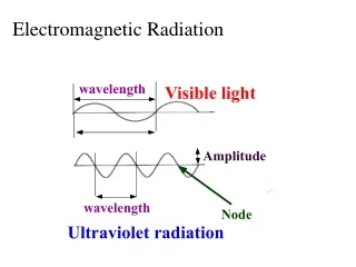
MILLIMETER WAVELENGTH RADARS IN METEOROLOGY Roger Lhermitte, Pavlos Kollias, and Bruce Albrecht RSMAS/MPO, Univ. of Miami, FL, USA INTRODUCTION CURRENT STATUS CONCLUSIONS EARLY STAGES 94-GHz Doppler radars are about the shortest wavelength radars that are typically assembled for meteorological use. Their sensitivity results from the proportionality of the backscattering cross section in the Rayleigh regime (D « ) to 1/4 (Lhermitte, 1987). Millimeter radars are capable of detecting very small droplets with diameters of tens of microns. In addition to their high sensitivity, millimeter radars can be configured to have excellent temporal and spatial resolution and can operate with antennas that have a very narrow beamwidth. These factors result in sampling volumes that are very small compared with those of longer wavelength radars. This reduced sampling volume decreases the effects of the Doppler spectrum broadening due to turbulence. The capability of 94 GHz radars for cloud detection and their portability make them a good tool for studying cloud microphysics and dynamics of boundary layer clouds and cirrus. Because of the deep Mie backscattering oscillations occurring in the raindrop particle size range (Lhermitte, 1988), the 94-GHz radar is also an attractive choice for vertical air motion and drop size distribution measurements, particularly when used in conjunction with an S-band or an X-band radar. In the early eighties, a very short wavelength Doppler radar ( =3.2 mm or 94 GHz , W-band) was introduced to radar meteorology by Lhermitte (1981, 1987), as a new tool for cloud physics research, primary for the observation of low radar reflectivity clouds. Similar systems were developed later (e.g. Clothiaux et al., 1994) and used in various meteorological projects. Starting with the operation of the first cloud radar, a large number of research papers (Danne et al., 1999; French et al., 2000; Hogan et al., 2000; Sekelsky et al., 1999) have been published on the performance and advantages of millimeter wave radars and the results acquired through their use in various research projects. This poster provides a brief description of the University of Miami 94-GHz Doppler radar and its development and demonstrates some major applications of 94-GHz Doppler radars to cloud and precipitation studies using a series of examples. Other groups working on similar developments and applications are listed. RADAR CHARACTERISTICS Although centimeter wavelength radars may have the sensitivity required to detect small cloud droplets provided these radars have sufficient power and a large antenna, the short range performance of such radars is limited by ground clutter. Since the backscattering from small targets such as cloud particles increases proportionally to -4 , a relatively low power radar operating at a shorter wavelength constitutes a better alternative. REFERENCES Babb, D.M., J. Verlinde, and B.A. Albrecht, 1999: Retrieval of cloud microphysical parameters from 94-GHz radar Doppler power spectra. J. Atmos. Oceanic Technol., 16, 489-503.Clothiaux, E.E., M.A. Miller, B.A. Albrecht, T.P. Ackermann, J. Verlinde, D.M. Babb, R.M. Peters, and W.J. Syrett, 1994: An evaluation of a 94 GHz radar for remote sensing of cloud properties. J. Atmos. Oceanic Technol., 12 , 201-229. Danne, O., M. Quante, D. Milferstädt, H. Lemke, and E. Raschke, 1999: Relationships between Doppler spectral moments within large-scale cirro- and altostratus cloud fields observed by a ground-based 95 GHz cloud radar. J. Appl. Meteorol., 38 (2), 175-189. French, J.F., G. Vali, and R.D. Kelly, 2000: Observations of microphysics pertaining the development of drizzle in warm, shallow cumulus clouds. Quart. J. Royal. Meteor. Soc., 126 (563), 415-443. Hogan, R. J., A. J. Illingworth and H. Sauvageot, 2000: Measuring crystal size in cirrus using 35- and 94-GHz radars J. Atmos. Oceanic Tech., 17(1), 27-37. Lhermitte, R. M., 1981. Satellite borne dual millimetric wavelength Radar. Precipitation Measurements from Space, David Atlas and Otto W. Thiele (eds.), Workshop report, October 1981, NASA/GODDARD Space Flight Center, Greenbelt , MD, D-277-D-282. Lhermitte, R. M., 1981. Millimeter Wave Doppler Radar , Proc. 20th Conference on Radar Meteor., Am. Meteor. Soc., 744-748. Lhermitte, R. M., 1987. A 94 GHz Doppler Radar for Cloud Observations. J. Atmos. Ocean. Tech., 4(1), 36-48. Lhermitte, R. M., 1988. Observations of rain at vertical incidence with a 94 GHz Doppler Radar: an insight of Mie scattering. Geophys. Res. Lett.,15, 1125-1128. Lhermitte, R. M., 1989. Satelliteborne Millimeter Wave Doppler Radar. URSI Commision F. Open Symposium Proceedings, La Londe-les Maures, France, Sept. 11-15, 1989. Sekelsky, S.M., W.L. Ecklund, J.M. Firda, K.S. Gage, and R.E. McIntosh, 1999: Particle size estimation in ice-phase clouds using multifrequency radar reflectivity at 95, 33, and 2.8 GHz. J. Appl. Meteor., 38, 5-28. Table I, which covers radar wavelengths from 10 to 0.14 cm, shows that despite large variations of some of the individual terms, there is only a relatively small change in the overall radar sensitivity for cloud observations. Note that the above data relates to typical meteorological radar characteristics that do not necessarily represent state-of-the art radar development. Besides the far field condition, which for antennae producing the same beamwidth, is more favorable at shorter wavelengths, the most important consideration for close range detection of weak atmospheric targets is not only the receiver noise level, but also ground echoes leaking through the antenna sidelobes. This is especially true for high-power long-wavelength radars. Assuming the same sidelobe structure for all antennae regardless of the wavelength, the effect of ground echo interference in the measurement of the weak backscattering produced by a small cloud at close range can be characterized by the contrast between returns from the ground and from clouds. Ground echoes are caused by a variety of large size targets such as buildings, trees, terrain, etc. The variation as a function of radar wavelength of ground clutter radar cross section per unit area ° is not well known and depends on the targets, but it seems to increase only very slowly with a decrease of the wavelength. On the other hand, cloud echo intensity increases proportionally to 1/ 4 , or a dramatic increase of 60 dB from 10 to 0.32 cm wavelength. Therefore, even with a possible 10 dB increase of ° with the shorter wavelength, the ground clutter-cloud return contrast will improve by at least 50 dB from a 10 to 0.3 cm wavelength. It is our experience that even surrounded with buildings, a 94 GHZ radar, providing a theoretical 15 dB (no clutter) cloud detection improvement over an S-band radar, does not show any measurable (less than 20 dB below receiver noise) ground clutter signal at short ranges (200 m) for elevation angles above approximately 5°. Therefore, a millimeter-wave radar operated in a vertically pointing mode (or slightly off vertical if three –dimensional scanning is required) is an attractive solution for the observation of low altitude low reflectivity clouds such as fair-weather cumuli. SATELLITE-BORNE 94-GHz DOPPLER RADAR 94-GHz DOPPLER RADAR RESEARCH GROUPS Using short wavelengths, narrow beamwidths are produced by relatively small size antenna. Also the radar reflectivity of weak targets (e.g. clouds) increases in proportion to -4,thereby reducing the need for high transmitter power. Short wavelengths thus represent an attractive choice for the probing of motion fields in precipitation systems by a Doppler radar installed aboard a satellite where physical space and power supply is limited. The increased signal attenuation by cloud and precipitation at shorter wavelengths is, however, a critical issue. Lhermitte (1981;1989) first proposed the use of a space-borne 94 GHz Doppler radar for the detection of clouds and precipitation. 15 years later the CloudSat mission is under way. CloudSat is a multi-satellite, multi-sensor experiment designed to measure cloud properties from space. The primary CloudSat instrument is a non-Doppler 94 GHz cloud profiling radar. This space-borne radar is designed to have a sensitivity of – 29 dBZ and 500 m vertical resolution. The radar measurements will be supported by an optical imager and a lidar.http://cloudsat.atmos.colostate.edu/mission.html • University of Reading radar group (UK) • GKSS 95 GHz cloud radar (Germany) • Pennsylvania State University (Department of Meteorology) • University of Massachusetts (Microwave Remote Sensing Laboratory) • University of Wyoming (Department of Atmospheric Science) • University of Miami (Meteorology and Physical Oceanography) PRECIPITATION CIRRUS Lhermitte (1988) first used the observed Mie backscattering oscillations at 94 GHz to calculate the vertical air motion and raindrop size distributions in stratiform rain. Fig. 3. Right panel: An example of Doppler spectrum observed in stratiform rain using vertically pointing 94 GHz Doppler radar. STRATOCUMULUS FAIR-WEATHER CUMULUS Fig. 1 Examples of time–height mapping of radar reflectivity (top) and mean Doppler velocity in a marine stratus. The data demonstrate the excellent sensitivity of the radar and illustrate updraft and downdraft structures within these non-drizzling stratus. Fig. 2 Examples of time–height mapping of mean Doppler velocity in fair-weather cumuli. The top panel shows a small cumulus observed in 1987 (Lhermitte, 1987) and the bottom panel shows a fair-weather cumulus observed in 2001. There are remarkable similarities in the observed mean Doppler velocity field with a well-defined updraft core and surrounding downdrafts. Fig. 4. Top panel: 915-MHz radar reflectivity mapping of a convective core. The reflectivity exceeds 50 dBZ at levels between 1.5 and 4 km. The box defined by the white lines indicates the area where the millimeter radar data were used for microphysics and air motion retrievals. Bottom panel: Vertical air motion field retrieved using the shifting of the Mie minima from millimeter radar Doppler spectra. Fig. 5. Top panel: Cross section of radar reflectivity observed with the UM 915 MHz wind profiler (black) at 1.3 km altitude and the corresponding rainfall rate at the surface (red). Bottom panel: Retrieved vertical air motion within the convective core (black) using the shifting of the first Mie minima and the median volume diameter (red) retrieved from the Doppler spectra. Fig. 6. Doppler moments from a cirrus anvil: power (top), mean Doppler velocity (middle) and spectrum width (bottom) calculated from the recorded FFTs. The spectra were recorded within a variable range window (6 km layer) with a gate spacing of 60 m.