Download
1 / 221
2.22k likes | 2.24k Views
Explore the realm of geography with definitions from various texts, focusing on the analysis of Earth's physical and human characteristics through spatial inquiry. Learn about human geography themes, vocabulary, map distortions, and historical evolution of mapmaking.

E N D
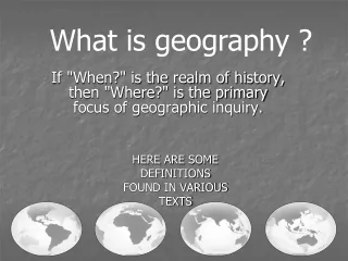
What is geography ? HERE ARE SOME DEFINITIONS FOUND IN VARIOUS TEXTS If "When?" is the realm of history, then "Where?" is the primary focus of geographic inquiry.
Geography --- deBlij “Geography is concerned with the analysis of the physical and human characteristics of the Earth’s surface from a spatial perspective”. deBlij Human Geography, A-21.
Human Geography -- Fellmann “The spatial analysis of human populations, their cultures, their activities and behaviors, and their relationship with and impact on the physical landscapes they occupy”. Fellmann, Human Geography, p 553.
Geography -- Rubenstein “The scientific study of the location of people and activities across Earth, and the reasons for their distribution”. Rubenstein Human Geography, p 2. ____________________________________ Human geography -- Rubenstein “The study of where and why human activities are located where they are”. Rubenstein, p. 4
Why what is where. Can be anything
Why what is where. Spatial component
Why what is where. tallest buildings fast food restaurants slums volcanoes
Why what is where. center of city grouped together Outskirts of cities edge of plates tallest buildings fast food restaurants slums volcanoes
AP Human Geography Topics • Geography: Its Nature and Perspectives • Population & Migration • Cultural Patterns and Processes • Political Organization of Space • Agricultural and Rural Land Use • Industrialization and Economic Development • Cities and Urban Land Use
Human Geography: Five Themes • Location – the space that is occupied in the universe (absolute/relative). • Place – physical and human characteristics: space after humans. • Human/Environment Interactions – how humans depend, modify, and adapt to their environments. • Movement – how humans interact on earth, the diffusion of religion or trade patterns through connections of peoples. • Regions – an area with one or more shared characteristics.
Vocabulary Tests • Map Tests • Multiple Choice Tests • Free Response Questions (FRQs)
Debra Troxell, NBCT
Three sources of map distortion • Map scale – most maps are smaller than the reality they represent. Map scales tell us how much smaller. • Map projection – this occurs because you must transform the curved surface of the earth on a flat plane. • Map type – you can display the same information on different types of maps.
Map scale – tells us relationship between distance on map and distance on earth’s surface • Ratio scale = ratio of map distance to earth distance. • 1:10,000 means that one inch on the map equals 10,000 inches earth’s surface; one centimeter represents 10,000 centimeters; or one foot equals 10,000 feet. • Recall a small fraction has a large denominator so that 1:100,000 is a smaller scale than 1:25,000. • A large-scale map depicts a small area with great detail. • A small-scale map depicts a larger area with little detail. Distortion is especially severe here.
A. B. C. D. Which is the large-scale map?
Which map scale shows the most detail? a. 1:250,000 b. 1:24,000 c. 1:100,000 d. 1:62,500 • A map with a large scale usually shows a. a large amount of land space b. a small amount of land space c. physical features only of a land space d. the local-global continuum e. political boundaries between countries only
the other Scale • Refers to at what scale a process occurs – • For example, while the storm didn’t make the national news, at the local scale it was a major story.
Evolution of Mapmaking • Babylonians – 2300 BC earliest surviving maps written on clay tablets. • Aristotle – 384-322 BC demonstrated earth was spherical through maps.
Evolution of Mapmaking • Eratosthenes – 276-194 BC first person to use the word geography. Also the first person to correctly divide earth into 5 climatic regions. • Ptolemy – 100-170 AD Guide to Geography • Age of Exploration – by the 17th century, most continents and oceans were accurately displayed.
Who demonstrated the Earth was round using maps? a. Ptolemy b. Aristotle c. Eratosthenes d. Sauer • Who coined the word geography? a. Ptolemy b. Aristotle c. Eratosthenes d. Sauer
GeoSpatial Revolution • Episode 1 http://geospatialrevolution.psu.edu/episode1
Contemporary Mapping • GIS (geographic information systems) • GPS (global positioning system) • Remote Sensing Satellites
Remote Sensing • The acquisition of data about Earth’s surface remotely such as from an airplane or satellite orbiting the planet. • Primarily environmental mapping – vegetation, surface cover, winter ice cover, deforestation
Satellite images of the north-east coast of Japan before (left) and after the earthquake and tsunami. Water is black or dark blue and the thin green line in the 'after' image indicates the shoreline. Photograph: Nasa • http://www.nytimes.com/interactive/2011/03/13/world/asia/satellite-photos-japan-before-and-after-tsunami.html?_r=0 • http://eijournal.com/2011/disaster-response-in-japan-2
a. Remote Sensing b. GPS c. GIS d. DTM • Layers of geographical information that can be selected or deselected when viewing a map • Can immediately scan the Earth’s surface to determine changes in geography
Subway: Know Where You’re Going
Homework: The Subway Geographic Activity 1
Class Work: The Subway Geographic Activity 2
Distribution Density Concentration Pattern
Distribution definition • The arrangement of something across earth’s surface
What factors affect population distribution? • Economic • Social • Political • Environmental