Download
1 / 17
170 likes | 191 Views
COMASS-II is an advanced online cartography system that provides interactive mapping, complex analysis, intuitive data mining, and decision-making support. It is used in various fields such as economics, sociology, demography, politics, business, and management.

E N D
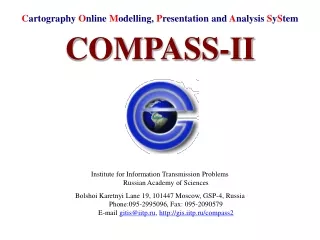
Cartography Online Modelling, Presentation and Analysis SyStem COMPASS-II Institute for Information Transmission ProblemsRussian Academy of Sciences Bolshoi Karetnyi Lane 19, 101447 Moscow, GSP-4, RussiaPhone:095-2995096, Fax: 095-2090579E-mail gitis@iitp.ru, http://gis.iitp.ru/compass2
COMPASSFunctionalities • Internet publishing of Geographic Information (GI) • Interactive GI cartographic representation • Complex analysis of spatial properties of geographical objects • Intuitive understandable spatial data mining • Decision making support
COMPASSFields of Application • Economics • Sociology • Demography • Politics • Business • Management
COMPASSFacilities • Cartographic and graphic functions: • Understanding the scope of spatial and spatial-temporary properties distribution within a geographic region by painting map areas according to indicator values • Selection of geographical elements on the map and presentation of indicator values, table of indicators, text and photo documents in hypertext form • Selection of geographical elements to create of a subset of precedents • Histogram presentation of visualized indicator values • Map zooming and scrolling • Analytical functions: • Estimation of similarity between the geographical elements and a set of user selected precedent elements with a given subset of indicators • Classification of geographical elements by a set of user-selected precedent elements with a given subset of indicators
COMPASSData Exploration Indicator map presentation, selection of geographical objects on the map, table of indicators for selected object, hypertext documents
COMPASSMultilayer SupportWeb-Site Connection Regions and cities indicator mapping. URL can be assotiated with geographical object.
COMPASSGeographical objects Comparison Pie charts show the partitions of selected countries and partition of all selected countries in total value for the World for given indicator
COMPASSComparison with given value The countries are compared with Germany by value of indicator “GNP per capita”
COMPASSGrouping The indicator range is divided into several intervals. The quantity of objects in each interval is shown on the top of corresponding column.The countries of selected interval are highlighted on the map. In classify mode countries color match color of column.
COMPASSSimilarity Similarity of the countries with Germany by indicator “Total population”
COMPASSSimilarity Similarity of the countries with Germany by complex of two indicators: “Total population” and “Population density”
COMPASSSimilarity Similarity of the countries with Germany by complex of three indicators: “Total population”, “Population density” and “Population growth rate”
COMPASSSimilarity Similarity of the countries with Germany and France by complex of three indicators: “Total population”, “Population density” and “Population growth rate”
COMPASSSimilarity Similarity of the countrieswith the set of user selected precedentsand given subset of indicators
COMPASSMembership (Classification) Classification of the countries on two classes by three indicators. Precedent of the 1st class: Germany. Precedent of the 2nd class: Poland.
COMPASSReport Report is generated as HTML-document which may be edited by user