Download
1 / 29
300 likes | 398 Views
Explore challenges and advancements in hydrological predictions at both continental and watershed scales. Learn about innovative modeling techniques and methodologies such as the MESH system and landscape-based regionalization approaches.

E N D
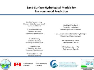
Land-Surface-Hydrological Models for Environmental Prediction Dr. Alain Pietroniro P.Eng. Director – Water Survey of Canada Environment Canada Dr. Muluneh Mekonnen Centre for Hydrology University of Saskatchewan Dr. John Pomeroy Centre for Hydrology University of Saskatchewan Dr. Pablo Dornes Centre for Hydrology University of Saskatchewan Mr. Bruce Davison – HAL Environment Canada Mr. Matt Macdonal Centre for Hydrology University of Saskatchewan Ms. Laura Comeau Centre for Hydrology University of Saskatchewan Ms. Brenda Toth – HAL Environment Canada Mr. Anthony Liu – HAL Environment Canada
Acknowledgments Funding for the work provided by IP3 and IPY In-kind support – HAL lab – Environment Canada Data provided through many collaborative studies over the years Specific thanks to Rick Janowicz for providing advice and data for this work. Diana Verseghy and Paul Bartlet for advice on CLASS Bryan Tolson for assistance with DDS Nick Kouwen for WATFLOOD help many other ……………………
Challenges of Hydrologic Predictions Continental Scale: Focus of Hydro-Climate modelers Watershed Scale: (Where hydrology happens) Focus of Hydro-Met. Modelers Courtesy of : Dr. Soroosh Sorooshian, University of California Irvine
Courtesy of : Dr. Soroosh Sorooshian, University of California Irvine Short Range Long Range hours days weeks months year Flash Flood Warning Flash Flood Guidance Headwater Guidance Flood Forecast Guidance Reservoir Inflow Forecasts Spring Snow Melt Forecasts Water Supply Volume Required Hydrologic Predictions Hindcast and Now cast – Planning and design
The tile connector(1D, scalable) redistributes mass and energy between tiles in a grid cell e.g. snow drift The grid connector (2D) is responsible for routing runoff can still be parallelized by grouping grid cells by subwatershed MESH: A MEC surface/hydrology configuration designed for regional hydrological modeling Tile connector Grid connector
Improved Soil Water Balance MESH (CLASS 3.5) CLASS 2.7 Model Surface Excess Surface Runoff Interflow slope Drainage Drainage
Environmental Prediction Framework Upper air observations 4DVar data assimilation GEM atmospheric model CaPA: Canadian precipitation analysis “ “ On On - - line” line” “ “ Off Off - - line” line” mode mode mode mode Surface observations Surface scheme (CLASS or ISBA) and routing model CaLDAS: Canadian land data assimilation MESH Modélisation environnementale communautaire (MEC) de la surface et de l’hydrologie
HOW TO COMBINE INDUCTIVE AND DEDUCTIVE APPROACHES TO PREDICTION IN UNGAUGED BASINS Pablo F. Dornes Facultad Ciencias Exactas y Naturales Universidad Nacional de La Pampa, Argentina pablodornes@exactas.unlpam.edu.ar 8
Philosophies of Modelling • Inductive Approach – Top Down • Analyses processes based on data (e.g. dominant responses) at larger scales (e.g. basin) and then, if needed, make inferences about processes at smaller scales. • Deductive Approach – Bottom-Up • Analyses processes at smaller scales using physical laws, and then extrapolates the process at larger scales using aggregation techniques. 9
Study Area Wolf Creek Research Basin 60° 31’N, 135° 07’W Area: 195 km2 Granger Basin 60° 31’N, 135° 07’W Area: 8 km2 10
Modelling Methodology • Three models: • Small-scale physically based Hydrological Model (CRHM) • Land Surface Scheme (CLASS) • Land Surface Hydrological Model (MESH) 11
Landscape Heterogenety Granger Basin 12
Hydrological Land Surface Simulations • Snowcover ablation and Snowmelt runoff using MESH • Spatial representation based on the GRU approach • Definition of GRU based on: • Topography and vegetation cover Grid size 3 km x 3 km 13
Basin Streamflow Simulations Wolf Creek Research Basin 14
CONTENTS • Top-down & bottom-up modeling approach • Scale-free parameter regionalization • Case studies • The South Saskatchewan River Basin (SSRB) and • The Upper Assiniboine River Basin • Results
TOP-DOWN & BOTTOM-UP MODELING APPROACH • Use literature based parameter values for the LSS model • Step by step include lateral flow processes and calibrate parameters only related to the lateral flow processes
SCALE-FREE PARAMETER REGIONALIZATION • Combining the GRU approach with sub-basin based parameter calibration • Validate consistency of parameter values in both time-space dimensions • Hence parameter values are transferrable within the basin (without bringing in scaling issues)!
RESULTS – SSRB – COARSER GRID • More improvements by including lateral flow process • Model grid size - 0.2 degrees by 0.2 degrees • 6 land classes • 5 sub-basins to calibrate and validate (time dimension) model parameters • 3 independent sub-basins to spatially validate calibrated parameter values
RESULTS – ASSINIBOINE – FINER GRID • Further improvements by including the frozen soil infiltration algorithm • Model grid size - 0.125 degrees by 0.125 degrees • 4 land classes • 1 sub-basin to calibrate and validate (time dimension) model parameters • 2 independent sub-basins to spatially validate calibrated parameter values
WITH AND WITHOUT THE FROZEN MODULE – CALIBRATION AND VALIDATION WITHOUT FROZEN MODULE WITH FROZEN MODULE
WITH AND WITHOUT THE FROZEN MODULE – SPATIAL VALIDATION WITHOUT FROZEN MODULE WITH FROZEN MODULE
WITH AND WITHOUT THE FROZEN MODULE – SPATIAL VALIDATION WITHOUT FROZEN MODULE WITH FROZEN MODULE
Conclusions Small scale process studies were successfully used in a bottom-up approach to assist in calibrating and segmenting the basin in a large-scale “top-down” type of modeling system. Landscape-based parameters used in vertical water budget estimates that were calibrated in one basin have some validity when used in other basins. At the large-scale, the GRU approach allows for consistent landscapes parameterization provided we have sufficient information for validation in space and time. Large Scale modeling of the Saskatchewan and Assiniboine River systems were successful using a landscape based approach with MESH. Further refinements to the model ( parameterization and some aspect of physics) particularly dealing with basin segmentation and grid size still needs to be considered. MESH and CHRM form a complimentary modeling platform that allow for rigorous testing from the bottom-up and the top down. With the Sask River basin and the upper Assiniboine testing completed, we are in the enviable position of looking at scale effects on hydrological modeling while quantifying to some degree the importance or need for calibration and important scale dependencies for physical processes and parameterizations. Because we are running coupled system with the atmosphere, the sensitivity and importance of parameterization for closing water budget ( comparing to hydrographs) should impact in a positive way our ability to predict short-term weather and also improve our ability to engage in improved regional climate modeling.