Datum & Coordinate Systems
Datum & Coordinate Systems. Lecture 6. Representing Geography Maps. Maps are a 2-D representation of Reality Legend Scale (ratio of map distance: real world distance) Directional arrow As a 3-D world is represented in 2-D, the transformation Always involves distortion. Datum.


Datum & Coordinate Systems
E N D
Presentation Transcript
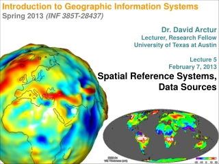
Datum & Coordinate Systems Lecture 6
Representing GeographyMaps • Maps are a 2-D representation of Reality • Legend • Scale (ratio of map distance: real world distance) • Directional arrow • As a 3-D world is represented in 2-D, the transformation Always involves distortion
Datum • A mathematical model that represents an approximation of the earth.
Once you have a mathematical model of the size and shape of the earth, you can apply a coordinate system to in. • Coordinates without a datum are vague • Datum provides an origin that gives meaning to the coordinates • Datum are errorless in Abstract • When a datum is applied to reality, error is introduced
Alexander Clarke - 1866 • Calculated the shape of the earth based on surveying measurements • Established the Clarke 1866 Ellipsoid • Standard reference for mapping • Used to create NAD27 • North American Datum of 1927 • NAD83 • North American Datum of 1983 • Uses GRS 80 Ellipsoid as it’s Base Model
GPS has contributed to Datum Development over time • WGS 84 - World Geodetic System 1984 • the reference frame upon which all geospatial-intelligence is based • Latest update 2004 • NGS - National Geodetic Service • Brass markers are placed to pinpoint locations based on Datum
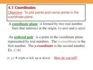
Coordinate Systems • Systems used to pinpoint a location as related to an origin • Cartesian Coordinate System • X, Y axis • Based on an origin • Divides an area into 4 Quadrants • Upper right (+, +) • Lower left (-, -)
UTM & State Plane • UTM • The National Imagery and Mapping Agency (NIMA) (formerly the Defense Mapping Agency) adopted a special grid for military use throughout the world called the Universal Transverse Mercator (UTM) grid. In this grid, the world is divided into 60 north-south zones, each covering a strip 6 degrees wide in longitude. These zones are numbered consecutively beginning with Zone 1. In each zone, coordinates are measured north and east in meters.
State Plane • The state plane coordinate system (SPCS) is similar to the UTM system in many respects, but it does have some important differences. In the SPCS, each state has its own zone(s).The number of zones in a state is determined by the area the state covers and ranges from one for a small state such as Rhode Island to as many as five.
Geographic Grid Coordinate System • Degrees, Minutes, Seconds • DD MM SSS • Decimal Degrees • DD.MMMMMMMM • Origin • Equator • Prime Meridian
Latitude • Measured as the internal angle from an origin in the center of the earth. • 0 degrees - Equator • 90 degrees - Poles • North is Positive • South is Negative
Longitude • Measured as a portion of the circumference of the earth. • Longitude lines are all Great Circles • Range 0 – 180 degrees • East is Positive • West is Negative
Degrees, Minutes, Seconds • 1 Degree Latitude - 69 Miles • 1 Degree Longitude - 69 Miles at the Equator • Converges at the Poles • In San Diego, 1 Degree Longitude = 58.5 Miles • 1 Degree = 69 Miles • 1 Minute (1/60 of a Degree) = 1.15 Miles • 1 Second (1/60 of a Minute) = 0.01917 Miles (101.2 Feet)
Where is San Diego? • 32o 28’ 18” N (Latitude) • 117o 48’ 53” W (Longitude) • Also represented as • 32o 28’ 18” • -117o 48’ 53”
Decimal Degrees • Increment between lines of latitude or longitude are represented as the decimal fraction between them. • lat: 32.720939 N long: 117.151969 W or • lat: 32.720939 long: -117.151969
Converting from DMS to DDD • The latitude of London expressed in DMS is 51° 29' 16" North. To convert this location to DD, follow these steps: • 1. Divide each value by the number of minutes (60) or seconds (3600) in a degree: • 29 minutes = 29/60 = 0.4833 degrees • 16 seconds = 16/3600 = 0.0044 degrees • 2. Add up the degrees to get the answer: • 51° + 0.4833 ° + 0.0044 ° = 51.4877 DD