Download
1 / 25
250 likes | 365 Views
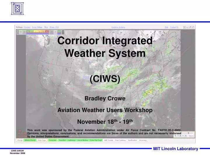
Corridor Integrated Weather System (CIWS) Bradley Crowe Aviation Weather Users Workshop November 18 th - 19 th.

E N D
Corridor IntegratedWeather System • (CIWS) • Bradley Crowe • Aviation Weather Users Workshop • November 18th - 19th This work was sponsored by the Federal Aviation Administration under Air Force Contract No. FA8721-05-C-0002. Opinions, interpretations, conclusions, and recommendations are those of the authors and are not necessarily endorsed by the United States Government.
Outline • CIWS background • CIWS base weather products • Precip • Winter Precip • Echo Tops • CIWS 2 hour deterministic forecasts • Additional CIWS products • RAPT overview • Future work
Corridor Integrated Weather System (CIWS) Canadian ASR-9 NEXRAD TDWR Canadian Researchers Canadian Weather Radar Automated Weather Products LLWAS ASOS Real-time Weather Product Generator Lightning Decision Support Tools Surface Weather Satellites Web-based Tools Models (e.g., RUC) Aircraft Dedicated Displays 2008 2007 Dedicated CIWS Display Users • Air Traffic Control System Command Center • Air Route Traffic Control Centers (ARTCC) • (ZAU, ZOB, ZID, ZDC, ZBW, ZNY, ZMP, ZKC) • Terminal Radar Approach Controls (TRACON) (N90, C90, CVG, D21, PIT, CLE) • Great Lakes Office • Airlines with dedicated displays • User driven research with high degree of operational interaction • Platform for evaluating new forecast technologies in an operational setting • Provides digital weather products to weather- assimilated Decision Support Tools and researchers
Operating the Prototype 24 x 7 operation User access to operational team via page, phone, e-mail Proactive user support Observing system behavior and operational use in real-time Regular operation-based training “… we NEED this information to do our jobs … without it, the wheels will come off the wagon …” ZDC STMC Planned for transition to WJHTC by 2011
Estimated CIWS Applications Per Year Estimated Annual Benefits Occurrences 1 Improved situational awareness 9 Directing pathfinders 2 Enhanced inter/intra-facility coordination 10 Close routes proactively 3 Reduced workload 11 FAA facility staffing assistance 4 Proactive reroutes 12 Directing traffic through weather gaps 5 Routes open longer 13 More departures during Severe Weather 6 Improved Arr/Dep transition area Avoidance Programs (SWAP) (ATA/DTA) management 14 Improved safety 7 Reduced Miles-in-Trail (MIT) restrictions 15 Improved Ground Delay Program (GDP) 8 Improved Ground Stop Program management management
Overview of CIWS display features Precip Products (title Bar) Forecast Products Color Bars System Menus Echo Tops Products Loop Controls Secondary CIWS Weather Products Base CIWS Weather Products View Menu
CIWS on the Web URL: http://www.wx.ll.mit.edu/ciws Click Live Website link Login with assigned Account and Password NWS NWS216 Web and SD are both Java based and very similar Account and Password request available on home page
CIWS Weather Products • Precp: Mosaic of Vertical Integrate Liquid Water (VIL) • Mosaic consists of NEXRAD, Canadian and TDWR data • Winter Precip: Uses VIL with an improved lower • threshold to sense weaker precipitation as well as • surface and model data to display precipitation type • Echo Tops: used high resolution Echo Tops product • in a mosaic to display tops at 18 dBZ
Standard and Winter Precipitation Colors Standard colors for past and current weather Winter colors for past and current weather
Precipitation Product • Loops from -120 min to present in 5-min increments • Spatial resolution is a function of zoom: ~4 nmi to ~0.5 nmi • Update rate: 2.5 min when looping Precip only;5 min when looping with Precipitation Forecast Filter options • First left click selects Precip as the base product • Subsequent clicks toggle display levels • Right click displays dialog box • First left click selects Precip as the base product • Subsequent clicks toggle display levels
Precipitation Phase Algorithm RUC Model Data CIWS precipitation phase algorithm CIWS precipitation phase and phase forecast MADIS DATA Precipitation phase algorithm uses: • Surface temperature and dew point • Upper level temperature and dew point • surface precipitation phase data MADIS mesonet stations in the North-American domain on May 26, 2004
= No PhaseInformation Winter Precipitation Product Filter Options • Provides additional detail within Level 1 precipitation, which may contain light (Level 1a), moderate (Level 1b), or heavy (Level lc) snow or mixed precipitation • Precipitation phase is represented in greens (rain), pinks (mixed), and blues (snow) • Coverage equal to extended radar coverage
Echo Tops Product • Echo tops in 5000 ft increments (MSL) • For 1000-ft increments use Echo Tops Tags • Loops from -120 min to present in 5-min increments • Spatial resolution is a function of zoom: ~4 nmi to ~0.5 nmi • Update rate 2.5 min when looping Echo Tops only;5 min when looping with Echo Tops Forecast Filter options Click to display where echo tops exceed radar coverage
CIWS Standard and Winter and Echo Tops Forecast Standard precip forecast colors • All CIWS base products have • an associated forecast product Winter precip forecast colors Echo Tops Forecast
ASR-9 NEXRAD TDWR Canadian Weather Radar Overview of CIWS 0-2 hr Forecast Algorithm Canadian Satellites Canadian LLWAS ASOS Surface Weather NOAA Numerical Weather Prediction
Precipitation Forecast Product • Loops from 5 min to 120 min in 5-min increments • Spatial resolution is a function of zoom: ~4 nmi to ~0.5 nmi • Update rate: 5 min • Product performance may be adversely impacted in the mountains due to beam blockage • Airmass storms can present challenges in a 2-hour forecast Filter forecast levels
Echo Tops Forecast Product • Loops from 5 min to 120 min in 5-min increments • 4-level forecast (<30kft, 30 – 34kft, 35 – 39kft, ≥40kft) • Spatial resolution is a function of zoom: ~4 nmi to ~0.5 nmi • Update rate: 5 min • Product performance may suffer in the mountains due to beam blockage Filter options
Additional CIWS products • Satellite • Lightning • Storm Motion • Echo Tops tags • Growth and Decay Trends • Forecast Contours • Verification Contours • Forecast Accuracy Satellite: Visible/Infrared satellite mosaic. Lightning: White + indicates location of cloud-to-ground lightning strikes over the past six minutes. Storm Motion: Black arrows and blue lines showing movement of Level 3+ weather. Echo Tops Tags: Echo tops labels in 1000-foot increments. Growth & Decay Trends: Areas of growth (orange cross-hatched) and decay (dark blue) within the last 15 to 18 minutes. Forecast on Precip Verification on Precip Forecast region on Precip
RAPT Algorithm Route Availability Planning Tool Architecture Display Route Database Model for ATC usage of airspace Pilot Wx Avoidance Model ETMS CDR PLAYBOOK RAPT departure route trajectory database WEB http://rapt.wx.ll.mit.edu Departure route is defined by an airport, a passing fix, and an ending jet route or as a CDR Departure trajectories are based upon average aircraft location, speed and climb profile CIWS Precipitation Forecast CIWS Echo Tops Forecast
Future Work • CoSPA 2-8 hr Forecast (Consolidated Storm Prediction for Aviation) • Lightning proxy for VIL and Echo Tops • NWS fronts
Comparison of Merged Field with Radar Truth • Improves precipitation intensity and echo tops heights estimates in areas where radar data are degraded (e.g., radar drop-outs and limits of coverage) • Improves precipitation intensity and echo tops heights forecasts • Improves safety
Automated front Location NWS provides CONUS front analysis MIT LL tracks and advects fronts Product could update every 5 min