Download
1 / 22
220 likes | 326 Views
Geospatial Technology. What is it Geospatial Technology and Why is it important to know about it?. Well Paid. Emerging Market. Enhances several Jobs. Technology with staying power. Combines Computers and outdoor activities. It’s “in demand ”. Many other reasons.

E N D
Geospatial Technology What is it Geospatial Technology and Why is it important to know about it? Well Paid Emerging Market Enhances several Jobs Technology with staying power Combines Computers and outdoor activities It’s “in demand” Many other reasons
Geospatial Technology is going to be part of your future The US Department of Labor researched the emerging job markets in the United States The top three are…. Nanotechnology Biotechnology and GEOSPATIAL TECHNOLOGY
Well Paid!!!! First Year salary ranges from $ 25,000.00 per year or ($ 12.50) per hour To $ 36,000.00 per year or ($ 18.00) per hour After five or more years certified professionals in this field can make $70,000.00 to $100,000.00 per year!!!
OK, so tell me about it……… Geospatial technology helps you to answer geographic based questions ….Like……..
Where is? The local high school My house The Fire Ant Population In the United States
How many Pizza Places are there in Cook county, Illinois (Chicago Area)? 104 How many are chains? Like Dominos, Little Caesars, Pizza Hut, and Papa John’s. How many do you think? 646
Helps you see patterns. Is there a pattern…to the locations of Volcanoes? Hard to tell… Hmmmmm
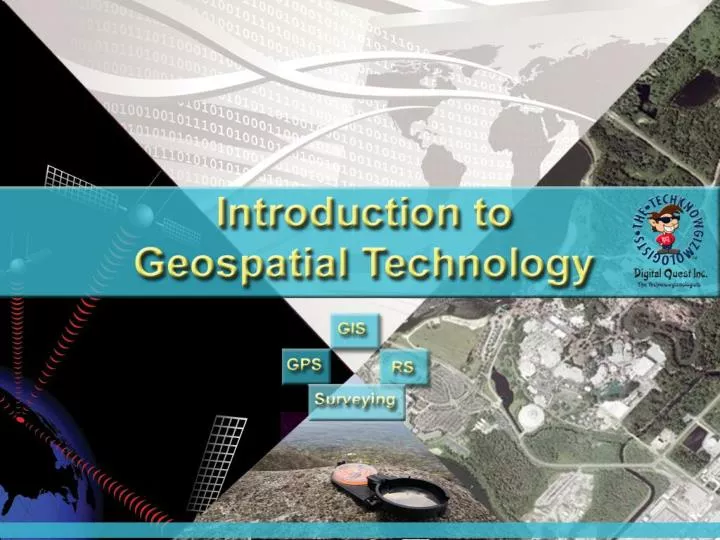
Geospatial Technology includes Four distinct technologies that work together. • GIS - Geographic Information System • GPS - Global Positioning System • RS - Remote Sensing • Surveying
GIS - Geographic Information System In GIS the term “Geographic” (relating to geography) means that it deals with…. Locations, interactions and distribution of people, places and/or things.
GIS - Geographic Information System In a GIS the term “Information” usually means a data base. Lists of people, places, or things. This information can come from…. Spreadsheets Databases Air Photos Satellite images GPS units Internet searches
GIS - Geographic Information System In a GIS the term “System” refers to the GIS Operator, the computer, the data, and the software working together. .
The US System • There are 24-32 satellites up there at any given time orbiting the earth at ~11,000 nautical miles. • These satellites have VERY accurate atomic clocks on board. • The satellites continuously send radio signals towards earth. • These radio signals are picked up by GPS receivers.
GPS is a SYSTEM There are three major components in this system: • GPS Receivers • A Satellite Constellation • Ground Control Stations GPS was developed by the US Department of Defense at a cost of over $12 billion
Remote Sensing Uses photography, radar, sonar, infrared, and other technologies to record information about the earth.
Surveying Surveying Technology ( as a part of map making) is the oldest of the Geospatial Technologies.
Surveying Technology • Surveyors measure distances, directions, and angles between points and elevations of points, lines, and contours on, above, and below the earth’s surface. • George Washington (Father of our Country) was a Surveyor. • (So were Louis and Clark).
Geospatial Technology is used more and more to enhance several different jobs. New jobs are being created all the time to use geospatial technology. More and more jobs that are not traditionally geospatial jobs are using GIS to help in decision making like… Police, Fire, First Responders, Banking, Public Health, Hospitals, Farming, just to name a few….
If you are interested in this exciting new field, you may want to register for Geospatial Technology at the Career Center. In the future, we plan to offer Advanced Geospatial Technology to allow students to complete the GIS certification.