Download
1 / 15
150 likes | 292 Views
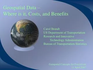
Geospatial Data – Where is it, Costs, and Benefits. Carol Brandt US Department of Transportation Research and Innovative Technology Administration Bureau of Transportation Statistics. Geospatial Concepts for Executives 11 April 2007. Topics. Where are these data? Benefits

E N D
Geospatial Data – Where is it, Costs, and Benefits Carol Brandt US Department of Transportation Research and Innovative Technology Administration Bureau of Transportation Statistics Geospatial Concepts for Executives 11 April 2007
Topics • Where are these data? • Benefits • Costs • Additional Information
Where are Geospatial data? • Everywhere • But the data may not have the accuracy or attributes needed for your analysis • At least 80% of government data has a spatial component • All government agencies have some form of spatial data based on their mission & goals and develop applications to analyze their specific issues • State and local governments are estimated to have twice the volume of Federal geospatial data • Can’t effectively do E-Gov and Homeland Security without geospatial information
How does this technology benefit me, Al Franken? • Visualization to improve decision-making • Improved Data QC • Improved & Faster Analysis • Easier & faster method to modify the query and see the results Image Acquired: February 19, 2007
How will this technology benefit my mission and/or strategic initiatives • Lowered costs through partnerships and leveraging to create and maintain geospatial data and applications • Access to geospatial data maintained by other organizations (authoritative sources) through the web that can be pulled into desktop GIS packages so that each staff person does not have to maintain a copy of every data set they need for mapping and analysis.
Benefits • Geospatial data and applications support: • homeland security • national policy and planning decision making • effective land and resource management • efficient delivery of government services • economic enterprise • etc …
What is the Cost of using this Technology? The costs are dependent on a number if items / issues: • What do you want to get out of it? • Internal funding for data and application development • Shared funding for shared services – dependent on agreements between Agencies • Staff to maintain the system • Staffing to participate in discussions and the future of the data and technology to assure your Department’s needs are included in the plan • Staff to develop and implement data sharing
How to keep GIS investment as low as possible • Make sure data and application specifications satisfy all major players • Make sure data and applications comply with all standards to maximize opportunities for re-using components and sharing across agencies • Share applications with other organizations • Acquire data regionally, state-wide, or nationally to capitalize on economies of scale (Imagery for the Nation; Transportation features for the nation) and reduce or eliminate duplication • Collaborate with local universities (UCGIS member)
Lessons Being (re-)Learned • Data must exist before, during, and after an event, and be readily accessible • Partnerships are required among State, local, tribal and Federal agencies, and the private sector • Map information is a national infrastructure, just like the Interstate Highway System (courtesy EarthData)
Effective Use of this Technology Will Result in • Better information • Better decisions • Improved operations • Improved customer service • Greater accountability • More trust in government & business
The Vision for Success • All data—local, regional, statewide and national—will be available via web services and can be easily accessed by various applications • Open standards-based geo-processing dominates • Technology vendors will differentiate their products “behind the interface” • Data will be available anytime, anywhere and in any combination • Restrictions will be due to classification or validated sensitivity • Publicly or commercially available data will be the norm • Anyone can connect with the location-aware digital and visual data web • The “digital divide” will fade • The location aware paradigm will dominate government work and service to the citizens Technology will enable ubiquitous data
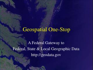
For More Information and Data Resources • Federal Geographic Data Committee (FGDC): www.fgdc.gov • Geospatial One-Stop: www.geodata.gov • Geospatial Line of Business: www.whitehouse.gov/omb/egov/c-6-8-glob.html • Center for Advanced Spatial Technologies: www.cast.uark.edu/geo_solutions.htm • Starting the Hunt: libinfo.uark.edu/GIS/us.asp • State of Utah: maps.utah.gov/index.php • Open Geospatial Consortium: www.opengeospatial.org
Thank You Questions, Comments? Carol Brandt carol.brandt@dot.gov 202.366.6662