Download
1 / 8
80 likes | 263 Views
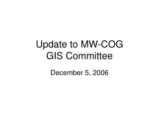
Update to MW-COG GIS Committee. December 5, 2006. Updates. Data acquisition status Physical Transfer: Montgomery County Prince Georges County Prince William County Alexandria Falls Church Loudoun County Manassas Web Services (WMS): Fairfax County Washington, D.C. Arlington

E N D
Update to MW-COGGIS Committee December 5, 2006
Updates • Data acquisition status • Physical Transfer: • Montgomery County • Prince Georges County • Prince William County • Alexandria • Falls Church • Loudoun County • Manassas • Web Services (WMS): • Fairfax County • Washington, D.C. • Arlington • Missing: • Manassas Park • Fairfax City
Data assembly • Basemap • Point layers • FGDC Homeland Security working group symbol standard • NSDI framework layers • The National Map standards • Other layers • Research and “best judgement” • HIRA Results • Pending output from SRA team
Application deployment • Initial deployment of NCR Map • Graphic design consistent with COG website • Built on EMMA platform • Expandable in the future • Requirements communicated to COG IT • Install scheduled for Monday, December 11th
National Capital Region HIRA Data Sharing Concept (October 10, 2006) Jurisdiction n Map Layers Web / Spatial Server(s) External Map Service n Consistent Map Symbolization (.axl) User External Map Service 2 Local GeoDatabase External Map Service 1 Fairfax County Base Map Service Web / Spatial Server(s) 4. HIRA Results 3. Regional Assembly of Data 2. HSIP Gold Data & other Fed Sources 1. Existing COG Regional Datasets Web / Spatial Server(s) Local GeoDatabase MW COG Washington, DC
Technical Approach • Base map: Common, consistent regional data • Local mapservice at MW-COG • Jurisdictional data: Detailed local data • 3 WMS Service Providers • “Add External Data” capability • Hosted by jurisdiction • 7 non-WMS • Service hosted @ MW-COG • 2 remaining • No data availability • Not included in HIRA project
Future Capabilities • Maintaining current data @ COG • Database replication • Increased data sharing capabilities • Data Exchange Hub • Expand capabilities • Build upon EMMA platform to include • WebEOC Integration • Geospatial Data Manager • HSIP Gold Data
HSIP Gold • State provides existing data. This data does not have to be geospatial, a list will suffice. For any given layer, it is highly likely that some agency within your state has an authoritative list for that layer. • State sends letter (fax, email or conf. call can also work) to relevant officials (e.g. fire chiefs) letting them know about program and asking them to cooperate. Letter should give state level poc for officials to call if they have questions about the legitimacy of the program. • TGS improves data. Most improvements are done by telephoning local officials to verify the name, address, phone number, and geospatial location of their facilities. Geospatial location is determined by asking the local official to describe their location relative to landmarks visible in ortho imagery. • TGS incorporates improved state data into "License Free HSIP" and makes it available to the states. • TGS incorporates improved state data into HSIP and delivers to NGA. • State considers sharing the improved data with the USGS.