Download
1 / 34
340 likes | 360 Views
The Deurganck Dock project in the Port of Antwerp Jan Bouckaert. Map Port of Antwerp, 1998, including Deurganckdock trajectory. Map of Left Bank Area according to the Left Bank Area Development Act of 15 July 1978. Regional Zoning Plan for Antwerp Port area, Royal Decree of 7 November 1978.

E N D
The Deurganck Dock project in the Port of AntwerpJan Bouckaert
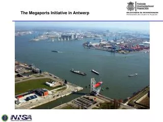
Map Port of Antwerp, 1998, including Deurganckdock trajectory
Map of Left Bank Area according to the Left Bank Area Development Act of 15 July 1978
Regional Zoning Plan for Antwerp Port area, Royal Decree of 7 November 1978
Project Area, with Doel village and nuclear plant on foreground 12-05-1981
Project area, with Waasland channel and Doeldock, 03-09-1996
Aerial survey of Left Bank Area, prior to commencing Deurganck Dock works
Annex 13 to the Flemish Designation Decree of 17 October 1988 (designation Left Bank Area as Article 4, para. 1 Birds Directive SPA)
Detail of Annex 13 to Flemish Designation Decree of October 1988 : “works in execution”
Article 1 para. 3 of the Flemish Designation Decree of 17 October 1988 • Natural areas, forestry areas, ecologically sensitive forestry areas and natural reserves within the meaning of the Regional Zoning Plan • Mud flats, salt marshes (of the River Scheldt), dykes, creeks and their vegetation • No integral designation of Left Bank Area, but only designation of parts of it
Comments regarding designation • Designation criteria? • Purely ornithological criteria; • Presence of numerous Annex I birds (e.g. : avocets, bluethroats…) and migrating birds (red- & greenshanks, ducks and geese) • Whole area was taken into account; not limited to specified habitats within perimeter of Left Bank Area • Later on confirmed by IBA reports • Final designation: more limited • Only specified habitats • Took into account prior industrial development • Decision was taken without taking account of the severe consequences of designation
Flemish Decree of 23 June 1998 : reduction SPA within Left Bank Area
Planning compensation Decrees of Flemish Government of 23 June 1998 and 1 June 1999 : designation of KBR as “flood control area”
Comments regarding planning compensation decrees of 23 June 1998 and 1 June 1999 • Compensation at planning level: • New zonal destination of compensation area: increased protection, linked with ecologi-cally balanced flood control of River Scheldt • See planning prescriptions: • “Flood control area: any acts and works allowed for nature conservation, agriculture and recreation in as far as not incompatible with works and acts required for realization of flood control area” • Compensation at planning level to be followed by compensation at project level: • expropriation of private lands in order to allow: • creation of flood control infrastructure: dykes, sluices, flood areas, marshland, reedbeds, mud flats
Comments regarding planning compensation decrees of 23 June 1998 and 1 June 1999 • Characteristics of compensation area: • Polder land with valuable but declining habitat relicts (creeks, wetlands, alluvial woodlands) and intensive agricultural lands • Located along River Scheldt, upstream • Surface compensation area > surface reduction SPA Left Bank • Scientific assessment potential compensation area for bird conservation (both Annex I and migratory species) • Planning compensation simultaneously with reduction SPA Left Bank • Compensation area also proposed by Flemish Government as Special Conservation Area • within meaning of Habitats Directive
Decision of Flemish Government of 8 September 2000 modifying existing Regional Zoning Plan for Left Bank Area
Comments regarding decision of Flemish Government of 8 September 2000 • What changed since Regional Zoning Plan of 7 November 1978? • + trajectory for the Deurganckdok • + industrial area (mainly for raising land with slush dredged from Deurganckdok) • + buffer zones (also as compensation areas) • + agricultural zones • - residential area (Doel) • - other industrial areas (reduced in surface) • - deletion of Baalhoek channel
Planning and project process • September 1995: • Kick off memorandum, assessing the need for the construction of a large container dock • Economic Cost-Benefit analysis • Traffic Impact Assessment • Several technical studies • Livability assessment of Doel village • November 1996: environmental impact assessment • 23 June 1998: first series of planning decisions; • June 1998: notification of Deurganck project to EU Commission • 1 June 1999: second series of planning decisions
Planning and project process • 8 September 2000: decision modifying Regional Zoning Plan for Left Bank Area • 24 August 1999: first building permit granted • 17 September 1999: start of works • 30 May 2000: suspension of second series of planning decisions of 1 June 1999 by Belgian Council of State • 31 May 2000: suspension of building permit of 24 August 1999 by Belgian Council of State • Beginning of June 2000: discontinuation of works as a result of suspension of building permit of 24 August 1999
Planning and project process • 13 June 2000: granting of regularization permit • June 2000: restart of the works • 18 January 2001: reasoned opinion of EU Commission, following complaint lodged by Doel inhabitants and environmentalists • 7 March 2001: suspension of regularization building permit of 13 June 2000 by Belgian Council of State • March 2001: discontinuation of the works • 31 July 2002: suspension of planning decision of 8 September 2000 modifying Regional Zoning Plan for Left Bank Area
The legal issue at stake: scope of Article 6 para. 4 Habitats Directive • Content of Article 6 para. 4 Habitats Directive : • Any plan or project not directly connected with or necessary to the management of the site but likely to have a significant effect thereon: subject to appropriate assessment of its implications for the site in view of the site’s conservation objectives • Only if the plan or project has been ascertained not to adversely affect the integrity of the site concerned shall the competent authorities agree to the plan or project • If the plan or project has been ascertained to adversely affect the integrity of the site, the competent authorities shall only agree to the plan or project:
if the plan or project must be carried out for imperative reasons of overriding public interest, including those of a social or economic nature; • in the absence of alternative solutions; • whilst taking all compensatory measures necessary to ensure that the overall coherence of Natura 2000 is protected • The Member State concerned shall inform the EU Commission of the compensatory measures adopted
Reasoned opinion of EU Commission of 18 January 2001 • Not convinced of overriding public interest • Not convinced of absence of alternative solutions (e.g. Zeebrugge and Vlissingen alternative) • Not convinced of arguments based on lack of designation obligation in the light of artificial nature of Project Area and execution of dredging works in Project Area prior to entry into force of Birds Directive on 6 April 1981 • Not convinced of sufficiency compensatory measures • Reasoned opinion of EU Commission contested by Belgian authorities and Antwerp Port Authority
The ruling of the Belgian Council of State of 31 July 2002 • The Belgian Council of State suspended planning decision of 8 September 2000 modifying Regional Zoning Plan for Left Bank Area because of unsufficiency compensatory measures: • KBR area was already proposed by Belgian authorities to EU Commission as Special Conservation Area within meaning of Habitats Directive • Therefore: designation KBR area as Compensatory Area for reduction Special Protection Area within Left Bank does not provide additional protection • No or hardly any assessment of arguments relating to absence of designation obligation in the light of : • Artificial nature of Project Area • Entry into force of Birds Directive on 6 April 1981
Consequences of legal battle for the Deurganckdok project • Reassessment of compensatory measures required, if works were to continue • Threat of economic and financial disaster, due to long-lasting suspension of works • Parliamentary intervention, in order to avoid disaster : ad hoc legislation allowing speedy implementation of Birds & Habitats Directive • Emergency Act of 14 December 2001, based on : • new environmental impact assessment • alternative compensation programme • dialogue with EC Commission
Restart of works: May 2002, after dismissal of constitutional proceedings against Emergency Act of 14 December 2001 • Delay in execution of works: more than 1 year • Financial Impact of delay for State Budget: severe • Cost of implementation Birds & Habitats Directive: estimated at 10 % of project costs • Litigation still pending
Alternative compensation programme Left Bank Area (green areas)
Comments regarding alternative compensation programme • No distinction between artificial habitat (created through dredging) and natural or semi-natural habitats • Inventory of Annex I and migratory species and habitats within project and affected areas • Establishment of compensation needs per species • Elaboration of compensation matrix (weighting loss of habitats against positive effects of compensation areas) • Integration of most of the compensation measures within Left Bank Area
Temporary management of dredged areas for waders • Reduced importance of KBR as compensation area • Long term monitoring of compensatory measures • Building up of a reserve for future port expansion
Conclusive remarks : • IMPORTANCE OF BIRDS- AND HABITATS DIRECTIVE IN PLANNING AND PROJECT PROCESS • Planning and permitting authorities must be aware of importance of Article 6, para. 4 of • Habitats Directive • Multidisciplinary project team required consisting of planners, economists, biologists and • lawyers in order to get plan and project duly authorized • Biological assessment to be incorporated as early as possible in planning and project process • Prior consultation with stakeholders and EU Commission on planning and project indicated • (prevention of litigation) • Different assessment steps provided for in Article 6, paras. 3 and 4 Habitats Directive to be • strictly followed.
B. CRITICAL REMARKS • Lack of concertation with various stakeholders in designation process (Birds- and • Habitat Directive); scientific criteria remain unclear • Conflict of Birds- and Habitats Directive regime with existing planning context • Extensive interpretation of the vague Article 6 paras. 3 and 4 of Habitats Directive leads to • Excessive conditions on port development deemed of vital economic importance (ex. what does • mean “the site’s conservation aims”? Extensive scope of compensatory meaures) • Conventional mechanisms with (private) landowners in order to realise compensatory • measures? • Conflict of EU nature conservation with transport policy (TEN’s)