Download
1 / 36
370 likes | 627 Views
Value of Land. After a local auction, one parcel of land sold for $2250.00 per acre, while the other parcel sold for $3100.00.How and Why does this happen???. Learning Objectives. Identify ways soils are classified.Explain land capability maps, classes, subclasses and units, and conservation plan

E N D
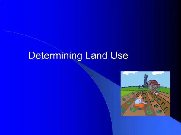
1. Determining Land Use
2. Value of Land After a local auction, one parcel of land sold for $2250.00 per acre, while the other parcel sold for $3100.00.
How and Why does this happen???
3. Learning Objectives Identify ways soils are classified.
Explain land capability maps, classes, subclasses and units, and conservation plan.
Differentiate between farm land-use and political land-use planning.
4. Terms Capability classes
Capability subclasses
Consistency
Farmland-use planning
Infiltration
Percolation
Permeability
Political land-use planning
Soil structure
Soil texture
5. In what ways are soils classified? Soil is classified based on its characteristics.
Those characteristics include texture, depth, color, structure, consistency, and permeability.
The National Cooperative Soil Survey has a system of classification that has six categories.
6. Soil Characteristics Soil texture is the proportions of sand, silt and clay in soil, which are referred to as the soil separates.
Soils are named on the basis of texture and proportion of materials
Texture determines how the soil can be used and the nature of the cultural practices to follow with crops.
8. Soil Characteristics Soil depth varies with the thickness of the horizons.
Very shallow soils are usually less than 10 ft. thick, while deep soils are more that 40 ft. thick.
Soil color varies widely and often depends on the kind of parent material and the amount of organic matter present in the soil.
9. Soil Characteristics Soil structure is the arrangement of the soil particles into shapes and pieces, and influences the properties of the soil.
Consistency is the ease of working with soil and is important in percolation and permeability.
10. Soil Characteristics Permeability, also known as internal drainage, is the movement of water in soil and depends on the texture and structure of the soil.
Permeability includes infiltration and percolation
Infiltration is the moving of surface water into the soil.
Percolation is the downward movement of water through the soil.
12. National Cooperative Soil Survey�s soil classification categories. Classification is based on soil properties observed in the field or inferred from those observations or from laboratory measurements.
Beginning with the broadest, these categories are the order, suborder, great group, subgroup, family, and series.
13. National Cooperative Soil Survey�s soil classification categories. Ten soil orders are recognized.
The differences among orders reflect the dominant soil forming processes and the degree of soil formation.
Each order is identified by a word ending is sol (ex. Mollisol)
14. National Cooperative Soil Survey�s soil classification categories. Each order is divided into suborders.
The last syllable in the name of a suborder indicates the order. (ex. Aquoll �aqu meaning water, plus oll, from Mollisol)
Each suborder is divided into great groups.
15. National Cooperative Soil Survey�s soil classification categories. Great groups are identified by name of a suborder and by a prefix that indicates a property of the soil.
Ex. Haplaquolls (Hapl, meaning minimal horizonation, plus aquoll, the suborder of the Mollisols that have an aquic moisture regime).
16. National Cooperative Soil Survey�s soil classification categories. Each great group has a typic subgroup.
Other subgroups are intergrades or extragrades.
Typic is the central concept of the great group, not necessarily the most extensive.
17. National Cooperative Soil Survey�s soil classification categories. Intergrades are transitions to other orders, suborders, or great groups.
Extragrades have some properties that are not representative of the great group but do not indicate transitions to any other known kind of soil.
18. National Cooperative Soil Survey�s soil classification categories. Each subgroup is identified by one or more adjectives preceding the name of the great group.
Ex. Typic Haplaquolls
Families are established within a subgroup on the basis of physical and chemical properties and other management properties.
19. National Cooperative Soil Survey�s soil classification categories. Family name consists of a subgroup preceded by terms that indicate soil properties.
Ex. Fine-silty, mixed, mesic Typic Haplaquolls
20. National Cooperative Soil Survey�s soil classification categories. The series consists of soils that have similar horizons in their profile.
The texture of the surface of the layer or of the underlying material can differ within a series.
21. National Cooperative Soil Survey�s soil classification categories. A series can further be divided into phases.
A phase is a variation in the series based on some factor that affects soil management, such as surface texture.
22. What are land capability maps? Scientists have developed a system for mapping soils according to the physical, chemical and topographical aspects of the land.
The U.S. Soil Conservation Service (SCS) has made soil mapping a priority and they can provide maps and classification information for almost any area in the U.S.
23. What are land capability maps? Maps can be used for many different things including using the maps to develop farm plans.
Land capability maps indicate capability class, capability subclass, and capability unit.
The maps are usually color-coded for ease in differentiating capability classes.
24. What are land capability maps? Capability classes are the broadest groups on a soils map and are designated by Roman numerals I through VIII.
The numbers indicate progressively greater limitations for the practical use of land.
Examples: Class I�soils have few limitations that restrict their use.
Class VIII�soils and landforms have limitations that nearly prevent their use for commercial plants.
25. What are land capability maps? Capability subclasses are soil groups within one class and are designated by adding a small letter e, w, s, or c to the class numeral.
The letter e�runoff and erosion
The letter w�wetness
The letter s�root zone or tillage problems
The letter c�climatic hazard
26. What are land capability maps? The soils in capability unit, soil groups within the subclass, are enough alike to be suited to the same crops and pasture plants, and require similar management.
Capability units are designated by adding numbers, 0 to 9, to the subclass symbol.
27. What are land capability maps? When planning for the most intensive use of a farm, the soil and land capability maps are used to prepare a conservation plan or proposed land-use map.
28. What is a conservation plan? A conservation plan takes into consideration the personal goals and objectives of the landowner.
The desired balance between cropland, pasture, woodland, and other land uses are considered when planning.
Also, a farmer must consider the land�s characteristics so appropriate livestock enterprises can be chosen.
29. How is a conservation plan used? There is also potential for income-producing recreation enterprises such as hunting, camping or fishing.
The conservation plan becomes the guide for future farming operations.
A conservation plan is required to obtain federal support.
30. What is the difference between farm land-use and political land-use planning? Farmland-use planning refers to the development of a cropping and livestock production system.
Political land-use planning deals with questions of political priorities.
31. What is the difference between farm land-use and political land-use planning? In many counties some sort of land-use planning is conducted and the governing body establishes its own set of rules and regulations.
The most common result of the decision making process is a set of �zoning regulations�.
32. What is the difference between farm land-use and political land-use planning? This means that the use to which each part of the community can be put is determined in advance.
Zoning regulations force like-activities to be grouped together.
33. Zoning Groupings Single family dwellings, only individual homes can be built.
Single or multi-family dwellings, apartment buildings could also be built in the same neighborhood as the individual home
34. Zoning Groupings Commercial, such as groceries and gasoline service stations.
Light industry, such as shops.
Heavy industry for large factories.
35. Land-Use Planning Considerations Planning should consider not only economics but also environmental impacts of the zoned uses of the community.
The capacity of existing water purification systems to supply water.
Additional sewage facilities
Traffic patterns and congestion
Increased runoff from parking lots
36. Review / Summary In what ways are soils classified?
What are land capability maps, classes, subclasses and units, and conservation plans?
What is the difference between farm land-use and political land-use planning?