Download
1 / 23
380 likes | 665 Views
Explore the significance of evapotranspiration (ET) in hydrology, water resources, and ecosystem processes. Learn about ET estimation methods, such as traditional approaches and Earth's energy balance. Dive into the calculation of net radiation, surface albedo, and soil heat flux. Understand the simplified surface energy balance index (SSEBI) for remote sensing applications to quantify ET rates accurately.

E N D
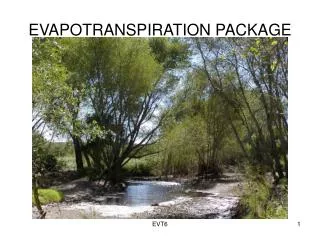
Evapotranspiration (ET) Estimation using Remote sensing Hydrology and Water Resources 720128 October 20, 2017 Institute of Space Technology
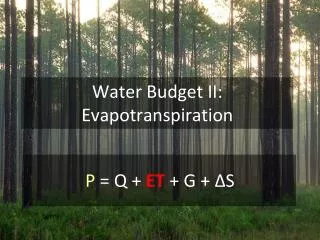
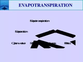
Evapotranspiration (ET) • Evaporation: • Change of liquid to vapor from soil or water surface • Transpiration: • Change of liquid to vapor from surface of plant • Evapotranspiration= Evaporation + Transpiration
Evapotranspiration (ET) • ET rates depends on • Humidity (ET increases with decrease in Humidity) • Temperatures • Sunshine • Wind • Moisture available • Vegetation type and coverage
Importance • ET is the largest outgoing water flux from the Earth’s surface • Accurate quantifying ET is critical to developing a greater understanding of a range of hydrological, climatic, and ecosystem processes, and beneficial in numerous applications, e.g., water resources management, drought monitoring, improvement of hydrological modeling, weather forecasts, and vulnerability of forest to fire. • The regional evapotranspiration is more than half of the total precipitation and the amount of evapotranspiration is almost equal to the precipitation in the semi-arid region.
Potential Evapotranspiration (pet) • For given atmospheric conditions, it is the maximum ET rate possible • The real evapotranspiration occurring in a specific situation is called Actual Evapotranspiration (AET) • AET < PET
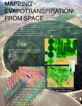
Methods for ET estimation • Traditional approaches • Weighing Lysimeter • Energy Balance Bowen Ratio (EBBR) • Eddy covariance techniques • Pan-measurement • Etc • Such measurements cannot be directly extended to large-scale ET due to natural heterogeneity of the land surface and complexity of hydrologic processes
Earth's Energy Balance • Earth's Energy balance describes how the incoming energy from the sun is used and returned to space. • If incoming and outgoing energy are in balance, the earth's temperature remains constant
Net Radiation • can be estimated from the sum of the difference between the incoming (Rs↓) and the reflected outgoing shortwave solar radiation (Rs↑) (0.15 to 5 μm), and the difference between the downwelling atmospheric (RL↓) and the surface-emitted and reflected longwave radiation (RL↑).
Net Radiation • Incoming shortwave radiation (Rs↓) is computed using the solar constant, the solar incidence angle, a relative earth-sun distance, and a computed atmospheric transmissivity. • The incoming longwave radiation (RL↓) is computed using a modified Stefan-Boltzmann equation with atmospheric transmissivity and a selected surface reference temperature. • Outgoing longwave radiation (RL↑) is computed using the Stefan-Boltzmann equation with a calculated surface emissivity and surface temperature • The surface emissivity is the ratio of the actual radiation emitted by a surface to that emitted by a black body at the same surface temperature
Net Radiation • Surface Albedo () • Surface albedo is defined as the ratio of the reflected radiation to the incident shortwave radiation. • The albedo at the top of the atmosphere ( toa) • Surface albedo is computed by correcting the ( toa) for atmospheric transmissivity • Path radiance range between 0.025 and 0.04, recommended value is 0.03 • Z is the elevation above sea level
Net Radiation • Incoming Shortwave Radiation (Rs↓) • Gsc is solar constant (1367 W/m2) • Cos = cosine of solar incidence angle. Cos is computed using the header file data on sun elevation angle () • where = (90 - ). • dr= relative distance between the earth and sun in astronomical units. It depends on Julian day
Net radiation • Outgoing longwave radiation (RL↑) is computed using Stefan-Boltzmann equation • = Boltzmann constant (5.67 × 10⁻⁸ W/m2/K4) • Ts = surface temperature (K) • Values for RL↑ can range from 200 – 700 W/m2
Soil Heat Flux • Soil Heat flux is the rate of heat storage into the soil and vegetation due to conduction Ts = Surface Temperature in Celcius
Simplified surface energy balance index (SSEBI) • A simplified method to estimate the surface flux from remote sensing. • The relation between reflectance (surface albedo) and surface temperature is the main base of this method to partition available energy into sensible and latent heat fluxes. • No additional meteorological data is needed if the surface extremes are available on the scene
Simplified surface energy balance index (SSEBI) • where TH is the land surface temperature corresponding to dry condition and represents the minimum latent heat flux (LEdry = 0) and maximum sensible heat flux (Hdry = Rn - G), • TLE is the land surface temperature corresponding to wet condition and represents the maximum latent heat flux (LEwet = (Rn - G)) and minimum sensible heat flux (Hwet = 0) for a given surface reflectance
Simplified surface energy balance index (SSEBI) • The major advantage of SSEBI are • Additional ground-based measurement is not needed to derive the EF except the surface temperature and reflectance (albedo) derived from remote sensing data if the surface extremes are present in the remotely sensed imagery • Extreme temperatures for the wet and dry conditions vary with changing reflectance (albedo) values, but in other methods like SEBAL, a fixed temperature is determined for wet and dry conditions
Simplified surface energy balance index (SSEBI) • = Evaporative Fraction • From above equation, Instantaneous Latent Heat flux (ET) can be estimated. Its unit is also W/m2 • To convert ET in equivalent evaporation depth following equation is used: • =Latent heat of vaporization in J/Kg (2260000 J/Kg) • ETinst is the instantaneous ET (mm/hr), 3600 is the time conversion from seconds to hours,