Geo SUR
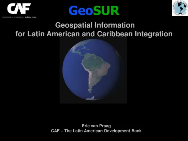
Geo SUR. Geospatial Information for Latin American and Caribbean Integration. Eric van Praag CAF – The Latin American Development Bank. GeoSUR Program Profile. Geographic area : Latin American and the Caribbean Implementation period : 2007 - 2013 Coordinating agencies

Geo SUR
E N D
Presentation Transcript
GeoSUR Geospatial Information for Latin American and Caribbean Integration Eric van PraagCAF – The Latin American Development Bank
GeoSUR Program Profile Geographic area: Latin American and the Caribbean Implementation period: 2007 - 2013 Coordinating agencies • Latin American Development Bank (CAF) • Pan-american Institute of Geography and History (PAIGH) Technical assistance • U.S. Geological Survey/EROS • Military Geographic Institute of Chile • National Geographic Institute of Colombia • Military Geographic Institute of Ecuador Participating agencies • National Geographic Institutes • Environmental agencies • Ministries of infrastructure and planning • Others
Participating Agencies • Instituto Geográfico Nacional Argentina • Instituto Geográfico Nacional El Salvador • Instituto Geográfico Nacional Costa Rica • Instituto Geográfico Nacional Perú • Instituto Geográfico Nacional Guatemala • Instituto Geográfico Venezuela Simón Bolívar • Instituto Geográfico Agustín Codazzi • Instituto Geográfico Militar Chile • Instituto Geográfico Militar Ecuador • Instituto Geográfico Militar Bolivia • Instituto Cartográfico Militar Rep.Dominicana • Instituto Geográfico Tommy Guardia • Servicio Geográfico Militar Uruguay • Servicio Geográfico Militar Paraguay • IBGE Brasil • INEGI México • CLIRSEN Ecuador • Ministerio del Ambiente Perú • Ministerio del Ambiente Rep.Dominicana • Ministerio del Ambiente Costa Rica • Ministerio del Ambiente Guatemala • Ministerio de Ambiente Ecuador • Ministerio de Ambiente Colombia • Ministerio de Ambiente Brasil • Dirección Nacional Medio Ambiente Uruguay • IDEAM Colombia • Secretaría de Ambiente Paraguay • Autoridad Nacional Ambiente Panamá • Comisión Nacional de Medio Ambiente Chile • Ministerio Obras Públicas Chile • Ministerio Obras Públicas Paraguay • Ministerio Desarrollo Urbano El Salvador • SEGEPLAN Guatemala • CIREN Chile • ANATI Panamá • Insituto Venezolano Invesitgaciones Científicas • Instituto Nacional de Estadísticas Bolivia • Instituto Nacional Estadística Panamá • Instituto Nacional Estadística y Censos Costa Rica • Instituto Socio Ambienta Brasil • Programa Regularización Catastro Costa Rica • Instituto Geológico INGEMMET Perú • Intendencia de Montevideo • Centro Internacional Agricultura Tropical • Land Information Council Jamaica • Water Resources Authority, Jamaica • Electoral Office, Jamaica • Land Information Center Belize • Management Instituut Suriname • Surveys and Mapping Division Trinidad&Tobago • Empresa SIGIS • TheNatureConservancy • University of West Indies • IABIN
GeoSUR Regional MapService TopographicProcessingService ?< The GeoSUR geoservices Mapsfromparticipatinginstitutions Regional Geoportal
GeoSUR Program – Accomplishments • GeoSUR has developed the first portal to provides access to geographic information from all South American countries. • The Topographic Processing Service developed by GeoSUR, which allows for the dynamic generation of derivative datasets from the SRTM 30-meter DEM, is the first of its type in the developing world due to its resolution and geographic coverage. • The GeoSUR portal provides access today to more than 90 WMS services, 30 maps viewers and 10 metadata catalogs. More than 10,000 metadata records are available on its repository. • The Program is changing the way planners and developers in the region execute projects, by providing easy access to data that lets them analyze potential environmental impacts or estimate benefits to the population, among other benefits.
Use of standards in GeoSUR • OGC and ISO standards underpin the interoperability of the GeoSURgeoservices and those of partner agencies. • GeoSUR relies on well tested specifications that are known throughout Latin America. • PAIGH currently supports the development of the Latin American Metadata Standard (LAMP). • GeoSUR has offered training in a limited set of specifications : WMS, ISO19115, ISO19119, CSW. • GeoSUR´s philosophy is to support a basic set of standards and specifications that allow for some basin interoperability.
Standardsused in GeoSUR • WMS: The most popular standard in the Program, around 90% of partner´s geoservices rely on it. • CSW: Used by around 80% of the catalogs services operated by partner agencies. • FGDC CSDGM: Not frequently used anymore. Around 30% of metadata records in the region rely on it. • ISO 19115: Main standard used by partner agencies to describe data. • ISO 19119: Main standard used by parner agencies to describe geoservices.
GeoSUR Geospatial Information for Latin American and Caribbean Integration CAF TheLatin American Development Bank Eric van PraagCAF – The Latin American Development Bank
3) Topographic Processing Service Watershed delineation Raindrop trace Viewshed analysis Altitude profiles Shaded relief Classified shaded relief Slope Classified slope Aspect SRTM 30 m. SRTM 90 m. GTOPO 250 m. GTOPO 500 m. GTOPO 1Km. WITH