Download
1 / 8
80 likes | 263 Views
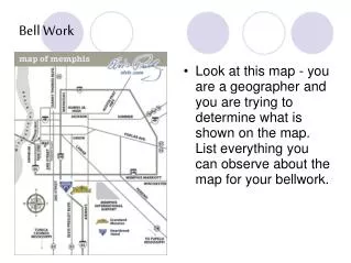
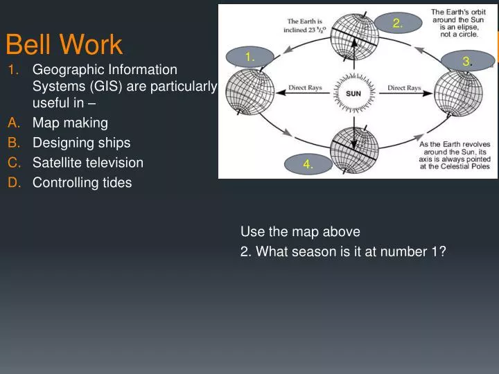
2 . 1. 3 . Bell Work. Geographic Information Systems (GIS) are particularly useful in – Map making Designing ships Satellite television Controlling tides. Use the map above 2. What season is it at number 1?. 4 . Bell Work. 3. The Hydrosphere is most affected by – Floods

E N D
2. 1. 3. Bell Work • Geographic Information Systems (GIS) are particularly useful in – • Map making • Designing ships • Satellite television • Controlling tides Use the map above 2. What season is it at number 1? 4.
Bell Work 3. The Hydrosphere is most affected by – • Floods • The water cycle • Deforestation • Erosion 4. What physical process, which took place over millions of years, produced the Himalaya mountain range? • Erosion caused by wind and water • Glacial movement which pushed up mountains • Tsunamis, storms, blizzards, ice, and dust storms. • Continental plates, which smashed into each other and produced mountains.
In your group, match the correct landforms with their definitions.
Physical Processes • What type of erosion?
Physical Processes • What type of erosion?
Physical Processes • What type of erosion?
Physical Processes What type of erosion?
Physical Processes • Work in a group to come up with famous things that were created on earth for each of the following: • Wind Erosion • Water Erosion • Glacial Erosion • Convergence • Digergence