Download

1 / 9
0 likes | 9 Views
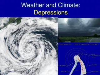
Depressions are weather systems characterized by different air masses converging around low pressure centers, leading to the formation of warm and cold fronts. The passage of a depression brings changes in weather, starting with a warm front bringing heavy rain, followed by a cold front with gusty winds and showers. Understanding the associated weather patterns and fronts within a depression is essential for predicting how conditions will evolve.

E N D
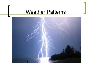
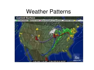
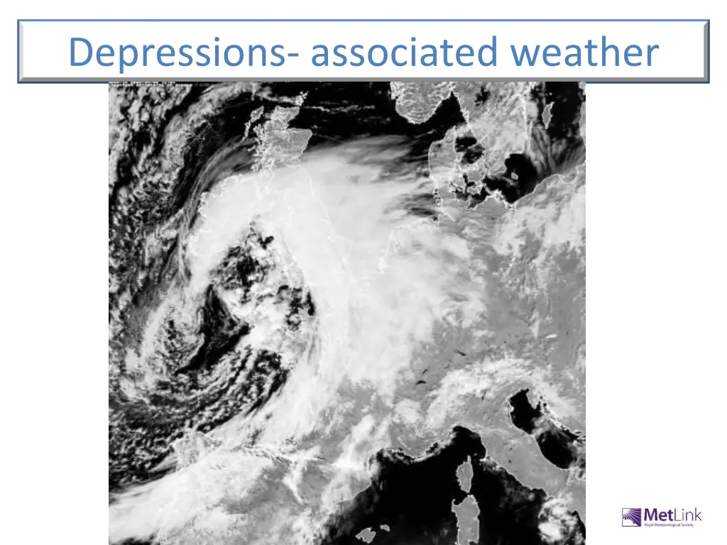
Depressions- associated weather
Objectives • Be able to describe and explain the type of weather associated with the different fronts in a depression. • Be able to describe how the weather changes with the passage of a depression. • Be able to reproduce a diagram of a cross-section of a depression.
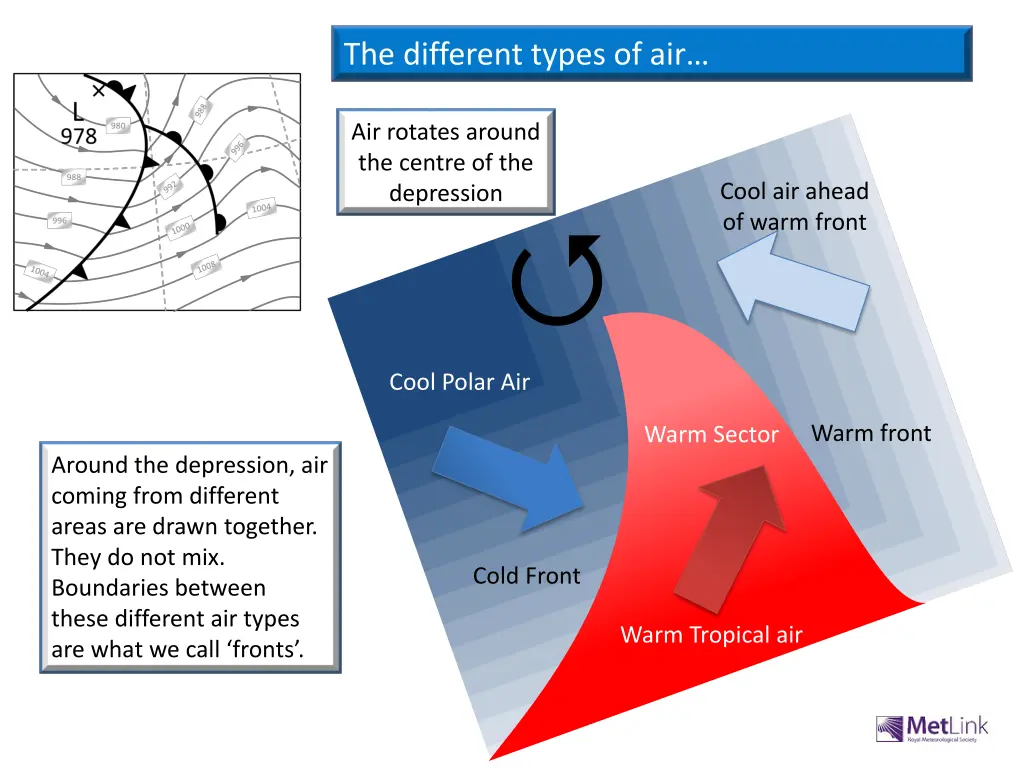
The different types of air… Air rotates around the centre of the depression Cool air ahead of warm front Q Cool Polar Air Warm front Warm Sector Around the depression, air coming from different areas are drawn together. They do not mix. Boundaries between these different air types are what we call ‘fronts’. Cold Front Warm Tropical air
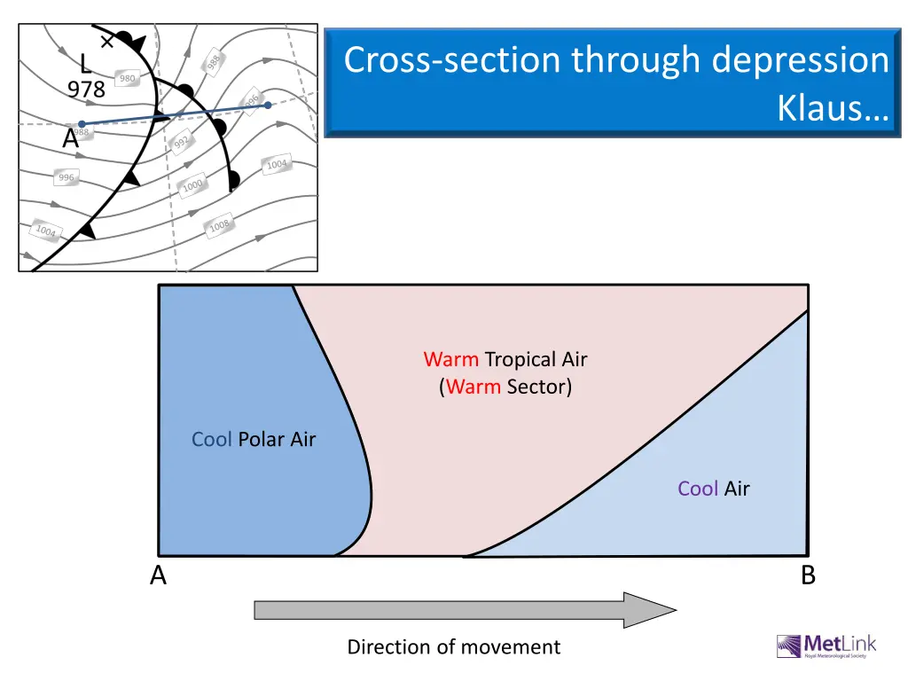
Cross-section through depression Klaus… A Warm Tropical Air (Warm Sector) Cool Polar Air Cool Air A B Direction of movement
Cross-section through the depression… Heavy rain (1-2 hours) Rain (3-4 hours) Showers Direction of movement
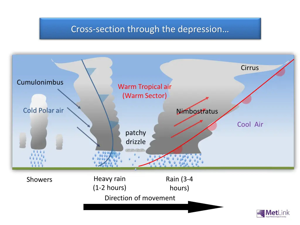
As the warm air meets the cool air it is forced to rise, as it is less dense. As it rises the air cools allowing moisture to condense. Clouds form. Clouds are found along the boundary between the warm air and cool air. This is the warm front. Where the front is high in the sky, temperatures are low and the clouds are made of ice, These are Cirrus clouds. The passage of a warm front
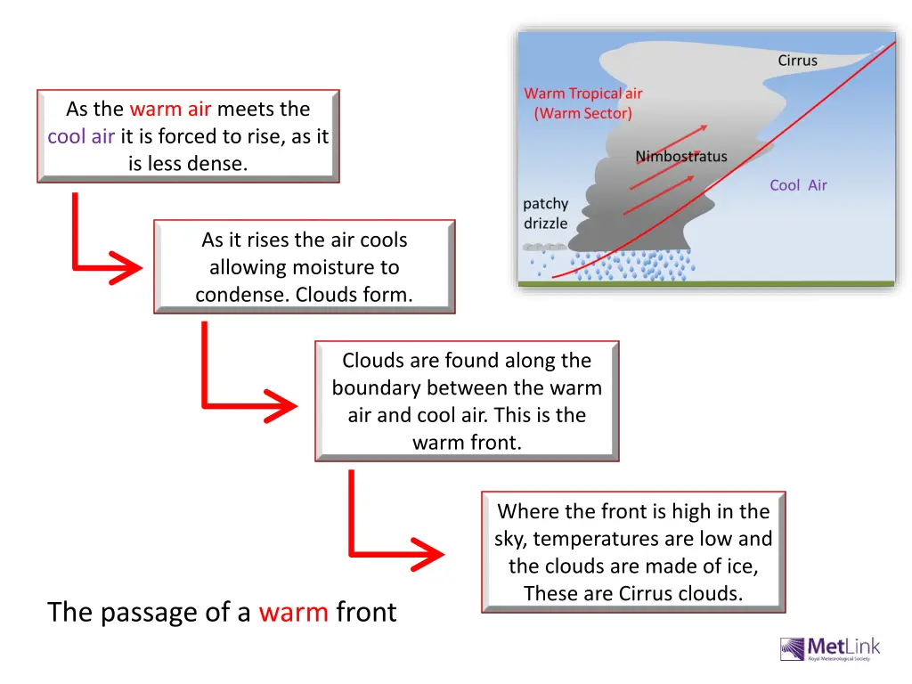
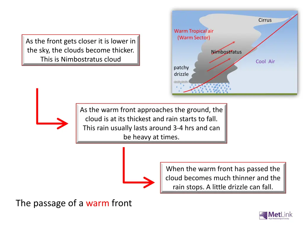
As the front gets closer it is lower in the sky, the clouds become thicker. This is Nimbostratus cloud As the warm front approaches the ground, the cloud is at its thickest and rain starts to fall. This rain usually lasts around 3-4 hrs and can be heavy at times. When the warm front has passed the cloud becomes much thinner and the rain stops. A little drizzle can fall. The passage of a warm front
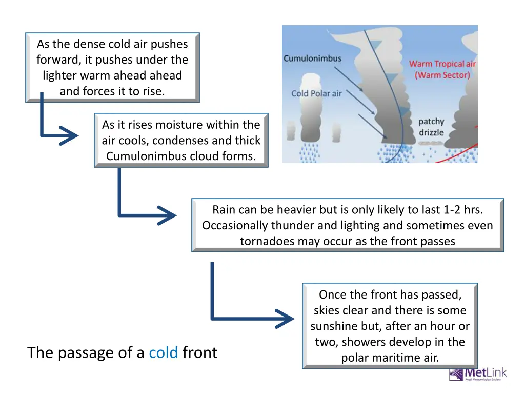
As the dense cold air pushes forward, it pushes under the lighter warm ahead ahead and forces it to rise. As it rises moisture within the air cools, condenses and thick Cumulonimbus cloud forms. Rain can be heavier but is only likely to last 1-2 hrs. Occasionally thunder and lighting and sometimes even tornadoes may occur as the front passes Once the front has passed, skies clear and there is some sunshine but, after an hour or two, showers develop in the polar maritime air. The passage of a cold front
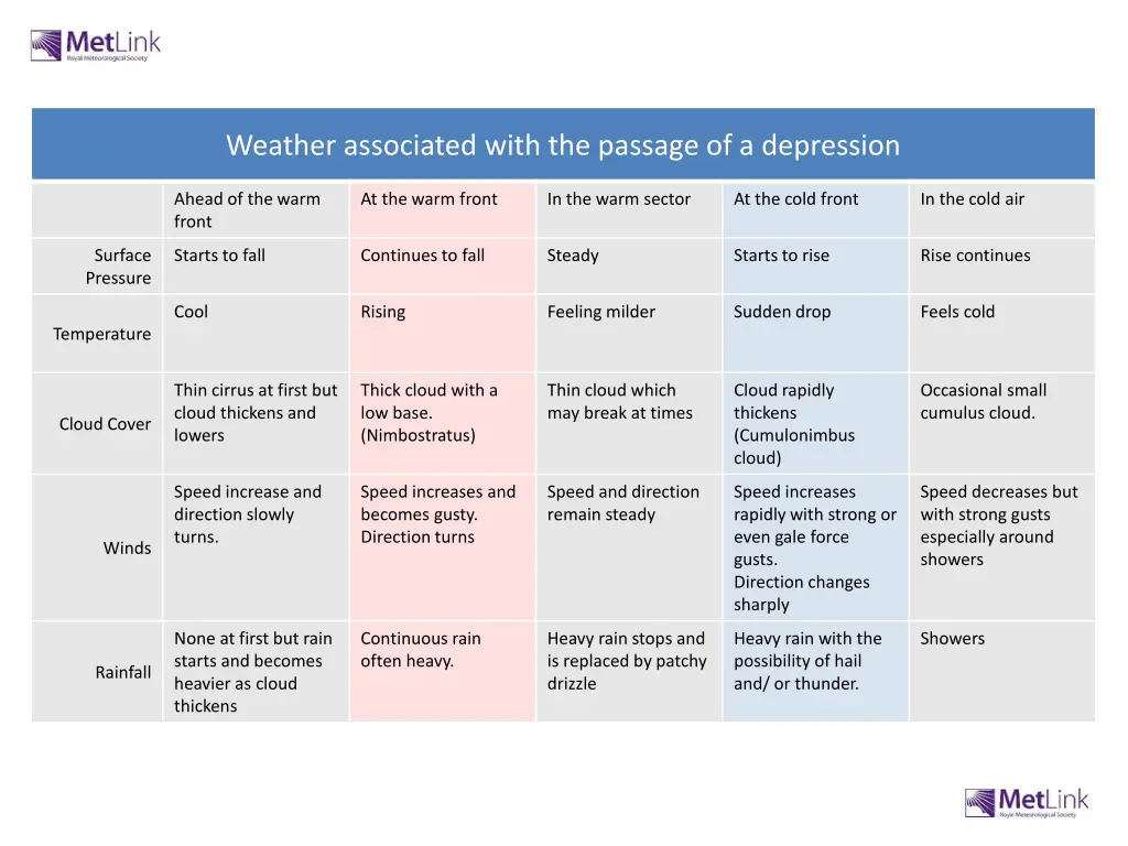
Weather associated with the passage of a depression Ahead of the warm front At the warm front In the warm sector At the cold front In the cold air Surface Pressure Starts to fall Continues to fall Steady Starts to rise Rise continues Cool Rising Feeling milder Sudden drop Feels cold Temperature Thin cirrus at first but cloud thickens and lowers Thick cloud with a low base. (Nimbostratus) Thin cloud which may break at times Cloud rapidly thickens (Cumulonimbus cloud) Occasional small cumulus cloud. Cloud Cover Speed increase and direction slowly turns. Speed increases and becomes gusty. Direction turns Speed and direction remain steady Speed increases rapidly with strong or even gale force gusts. Direction changes sharply Speed decreases but with strong gusts especially around showers Winds None at first but rain starts and becomes heavier as cloud thickens Continuous rain often heavy. Heavy rain stops and is replaced by patchy drizzle Heavy rain with the possibility of hail and/ or thunder. Showers Rainfall