Download
1 / 44
440 likes | 528 Views
Weather radars emit pulses of electromagnetic radiation to detect precipitation. They can determine the intensity, type, and movement of precipitation, making them essential tools for meteorologists. Learn how radar works and how it can change your life.

E N D
Weather Radar 101 • Weather radars can see where precipitation is falling • Can also tell the intensity of the rainfall • Doppler radars can also determine the precipitation/air velocity toward or away from the radar. • Radars can track storms, fronts, and other major features • An essential tool for the National Weather Service and other meteorologists.
What is Radar? • RAdio Detection And Ranging • Weather radars emit pulses of electromagnetic radiation in the microwave part of the spectrum • Radar is reflected or scattered back from a target (precipitation) • The time of return tells the distance • The amount of return tells us about precipitation intensity and type
Radar moves at the speed of light (186,000 miles per second in vacuum)
The amount of radar signal returned tells one about the nature of the object: type and intensity of precipitation • Big objects (eg., large rain drops associated with heavy rain)---big return • Small objects—lesser return • More objects—more return • Amount scattered ~ D6 where D is diameter
Reflectivity • There is a fancy name for the amount of radar signal that is returned by an object: reflectivity (Z) in units of dbZ • db or decibels-unit of power on a logarithmic scale • Precipitation intensity is proportional to Z (or dbZ)
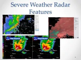
Reading a Radar Image • Most radar imagery has much in common. • Intensity of precipitation is color coded (units—dbZ)
Reading a Radar Image • Black (white in some)-no precip • Grey and pink (5-20)…light rain…not too bad. • Dark pink to green-moderate rain (20-35) • Yellows are heavy rain (forget it) • Reds and high (don’t even think about it)
Reading a Radar Image • Remember the beam can be blocked by mountains and is higher farther from the radar. • Time below is in UTC (GMT). • UTC=PST +8 hr
Modern Radars are Doppler Radars • Doppler radars can tell the speed of the target towards or away from the radar. • The wavelength/phase of the radar signal changes depending the speed of the target towards or away from the radar.
Based on Doppler Effect: evident when a train or car passes • https://www.youtube.com/watch?v=a3RfULw7aAY
Radar Imagery is generally not for a level surface • Scans in azimuth ( 0 to 360°) at a series of increasing scan angles from the horizontal.
Each radar elevation angle shown on a polar-type chart with range circles
Radar Was An Important Tool in WWII: Had One Pesky Problem—Precipitation!
After WWII Meteorologists Experimented with Military Radars: Thunderstorms and Convection Clearly Seen
In the late 1950’s a national meteorological radar network was established (WSR-57).
During the 1970s and early 80s a lot of experimentation with Doppler Radars • Provides speed of object towards or away from the radar • Can show wind shifts and circulations • Particularly useful for showing the rotation in severe convection—the mesocyclone
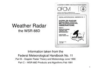
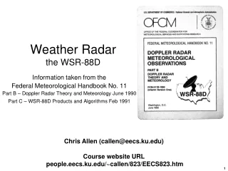
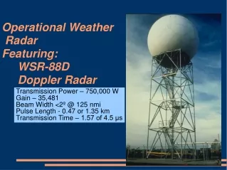
In the late 1980s, the NWS put in a network of Doppler Weather Radars NEXRAD WSR88D (Weather Surveillance Radar 88 Doppler)
Sound of train passing: http://www.fourmilab.ch/cship/sounds/doppler.au
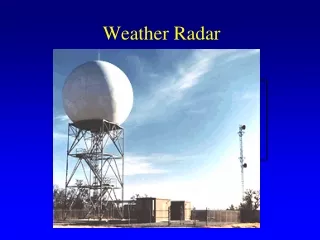
The National Weather Service has Installed Doppler Weather Radars Across the Country
Weather Radar Can Change Your Life! NWS Doppler Radar
Weather Radar Can Help You Plan Outdoor Recreation • Since the National Weather Service put the Camano Island weather radar in place during the early 90s, I rarely get seriously soaked while commuting by bicycle. • With a little knowledge of NW precipitation and weather radar, you can protect yourself too.
Different Situations • After fronts go through we often have showers and sun breaks. Radar allows you to stay in the breaks
Showers and Sun breaks, wait a few minutes for heavy rain to end
Puget Sound Convergence Zone: Go north or south to stay dry!
Rainshadows Rainshadow Windward Enhancement
Where to view radar imagery • On TV • On the web • Dedicated app.